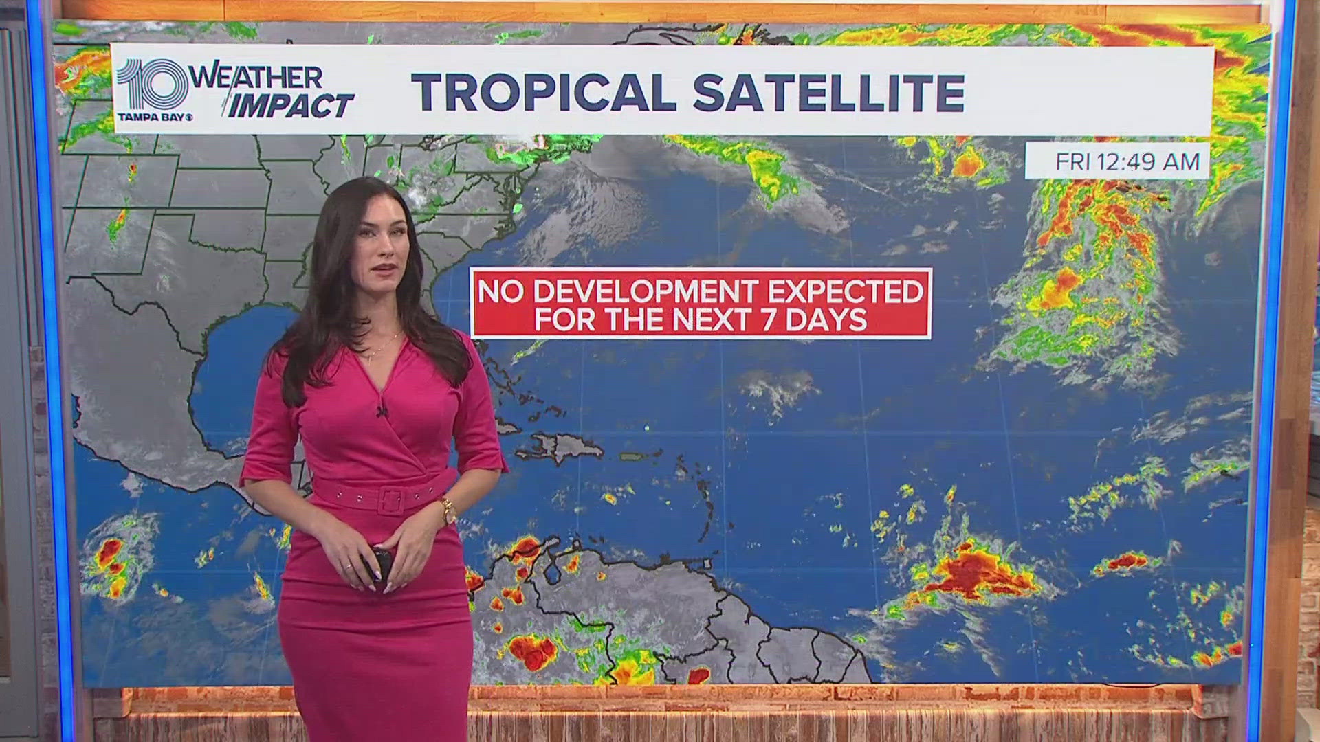
ST. PETERSBURG, Fla. — Tropical Storm Debby is making its way toward Florida and is expected to rapidly strengthen into a hurricane before it makes landfall along the Big Bend region.
Across much of the Tampa Bay area, a tropical storm warning and storm surge warnings are in place ahead of Debby as outer rainbands of the storm are already impacting the area. The system is expected to bring heavy rainfall, flash flooding, gusty winds, storm surge and tornado risks to the region.
But what is the Big Bend area? And where is it in Florida?
Here's what you need to know about the region:
What is Big Bend in Florida?
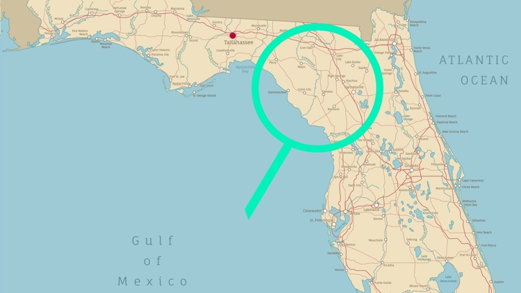
"Big Bend" is the informal name for the curve of Florida's peninsula around the Gulf of Mexico and Jefferson, Taylor, Dixie and Levy counties. Much of the Big Bend region is made up of some of Florida's "best wilderness destinations," according to the Florida Fish and Wildlife Conservation Commission.
Big Bend comprises many different landscapes including salt marshes, tidal swamps, deep woodlands and even some sandy beaches. Historic towns in the northern central part of the state also dot the area.
Mainly in Taylor and Dixie counties, there is also the Big Bend Wildlife Management Area (WMA), FWC said. It is comprised of 90,000 acres that include Snipe Island, Hickory Mound, Spring Creek, Tide Swamp and Jena.
Where is Big Bend in Florida?
Big Bend is located along the west coast and follows the curve of Florida's peninsula around the Gulf of Mexico and includes much of Jefferson, Taylor, Dixie and Levy counties. The start of the informal region begins about 119 miles north of Tampa.