
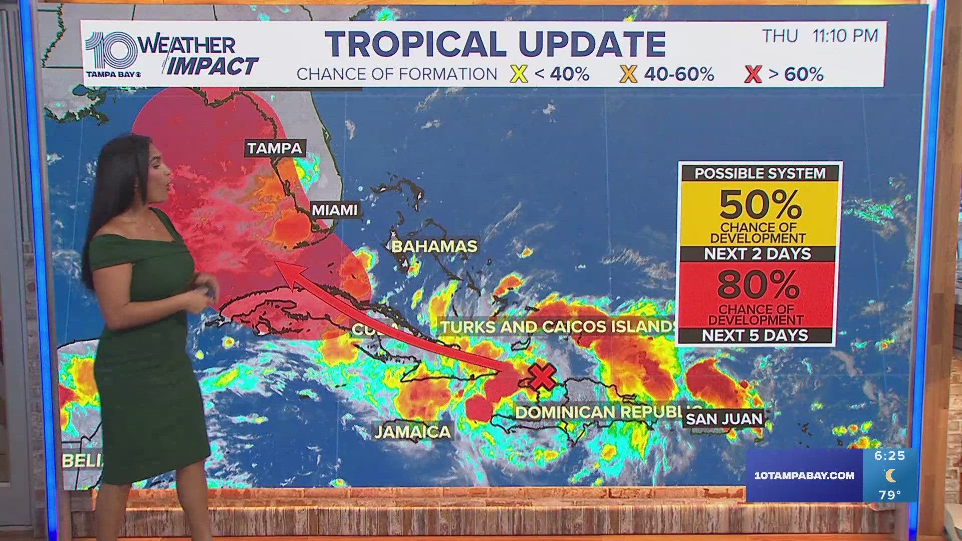
ST. PETERSBURG, Fla. — The latest talk of the town has been this tropical wave brewing near Cuba. However, this disturbance could likely become a tropical depression as early as this weekend, according to the National Hurricane Center.
The big question on everyone's mind is where the system may travel and what we could feel in central Florida.
As of Friday morning, this tropical wave has a 90% chance of development over the next seven days, along with a 60% chance of development over the next 48 hours.
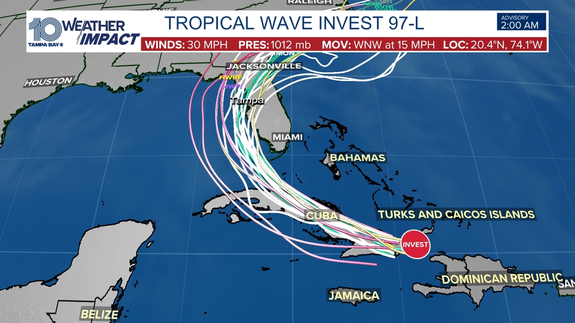
The system now has been given an "invest" — Invest 97-L, to be exact — meaning that hurricane center forecasters are watching it closely for potential development into a tropical depression or storm.
"The wave is expected to move near or over Cuba throughout the day and then emerge over the Straits of Florida tonight or Saturday. Environmental conditions are expected to be conducive for additional development after that time, and a tropical depression is likely to form this weekend over the Straits of Florida or eastern Gulf of Mexico near the Florida Peninsula," the NHC wrote in its Friday morning outlook update.
The NHC says it's possible parts of Florida could see tropical storm watches or warnings sometime Friday. NOAA Hurricane Hunters are expected to investigate the system later in the day.
On Sunday, we'll need to keep an eye on potential flooding and gusty winds as the disturbance moves over the Tampa Bay area.

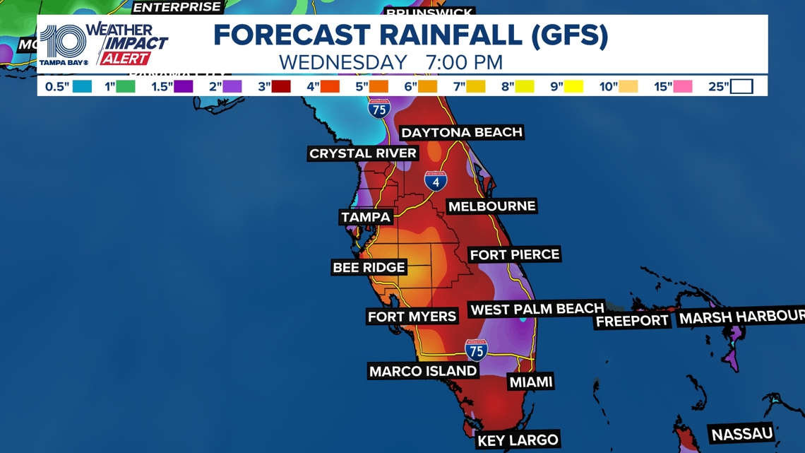
Meteorologists often use a variety of computer models like the European Centre for Medium-Range Weather Forecasts ("Euro" for short) or the Global Forecast System (GFS, also known as the "American" model). Both are excellent tools used for both daily and long-term tropical forecasting.
In the case of this tropical wave, both computer models have not entirely agreed on what could potentially become of it as we head into the weekend ahead. However, that trend is changing and they are slowly becoming more aligned with where this cluster of moisture could be heading.
Invest 97-L Euro, GFS models
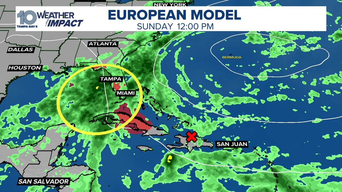
Earlier this week, the European model kept this system east of Florida, which would have kept the greatest impacts away from Tampa Bay. However, the latest model runs have this system drifting farther west, attempting to bring a disorganized system across the Straits of Florida and into the eastern Gulf of Mexico between Sunday and Monday.
European model for Sunday

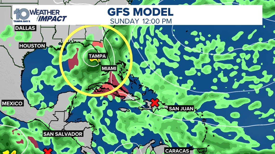
The GFS, or American model, had been struggling to generate an organized system, but this model is now trending toward a weak system drifting over Cuba and then up into the Gulf of Mexico while hugging the west coast of Florida, which would pump in more moisture over the area.
If this were to play out, there could be the potential for this system to be a slow mover in the northeastern Gulf, meaning higher rainfall totals across the Big Bend region, Nature Coast, and the Tampa Bay area.
GFS model on Sunday

It is still too early to say exactly how strong this system will become or where it will go, but if this latest trend holds, we could be looking at mostly a rain event across the Tampa Bay area, especially for Sunday through early next week. As of now, rainfall totals could range from 4-8 inches, with the highest totals likely along Florida's west coast.

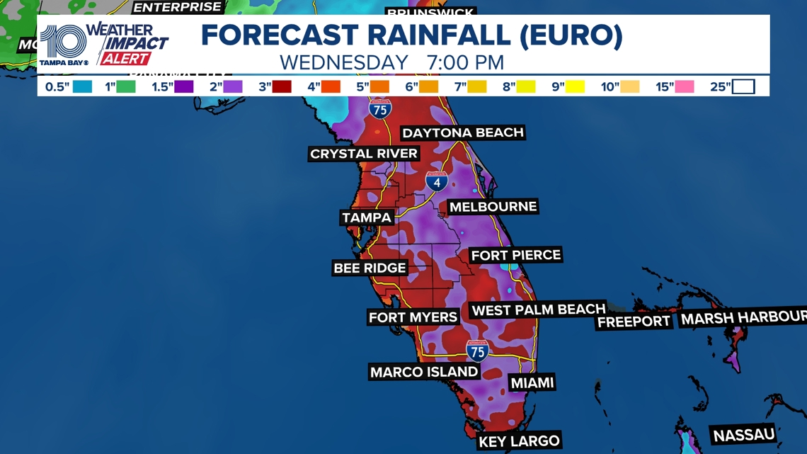
Depending on whether this wave cuts across Florida from the Bahamas like the Euro shows or drifts north from Cuba like the GFS thinks, this will impact just how much rain we could see.

Regardless of development, there is a concern that heavy rains could cause flash flooding across parts of Florida.
Be sure to stay tuned for the latest updates throughout this week.
If this system strengthens to a tropical storm, the next name on the list for the 2024 Atlantic season is Debby.