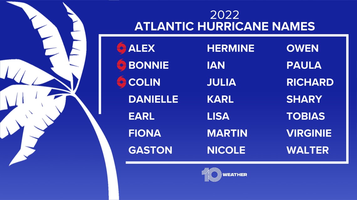
TAMPA, Fla. — The last-named tropical storm was Colin back in early July, but now we're keeping track of two areas in the Atlantic. One of those areas is Invest 91-L, which now has an 80% chance of development, according to the National Hurricane Center.
The tropical disturbance is becoming a little more organized as of 8 a.m. Wednesday but isn't quite to the point of being a tropical depression, according to 10 Tampa Bay Meteorologist Grant Gilmore.
It is not in a very favorable environment for strengthening with dry air around the system. Still, more organization and gradual development are expected, and there is a 60% chance it becomes a tropical depression in just the next 48 hours.

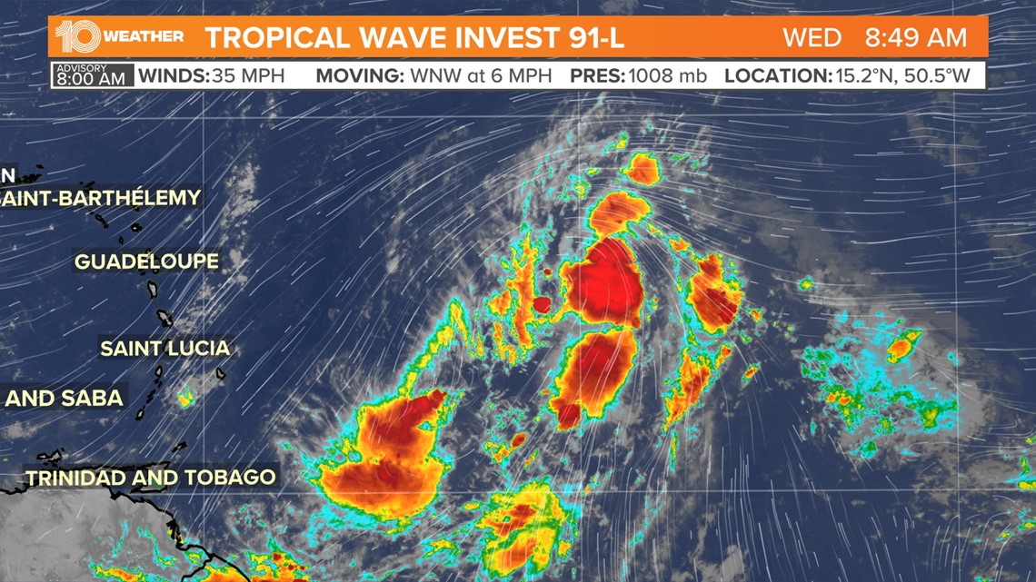
As the system lifts north of the Lesser Antilles and Puerto Rico, it will move into a more favorable area for development into the weekend.
If it continues to strengthen from there, the next name on the list for this season is Danielle.
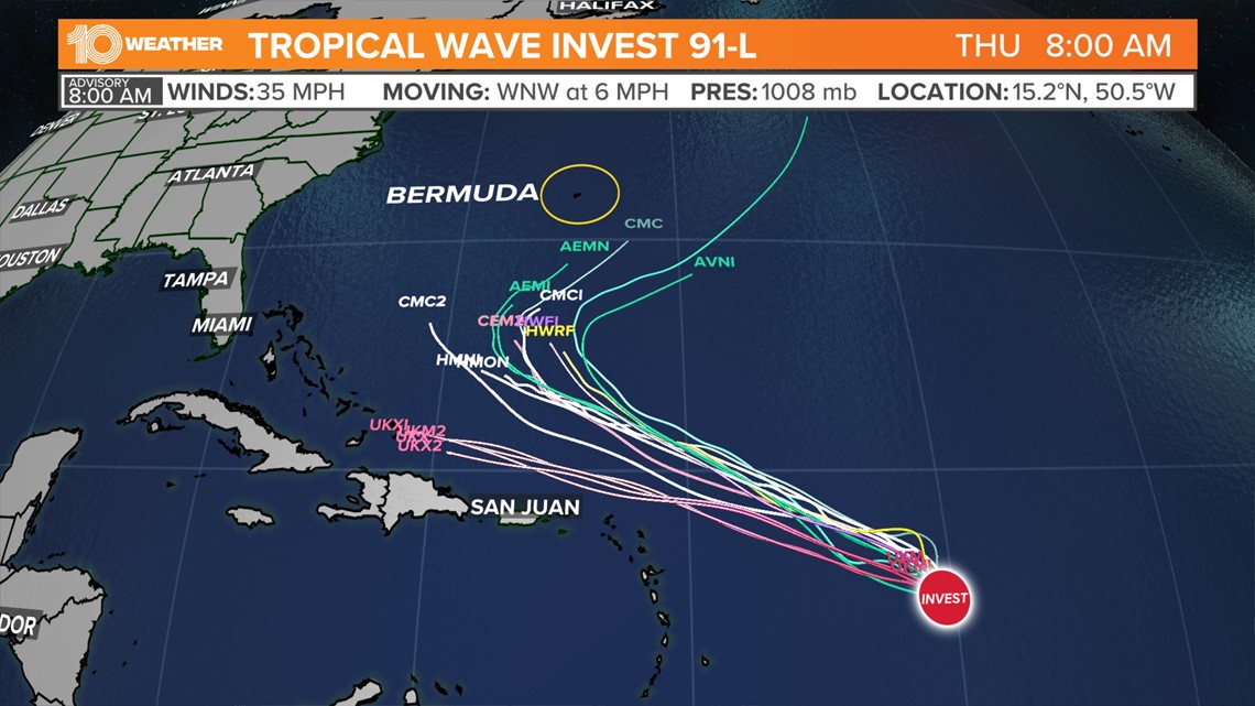
Where does Invest 91-L go after that?
Forecast models have been consistent in curving the system away from the United States north and then northeast into the north-central Atlantic. There could be some indirect impacts in the form of higher surf and rip currents to the Southeast and Mid-Atlantic coast, but the storm will steer well clear of the U.S.
Bermuda will have a closer call, but models continue to steer this system east of Bermuda, as well.

Another area likely to develop:
An area of low pressure, recently designated Invest 93-L, has formed along an old frontal boundary over the north-central Atlantic. As of 8 a.m. Wednesday the system was located about 850 miles west-southwest of the westernmost Azores.

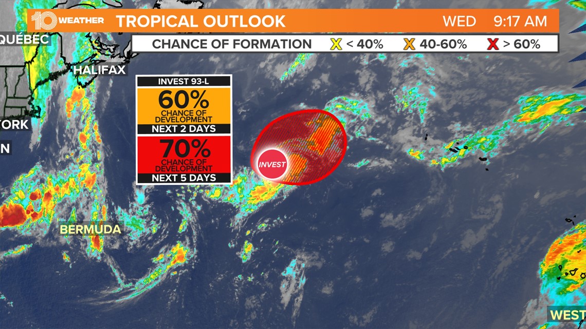
Development is expected to continue with this system in the coming days as environmental conditions are expected to remain conducive for the potential of a tropical or subtropical depression to form. At this point, the chance of formation before the end of the week is 70%.
The system will not be a concern for the United States as it is expected to track generally east across the Atlantic Ocean. The system could be a concern for the coast of Portugal toward the end of next week.
Disturbance coming off of Africa:
A third disturbance, a tropical wave that has recently moved off the coast of Africa is also showing a better chance of development. This system, however, will not have much time before it moves over cooler Atlantic waters and conditions become less favorable for development as it tracks to the west.
For the time being, showers and thunderstorms associated with the tropical wave have become a little better organized Wednesday morning. There is currently a 50% chance of the system becoming a tropical cyclone into the weekend.