ST. PETERSBURG, Fla. — By now, you might have heard that we have a cold front that brought some much nicer weather for this past weekend — but wait, there's more!
A second and much stronger cold front is looking likely Tuesday into Wednesday of this week.
We took a step in the right direction Friday into the weekend with our first cold front dropping dew points from the 70s into the mid-60s. It will also bring plenty of sunshine, along with highs in the mid-80s.
Might not sound like a big change, but it is something you will notice.
Stronger front this week
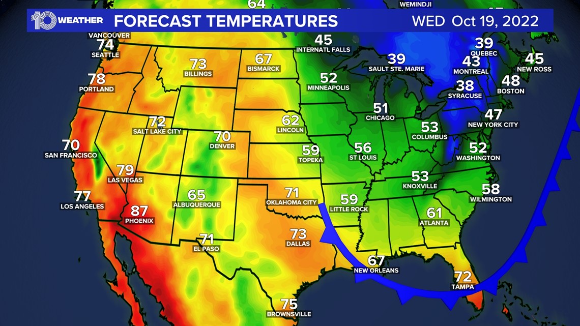
A secondary cold front will drop south quickly this week. This is going to bring chilly weather across most of the eastern United States, but in typical Florida fashion, it will bring some fantastic weather for us.
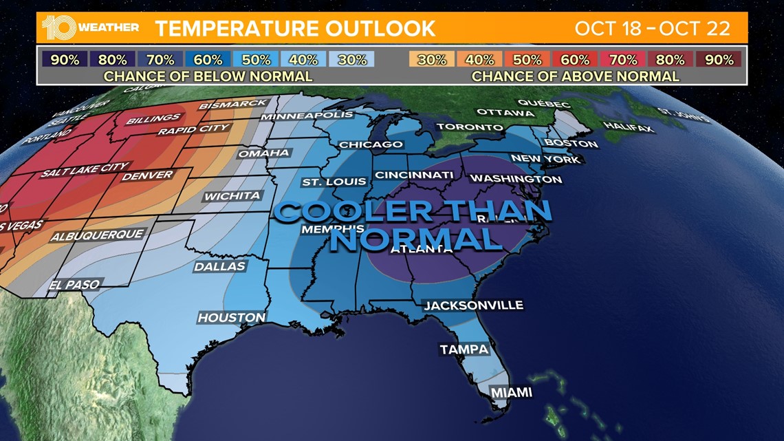
The Climate Prediction Center has highlighted the area that is expected to see below-average temperatures for the second half of next week.


How cool will it get?
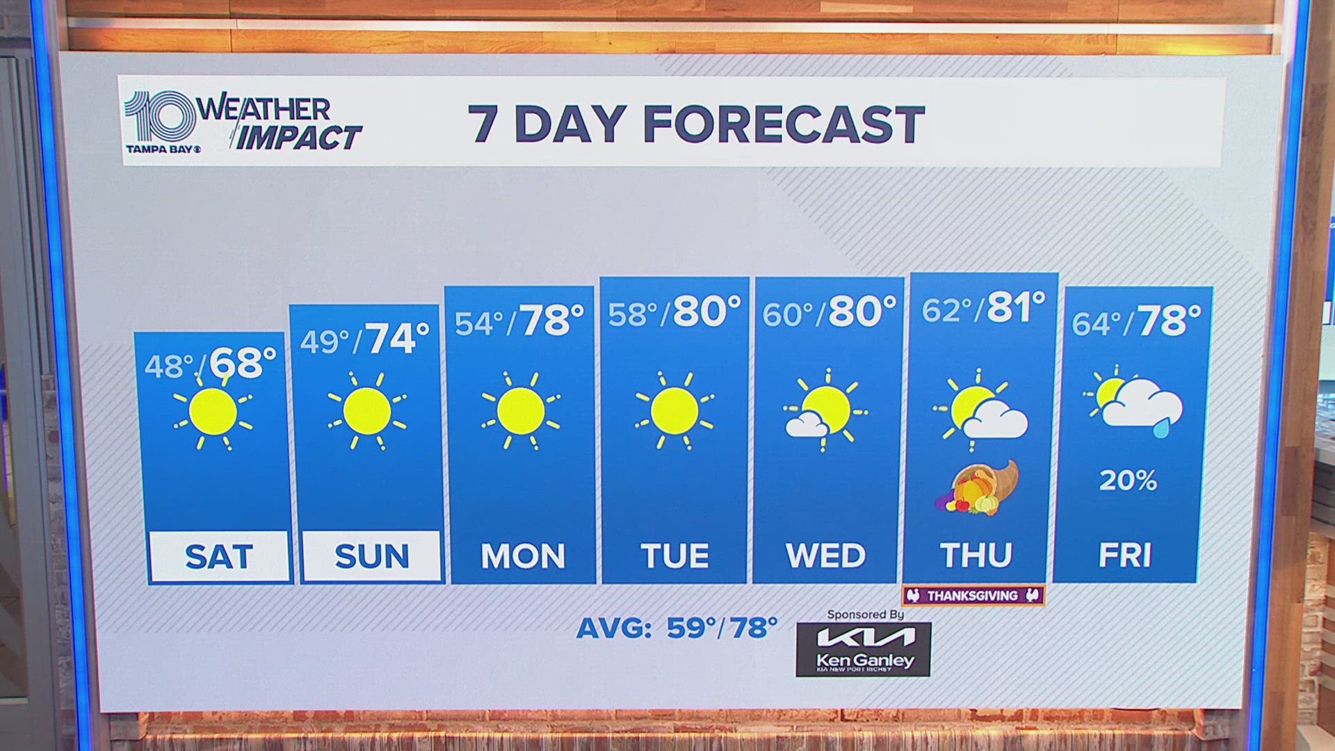
The Tampa area will likely see highs dipping into the 70s by the middle and end of next week. Overnight lows will also be cool in the 50s, even some upper 40s are possible toward the Nature Coast!
The Northeast and upper Midwest will likely see highs in the 40s and lows in the 20s! Even some lake-effect snow is possible in the Great Lakes! Parts of the Ohio River Valley and the Southern U.S. could see their first frost and freeze of the year.


Low humidity and dry behind the front
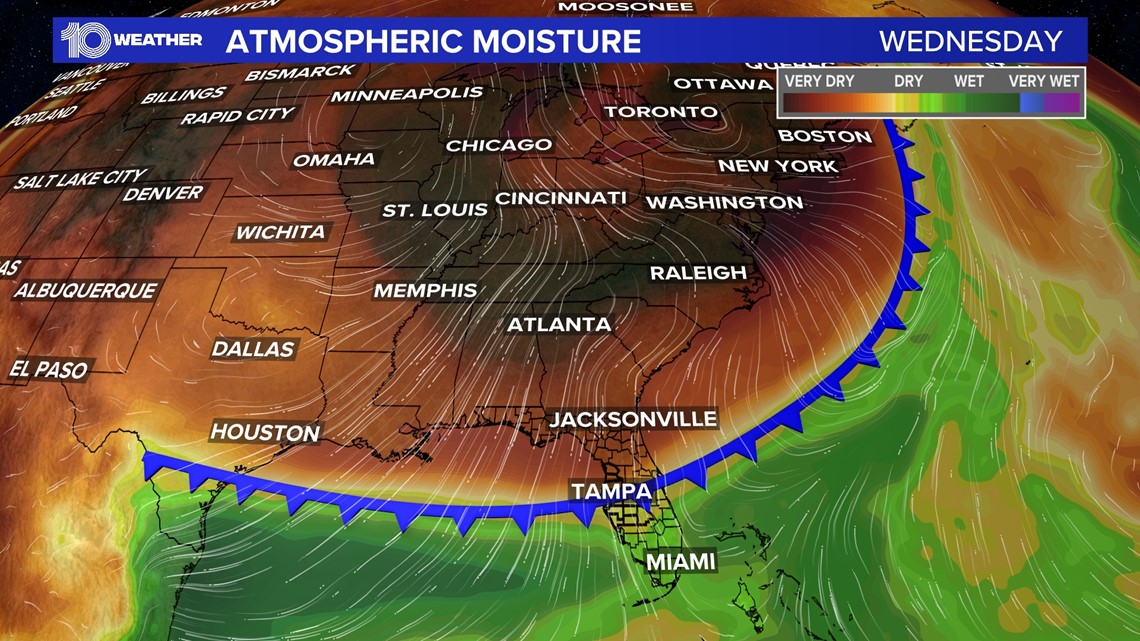
Along with a drop in temperatures will be a sharp drop in humidity. Dew points will come down a touch this weekend into the 60s, but look at what the models bring for late next week. Dew points in the 40s! It will be some of the driest air in months.


The drier air will not only be at the surface but throughout the entire atmosphere. That means little to no rainfall and plenty of sunshine for several days.


