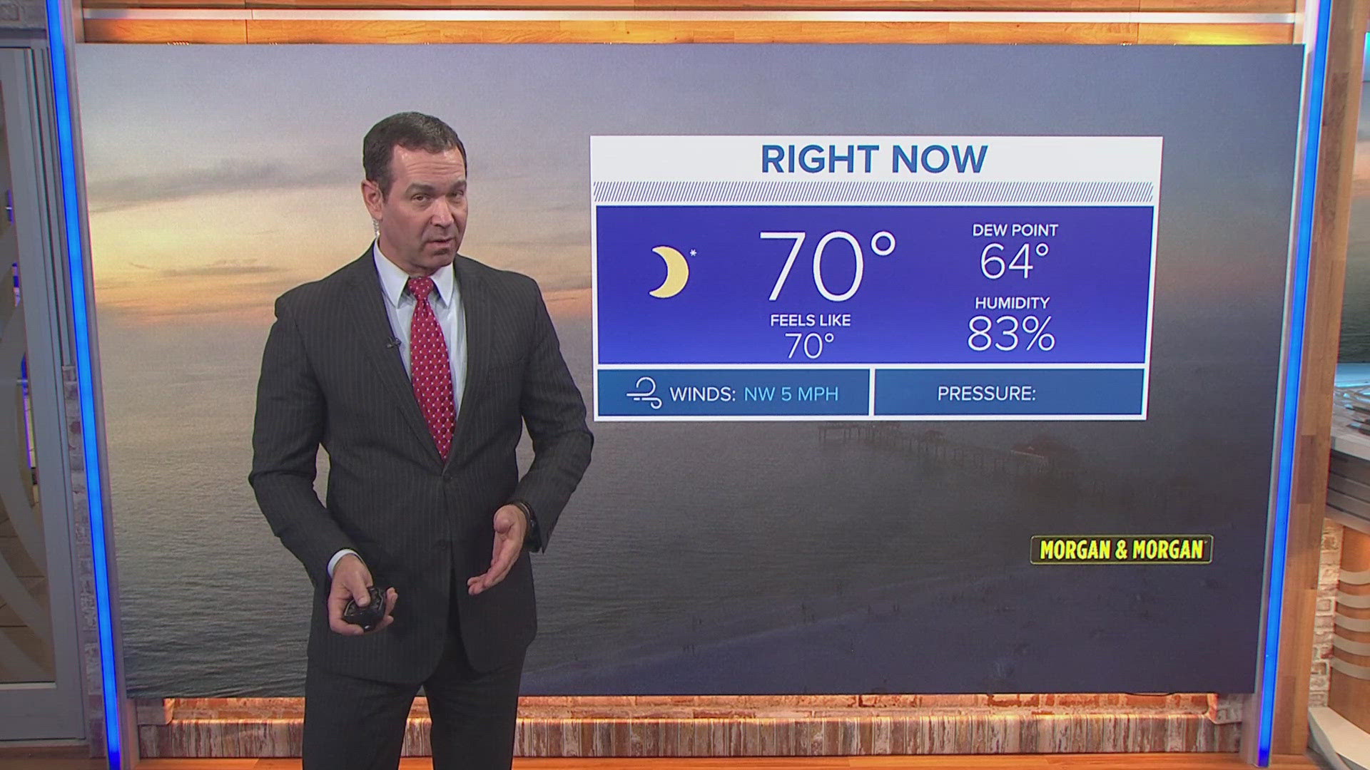
ST. PETERSBURG, Fla. — As our neighbors to the north flaunt their fall foliage and crisp October temperatures, there has been very little sign of fall in Florida.
Then again, this is nothing unexpected but a taste of fall is certainly something to look forward to after Tampa Bay's hottest summer on record.
COOLER TEMPS AFTER WARMEST SUMMER ON RECORD
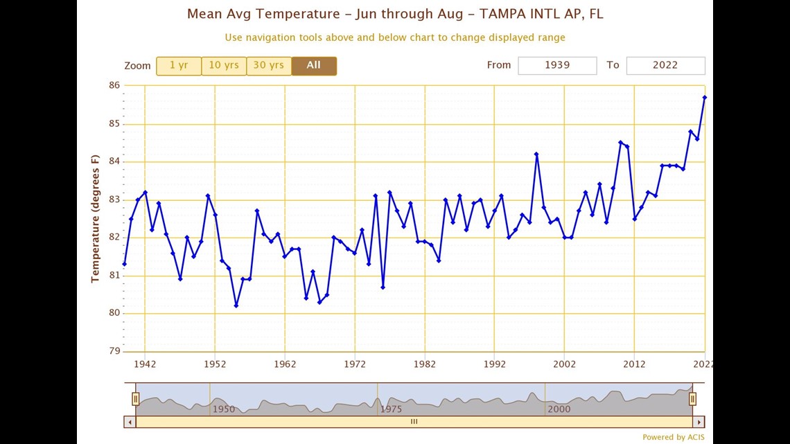
Not to look too much in the rearview mirror at this past summer, but Tampa International Airport did record its hottest summer on record with an average temperature of 85.7 degrees.
This blew the old record hottest summer (2020) out of the water by 0.9 degrees. While 0.9 degrees may not seem like much, the third hottest summer and tenth hottest summer on record in Tampa are only separated by 0.8 degrees.

'FALL'ING TEMPERATURES COMING
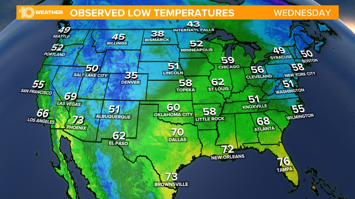
Back to the taste of fall coming. A cold front sweeping across the majority of the county is already dropping temperatures into the 30s for many across the Plains and Midwestern states.
This cold front will continue to move east and southeast across the country before sweeping through Florida on Thursday.

Ahead of the cold front, showers and storms will be likely on Thursday across Tampa Bay, but once the front moves through Thursday evening, drier and slightly cooler air will sink south across the region.

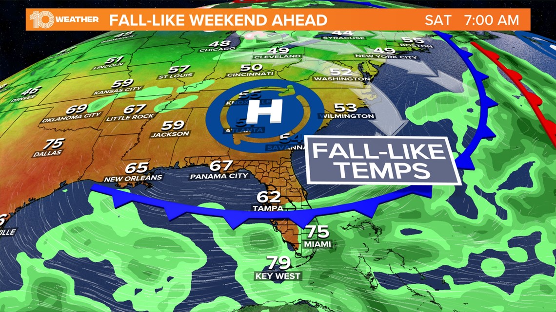
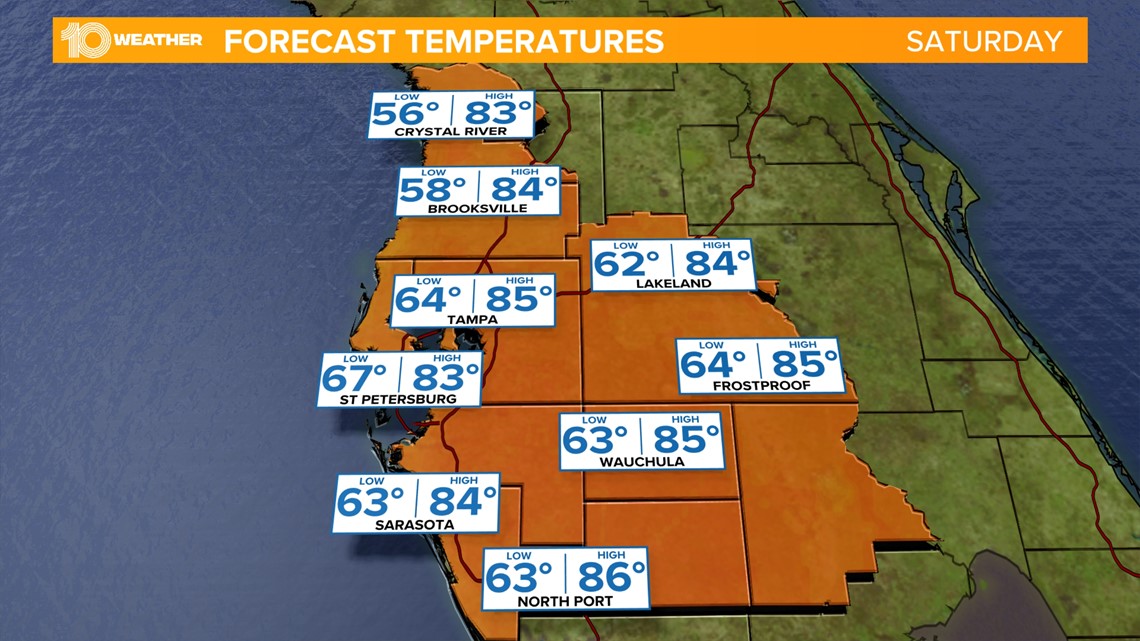
While the cooldown will not be as significant as it will be to the north, as the cooler and drier air pushes in from the north on Friday, by Friday night and Saturday morning, many places will see temperatures drop into the low 60s and even 50s through the Nature Coast.

The Tampa Bay area has already encountered one early taste of fall after Hurricane Ian helped usher in cooler and drier conditions into the region in the days following the storm. The high temperature in Tampa on Sept. 28 was 76 degrees and then 77 degrees on Sept. 29 and 30, which was about 10 degrees cooler than normal.
A reinforcing push of cool air then dropped the low temperature down to 63 degrees on Oct. 4th.
Since then, the temperatures have been warming back to near-normal if not a little warmer than normal. That is until this cold front moves through.
High temperatures after this cold front won't drop quite as much as they did after Hurricane Ian, but they will be in the low-middle 80s for several days into next week — and the humidity will be much lower.
The lower humidity will also aid in temperatures cooling off overnight when lows are forecast to stay in the low-middle 60s into the middle of next week.

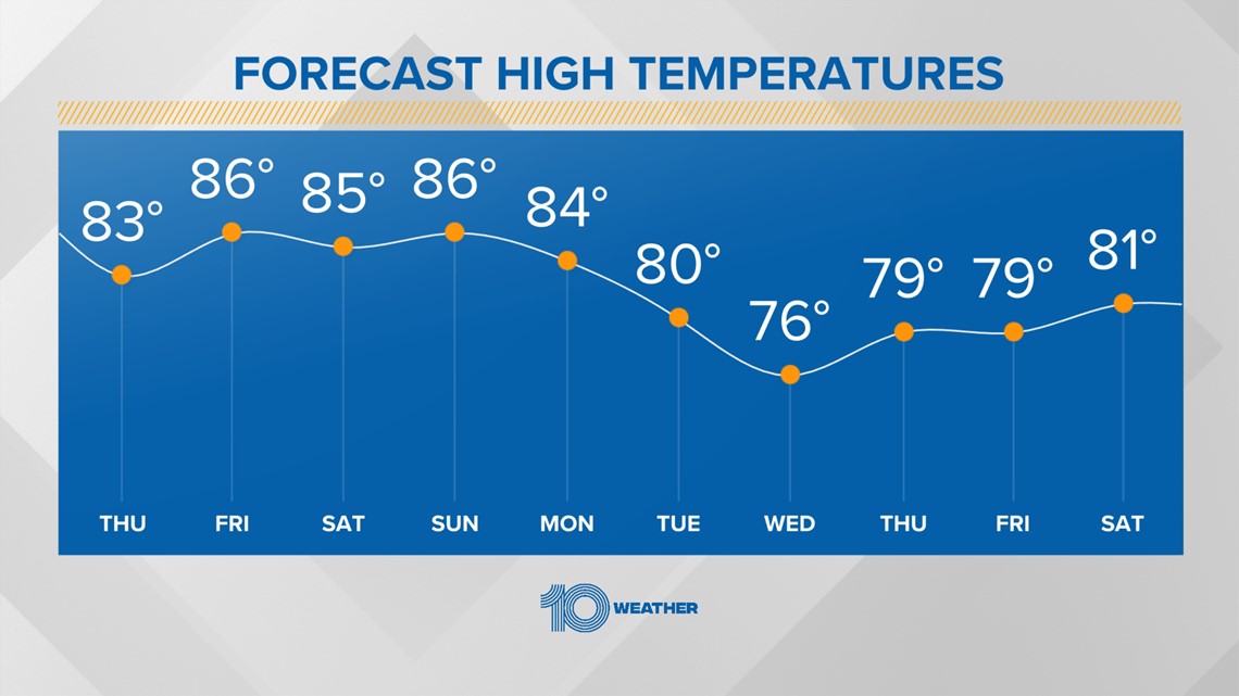
On the horizon, another reinforcing push of cooler air is expected to sweep into the area by the middle of next week. This wave of cooler air very well could drop high temperatures into the 70s and bring a few more people low temperatures in the 50s.
END OF THE RAINY SEASON?

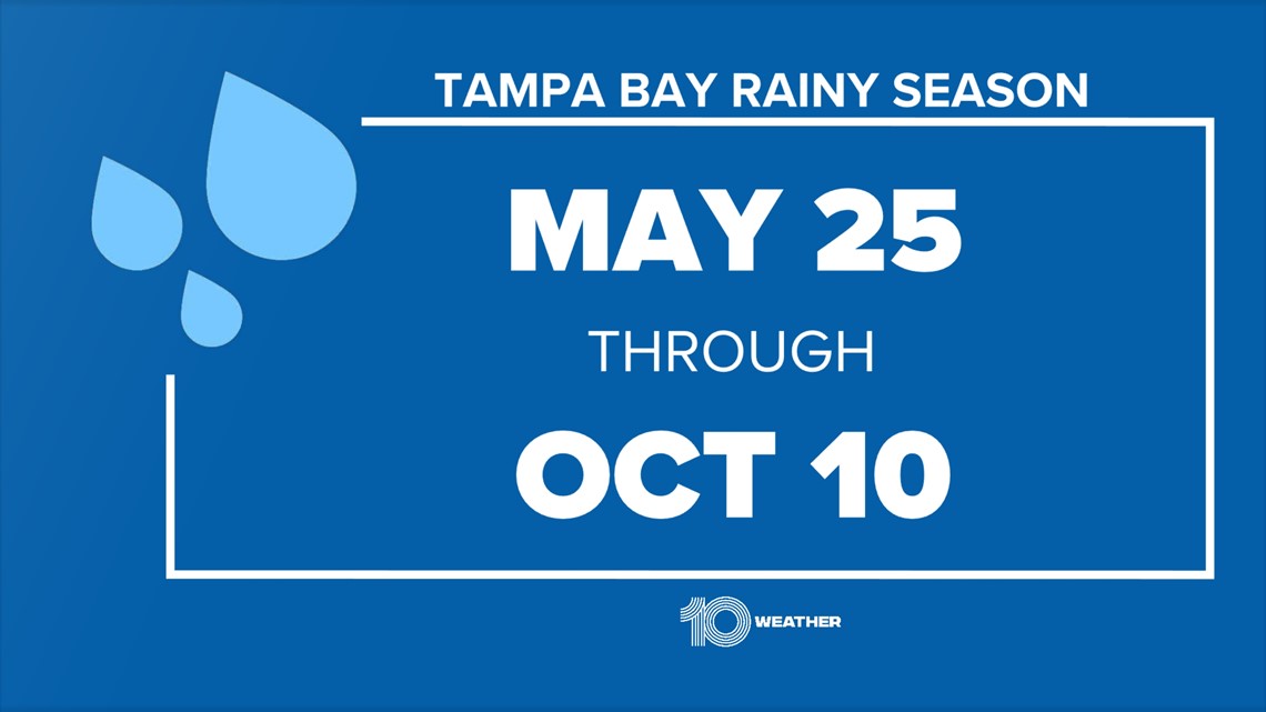
A side note to all of this is that with these cold fronts and cooler temperatures the rainy season is pretty much finished for the year. Since Hurricane Ian moved through, there has been very little sea breeze showers and thunderstorm activity, which almost perfectly coincides with the climatological end date of the rainy season of Oct. 10.


