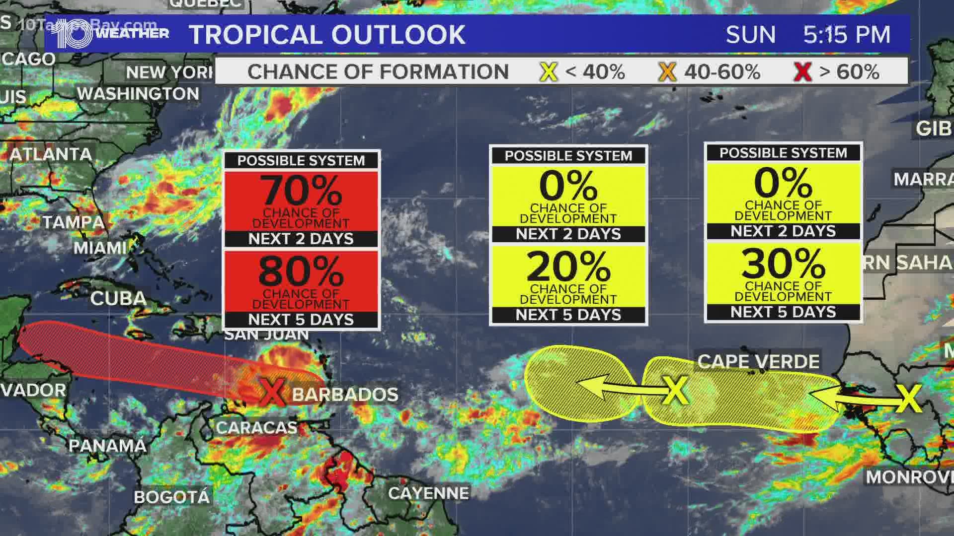
As of Sunday, there are now four areas of tropical concern being watched by the National Hurricane Center (NHC) as we head closer to peak season in September.
They’re labeled Disturbance 1, Disturbance 2, Disturbance 3, and Disturbance 4.
Let's start with the 3 disturbances pictured below:

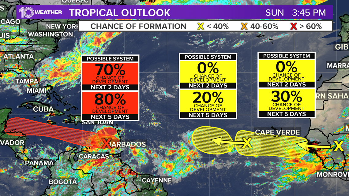
Disturbance 1, as of 12 pm Sunday, is getting its act together and now has a high, 80 percent chance of development over the next five days. This is a tropical wave, located in the eastern Caribbean Sea, is producing showers and thunderstorms, as well as showing signs of organization. Additional development of this system is possible during the next few days while it moves westward at about 15 mph across the Caribbean Sea.
Then there's Disturbance 2, which as of Sunday morning, the NHC decreased its chances for development to 30 percent. The NHC says Disturbance 2 in the eastern Atlantic Ocean, just southwest of the Cabo Verde Islands, is producing limited shower activity and is not a threat over the next few days as it slowly drifts west.
Also new as of Sunday morning is Disturbance 4. This brand new tropical wave is forecast to emerge off the coast of Africa in the coming days, but would also be slow to develop as it slowly drifts westward. So the NHC is only giving it a low 20% chance for tropical development over the next 5 days.
However, the closest one to home? Disturbance 3.

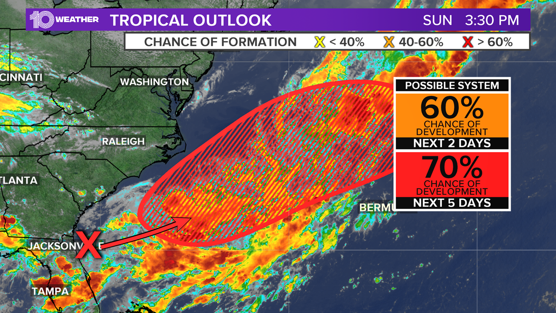
Disturbance 3 is an area of low pressure forming just off of the southeastern U.S. coast. This system has been given a high 70 percent chance for development in the next five days, and a medium 50 percent chance in the next two days. The latest information regarding the disturbance will be available from the NHC at 8 p.m. Sunday.
The next three weeks will likely remain active in the tropics as we move into the peak part of the hurricane season.

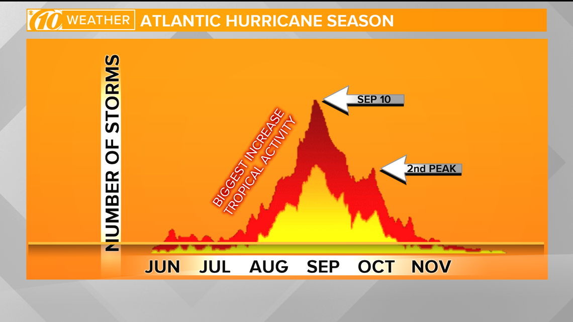
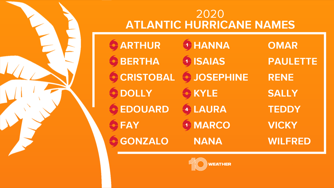
The next three names on the Atlantic list are Nana, Omar and Paulette. The record for earliest named “N” storm and “O” storm is Nate on Sep. 6, 2005 and Ophelia on Sep. 7, 2005. Both became hurricanes.

- Hillsborough County Schools to have emergency meeting after Florida's largest teacher's union dealt victory in reopening case
- VERIFY: Fact-checking the final night of the Republican National Convention
- Deputies: Florida man arrested for robbery while out on bond
- Man serving life for murder cleared after 37 years thanks to DNA
- Archaeologists search for more graves at old Pinellas County school
- Lightning, Bruins Game 4 postponed in support of social justice
►Breaking news and weather alerts: Get the free 10 Tampa Bay app
►Stay In the Know! Sign up now for the Brightside Blend Newsletter

