ST. PETERSBURG, Fla. — The last of the strong storms are moving through our area this morning. The best chance for severe weather this morning will now be on Florida's east coast.
A tornado watch has expired for all Tampa Bay area counties.
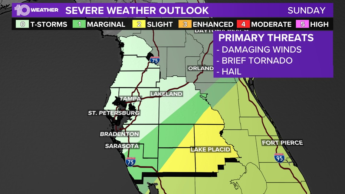
As for Sunday, that's when we expect round two, our final round, of storms to arrive. However, the timing will be very early! Possibly overnight through the pre-dawn hours of early Sunday.


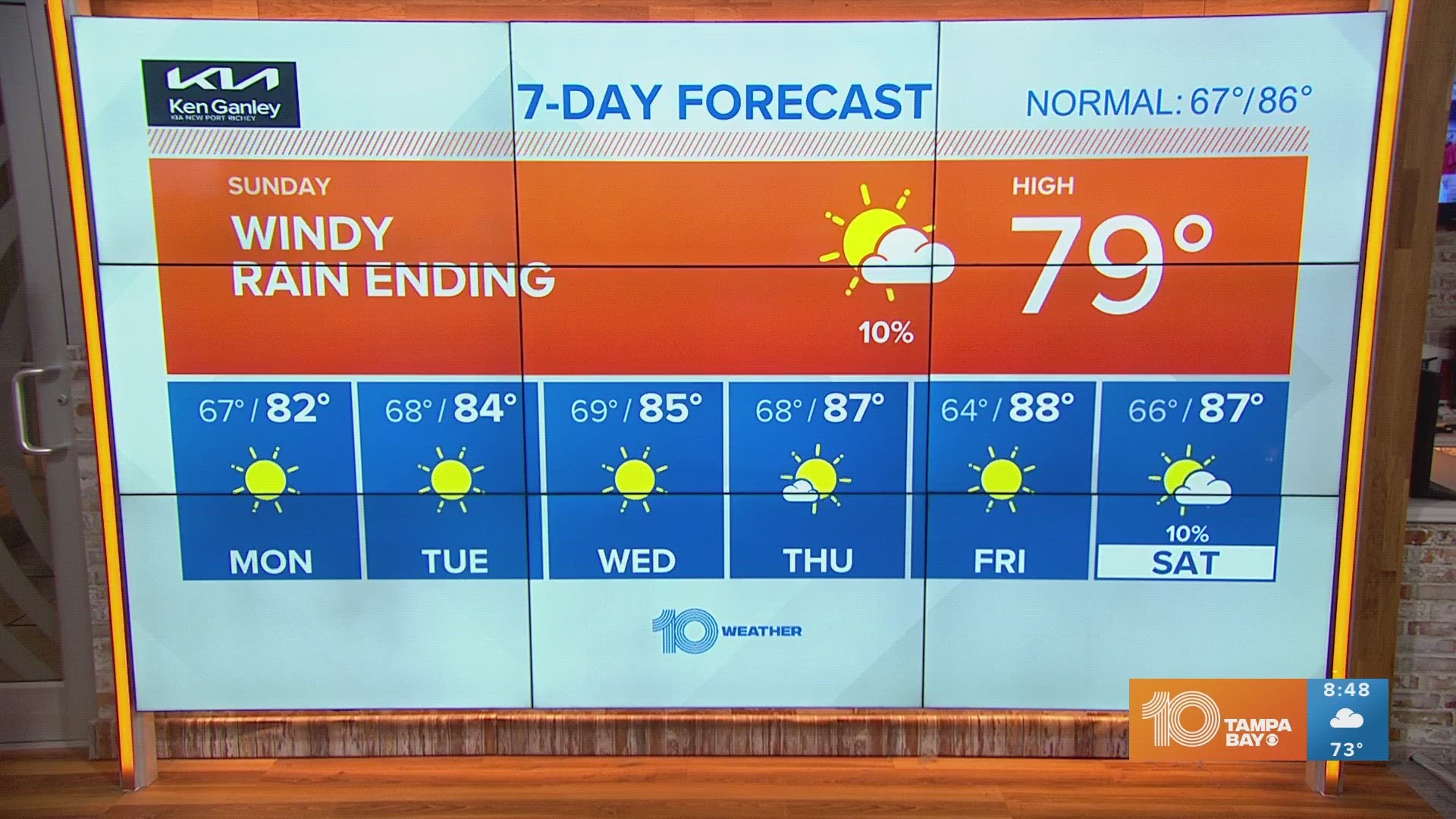
This very last round of rain is also bringing a cold front, allowing for gradual clearing Sunday afternoon and evening, followed by gusty winds throughout the day. Winds will gust close to 35-40 mph after the cold front moves through.
By next week, high pressure takes over and we get back to our dry and seasonal pattern of sunshine and middle 80s through much of next week.

