
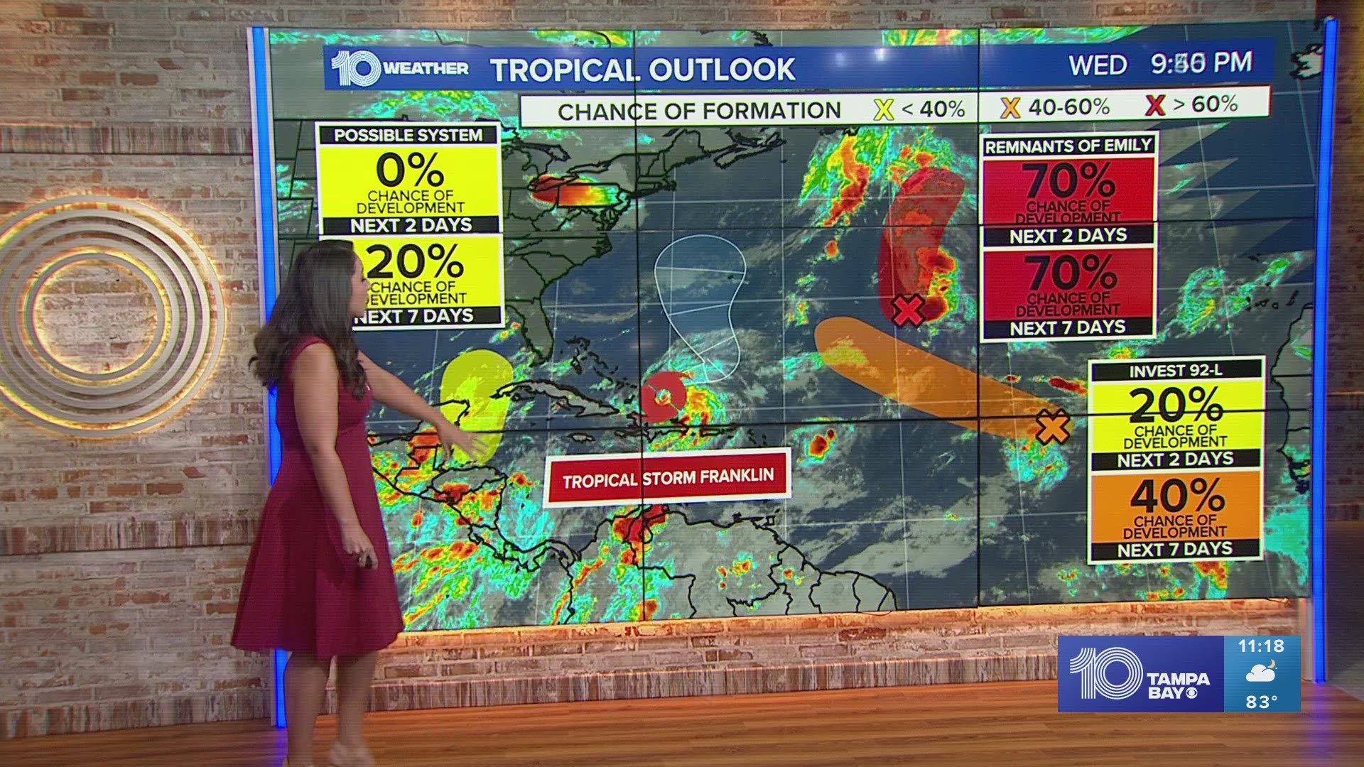
ST. PETERSBURG, Fla. — The latest update is in from the National Hurricane Center: Now that Harold has made landfall in Texas and weakened, attention now turns to Tropical Storm Franklin moving across Hispaniola and into the Atlantic.
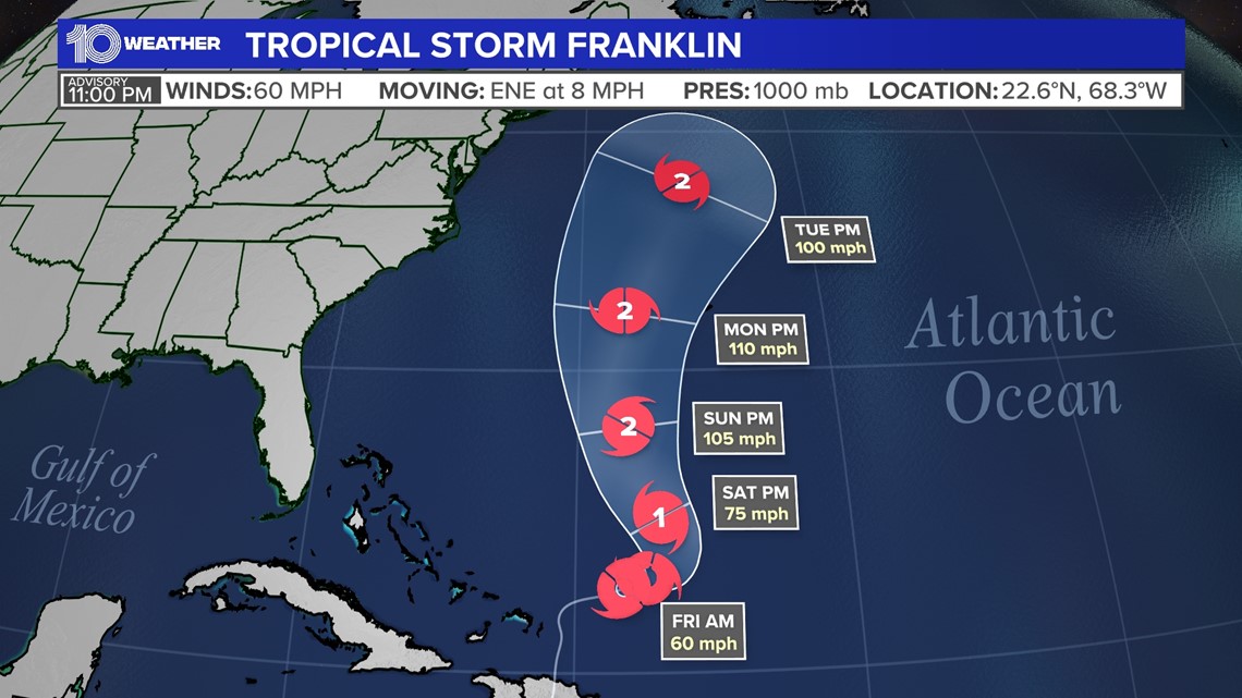
Right now, Franklin has winds sustained at 60 mph and is moving to the north-northeast at 8 mph after making landfall in the Dominican Republic earlier Wednesday morning. Flash flooding and mudslides will be the biggest threat to the island.
Franklin will emerge in the Atlantic Ocean slightly weaker. But it is expected to reorganize as it tracks farther to the north. The good news is that the steering flow in the atmosphere will keep Franklin away from the east coast of the United States, but it will bring high surf conditions.
Unfortunately, that means it could impact Bermuda, potentially as a hurricane.
Elsewhere in the tropics, there are two other areas we are tracking. The first is the remnants of Emily, which have a 70% chance of redeveloping into a tropical depression or tropical storm.
Regardless of development, it will not impact any land and will eventually weaken as it moves toward the cold waters of the north Atlantic.

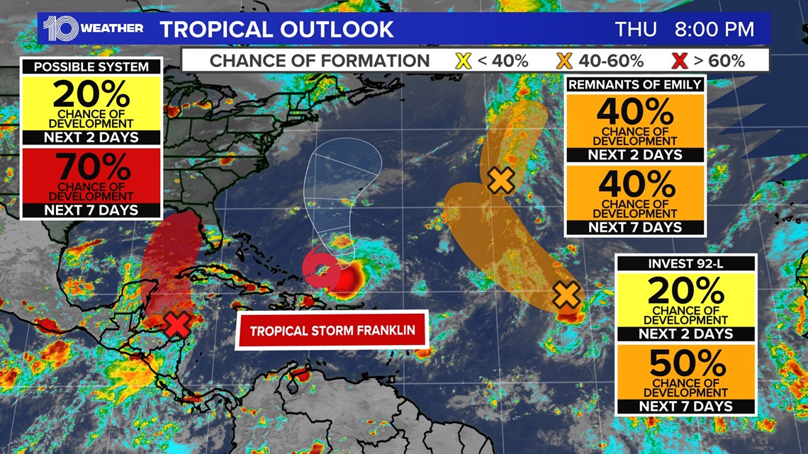

Last on the list is Invest 92-L, which only has a 30% chance of development. It is currently located in the eastern tropical Atlantic but is expected to move northwest. That will take it north of the Caribbean islands and away from any land.
Overall, nothing to worry about here in Florida or the coastal United States for the next few days. Interests in Hispaniola, Turks and Caicos and Bermuda should be monitored.