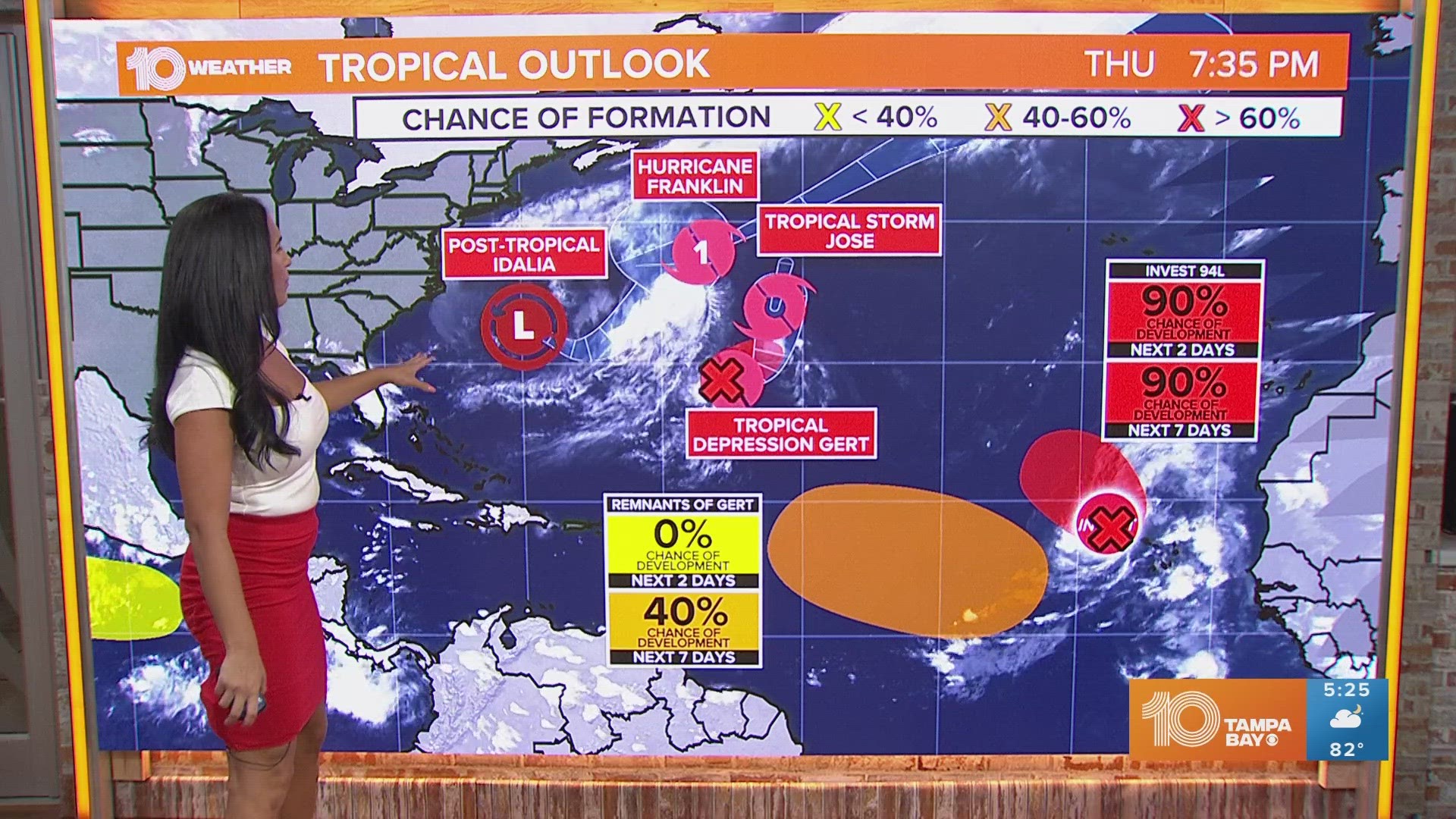
ST. PETERSBURG, Fla. — The Atlantic continues to be busy with activity; thankfully, most systems won't affect land. And, the United States and Florida don't need to worry about these current systems.
According to the latest advisory from the National Hurricane Center, Gert is back, having regenerated back into a tropical depression Friday morning. Its remnants have been meandering in the Atlantic for a while now. Tropical Depression Gert could strengthen a little on Friday and become a tropical storm again. However, by the weekend, Gert is expected to weaken again.
Tropical Storm Jose, which formed Thursday morning, has gotten a bit stronger. Still, the storm itself is compact and it is expected to weaken before being absorbed late Friday or Saturday by Hurricane Franklin, a physically bigger storm.
Hurricane Franklin is actually forecast to become an extratropical cyclone by Friday night. It's expected to go northeastward at an "accelerated pace" over the next few days. It's already weakening a little, but that weakening will happen more quickly by early next week.
As for Idalia, it's now a post-tropical cyclone over the open Atlantic. It is moving toward Bermuda, prompting a tropical storm watch. By the weekend, Idalia is expected to regain some strength and transition back to a tropical storm.
Finally, over in the eastern Atlantic, Invest 94-L has become Tropical Depression Twelve. It's forecast to move northwestward across the eastern tropical Atlantic.
The next name on the Atlantic hurricane season list is Katia.

