
ST. PETERSBURG, Fla. — The peak of hurricane season is quickly approaching, and the tropics are reflecting that.
Over the weekend, a tropical wave moved off the coast of Africa and is now over open water in the Atlantic.
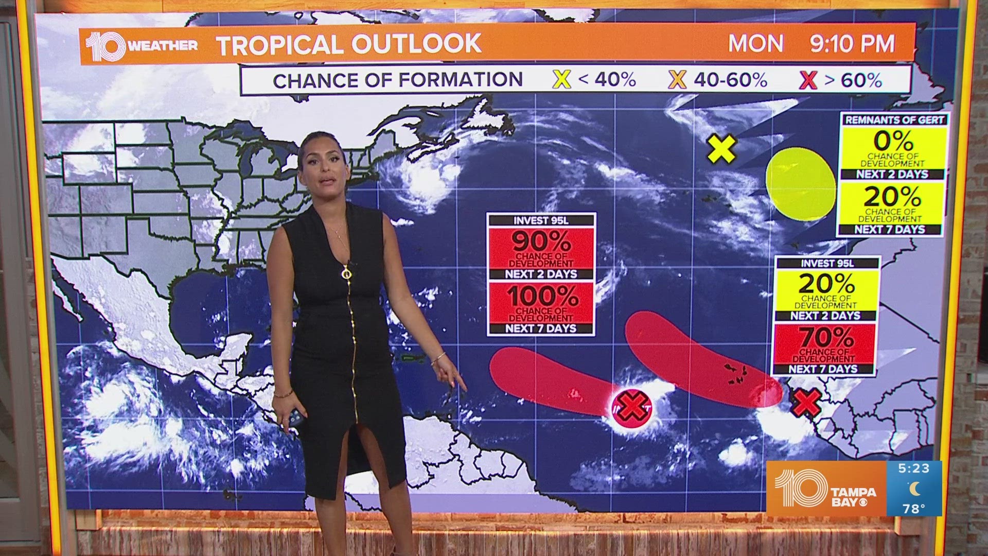
The National Hurricane Center has labeled this cluster of storms as Invest 95-L. It currently has a near 100 percent chance of development over the next day. The next name on the list of storms is Lee.
According to the latest update from the National Hurricane Center, the area is expected to become a tropical depression or storm by Tuesday. From there it will slowly strengthen and organize as it moves to the west-northwest, likely becoming a hurricane later this week.
By next weekend, it is expected to pass near or just north of the northern Lesser Antilles. At this point, further strengthening is likely, but the good news is that models show the system will start to curve north away from the east coast. That would keep the storm out over the open Atlantic.
Overall, this is still a system that is worth watching. We are looking at close to a week until it could start to impact some areas in the Caribbean, but a lot can change between now and then.
To find resources to help you and your family prepare for the upcoming peak of hurricane season, click here. 10 Tampa Bay is your Hurricane Headquarters and we have resources and tips to keep you and your family safe and prepared throughout the hurricane season. Download our free 10 Tampa Bay app, head to our Hurricane Headquarters page and stay up-to-date on our free 24/7 streaming app, 10 Tampa Bay+.