

ST. PETERSBURG, Fla. — As we start rebuilding as a community from Hurricane Helene, we are watching the tropics as it remains busy.
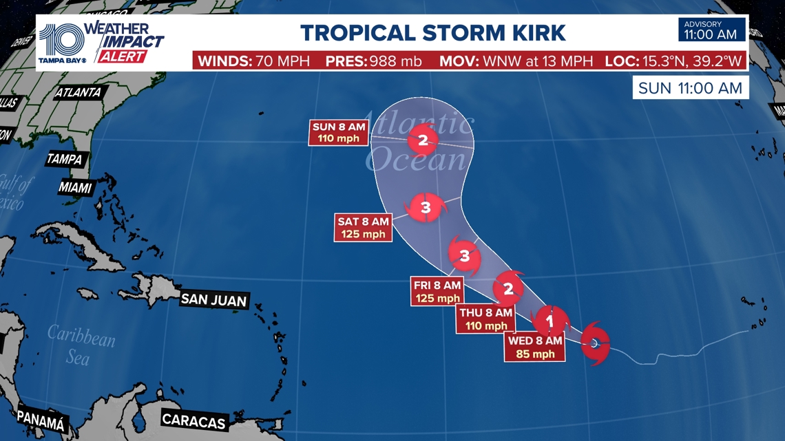
Tropical Storm Kirk is expected to become a hurricane on Tuesday before becoming a major storm sometime later this week.
Kirk is currently moving west at about 13 mph and a gradual turn to the northwest is expected by Wednesday, according to the National Hurricane Center's latest advisory. The storm is expected to strengthen into a Category 3 hurricane but models have it remaining far from the continental United States.
Maximum winds have increased to 70 mph with higher gusts, forecasters say. Tropical-storm-force winds currently extend outward of up to 195 miles.

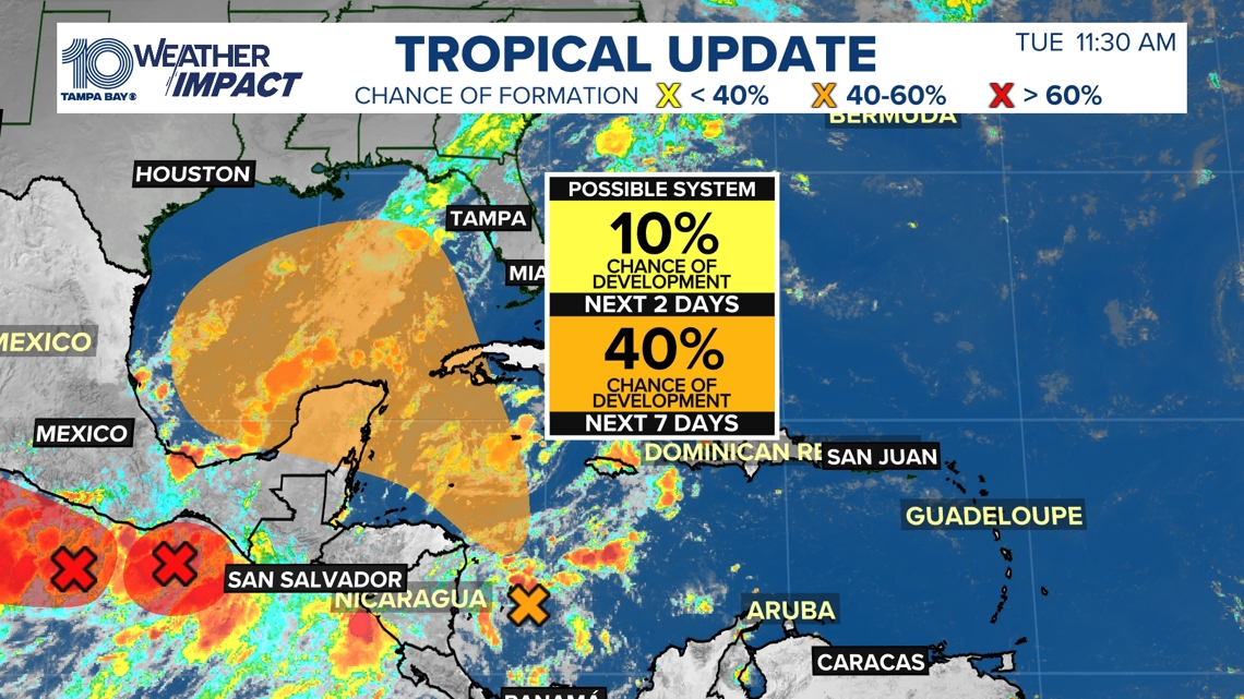
The wave in the western Caribbean Sea is something to watch, but as of now, the models are not consistent or confident in how this system will evolve. Some development is possible through the weekend into early next weekend so check back for updates.

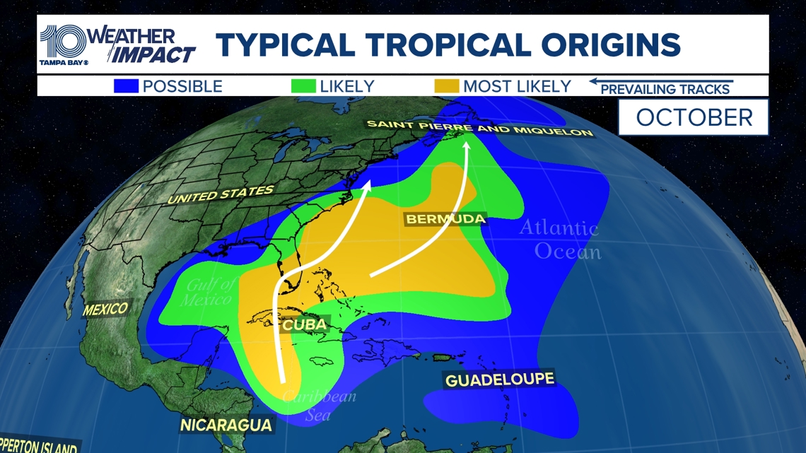
Historically, by October, the formation zones of tropical systems favor the western Caribbean Sea and Gulf of Mexico. These storms can develop quickly so it's always good to keep a close eye on the forecast.

For more weather updates and information, download the free 10 Tampa Bay app to your device.
10 Tampa Bay meteorologists on Facebook: Bobby Deskins, Amanda Pappas, Mike Prangley, Colleen Campbell
10 Tampa Bay meteorologists on X: Bobby Deskins, Amanda Pappas, Mike Prangley, Colleen Campbell