ST. PETERSBURG, Fla. — Hurricane season starts June 1, and it's been quite the quiet stretch since Barry came around in the Gulf of Mexico.
Philip Klotzbach, a meteorologist at Colorado State University, noted Wednesday there has been no named storm activity since Barry. Remember that? The storm suddenly became a Category 1 hurricane upon landfall on the Louisiana coast and lost its named status a day later on July 14.
It's been 31 days since Barry -- a whole month! In the next five days, the National Hurricane Center doesn't expect to name any storms, either. It's that quiet across the Atlantic Ocean, Caribbean Sea and Gulf of Mexico right now.
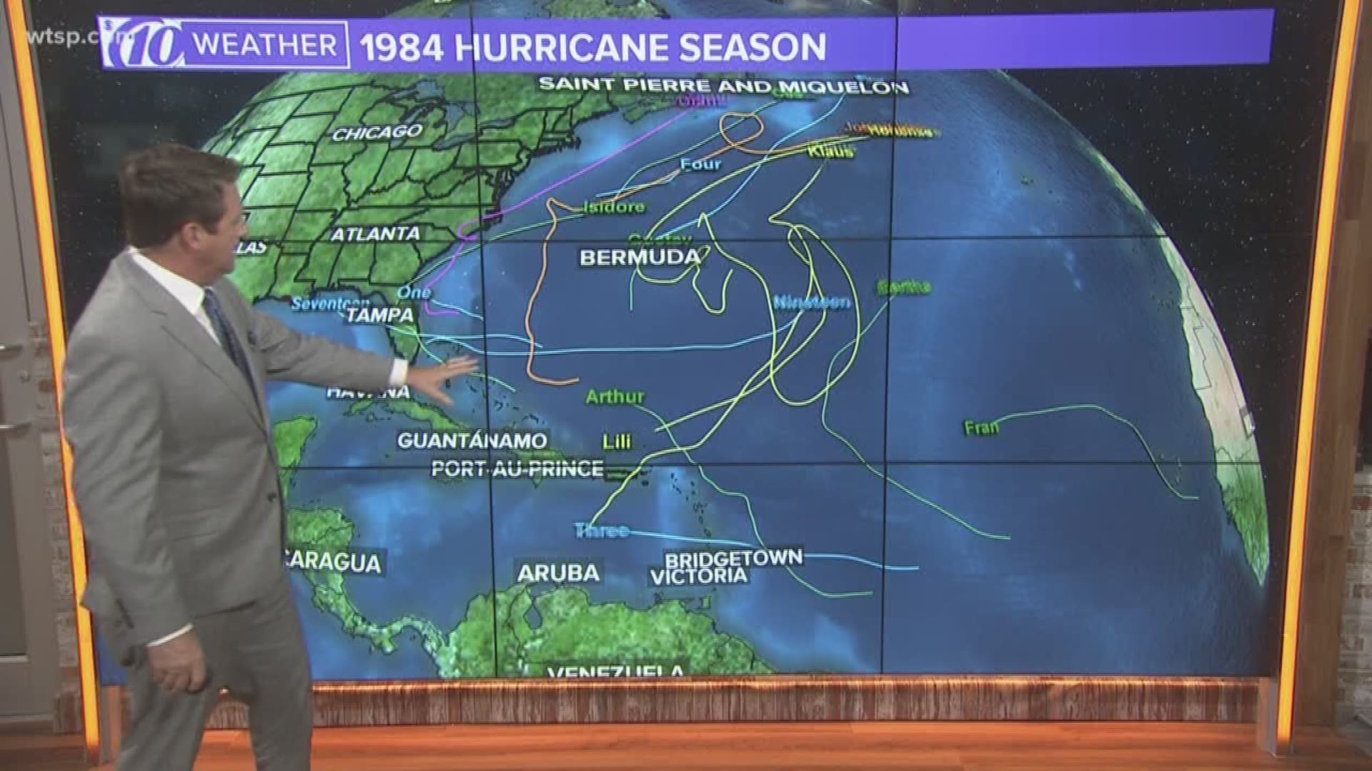
Klotzbach found the last time the Atlantic went from July 15 through Aug. 19 with no named storms was 1982.
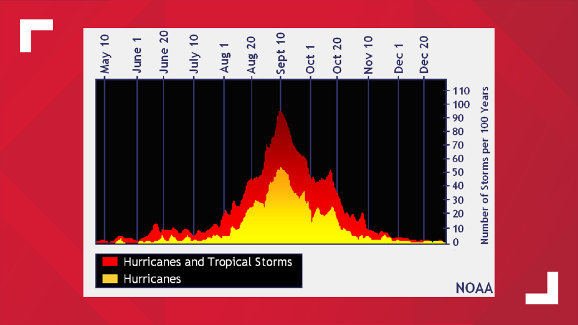
It's not like there's anything wrong with a quiet start to hurricane season, but there is a long way to go. Per climatology, the season picks up in earnest from about late August to September, and there's a bit of an uptick in the middle of October.
That's about the time of year when the main ingredients to create a tropical cyclone come together almost perfectly: warm sea surface temperatures (typically 80 degrees or greater), thunderstorm formation and low wind shear.
Check out the chart below. You'll see it's a steady climb to the top, and we have a bit of a way to go before the most activity is expected.


In the meantime, relax and enjoy the remainder of summer knowing it's quiet out there. In fact, there are a couple of factors at the moment hampering any probability of tropical development whatsoever.
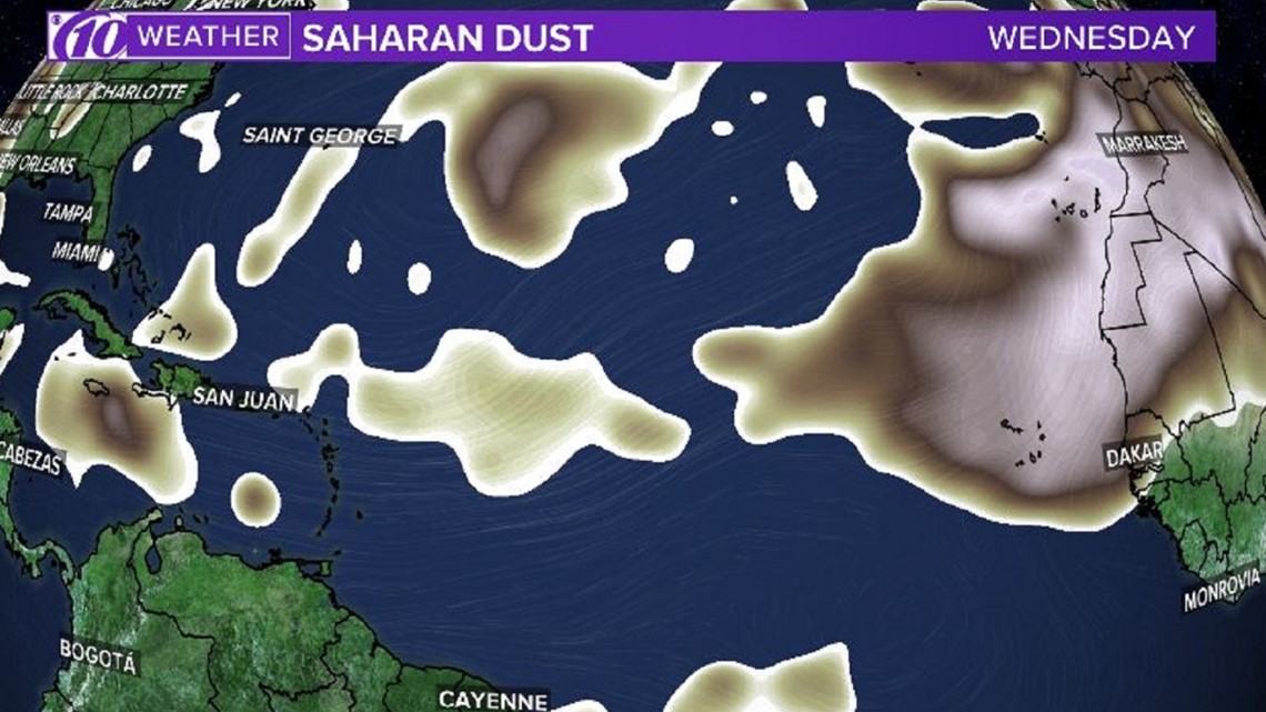
There's a good deal of Saharan dust -- that's actual dust blown off the continent of Africa -- floating about the Atlantic Ocean. This dry air actually puts a sort of "cap" on the atmosphere, greatly limiting or prohibiting thunderstorm development. Without a single thunderstorm, there will be no tropical cyclone.


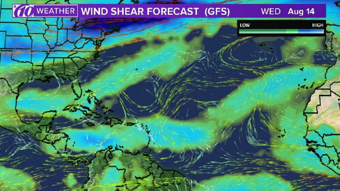
The latest wind shear forecast is another limiting factor. Wind shear -- the change in wind speed or direction with a change in height -- is moderate to high across a good portion of the Gulf, Caribbean and Atlantic.
Even if a storm were to develop in these areas, it would literally get torn apart by speedy winds coming at it from different directions.


This is what's happening at the in real-time, so it's important to stay tuned to forecasts through the rest of the season as these conditions will change. It's not yet too late to build up your hurricane supply kit and learn what to do if a storm threatens.
The National Oceanic and Atmospheric Administration recently revised its Atlantic hurricane season predictions as new data suggest El Niño has ended. As a result, it now says there's an increased chance for an above-normal hurricane season with 10-17 named storms (we can check Andrea and Barry off the list), five to nine hurricanes and two to four major hurricanes.
It only takes one, with a significant landfall, to go into the history books.
What other people are reading right now:
- Florida daycare worker charged with child abuse
- Florida man accused of holding Uber Eats driver against her will
- 'Chrisley Knows Best' stars indicted by federal grand jury for financial crimes
- VIDEO: Teens attack men with skateboards in Orlando
- Chickens test positive for mosquito-borne West Nile virus in Citrus County
►Make it easy to keep up-to-date with more stories like this. Download the 10News app now.
Have a news tip? Email desk@wtsp.com, or visit our Facebook page or Twitter feed.

