
ST. PETERSBURG, Fla. — Today is Aug. 1! The Atlantic tropical basin is active as we close out the month but so far, so good for the U.S. and for us in Florida.
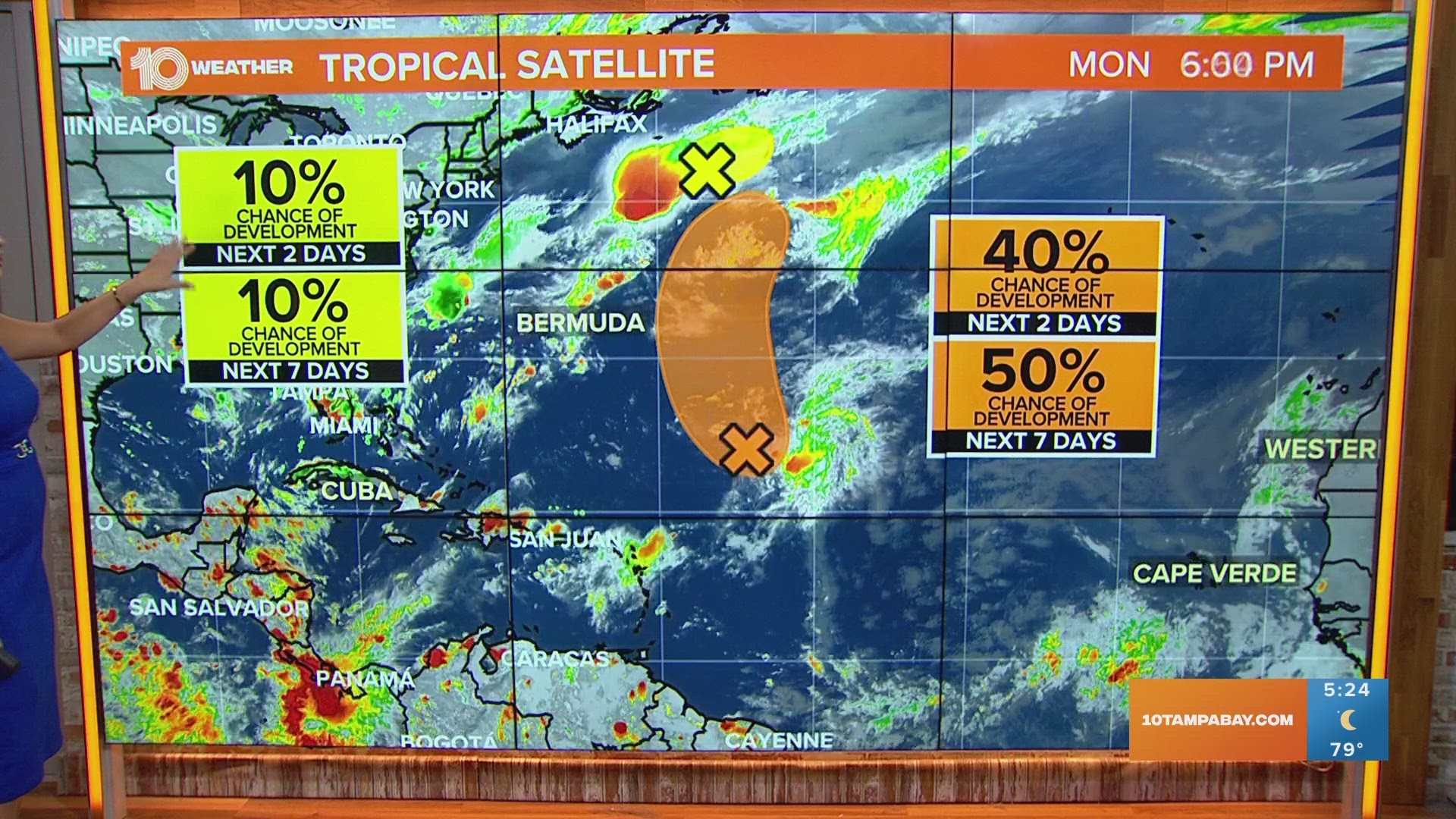
There is an area of interest that currently has been lowered to a 40% for development over the next two days and a higher 50% chance for development in the next week, according to the National Hurricane Center. The disturbance is in the middle of the Atlantic and will remain a fish storm as it is forecast to curve toward the northern Atlantic.
The other area of interest has been lowered to a 10% chance of development into a tropical system over the next seven days. This disturbance will move northeastward toward the mid-Atlantic and away from land.
Neither of these disturbances poses a threat to the United States.
Even though we are currently in no danger with the tropics — now is the time to prepare! Make sure to replenish your hurricane kit with all the supplies you would need, especially if the power goes out. The peak of hurricane season is Sept. 10, which is right around the corner!
Although it's been quiet recently, most of the activity does not occur until August through October. For example, Hurricane Ian made landfall on Sept. 28, 2022, in southwest Florida. In addition, remember the official end of hurricane season is Nov. 30, so we have plenty of time left to see more activity.
Most tropical systems in the month of August form either in the Caribbean, western Atlantic and the Gulf of Mexico, with Florida in the center of all of the hot spots for tropical development. The 10 Tampa Bay Weather team will continue to keep watch.