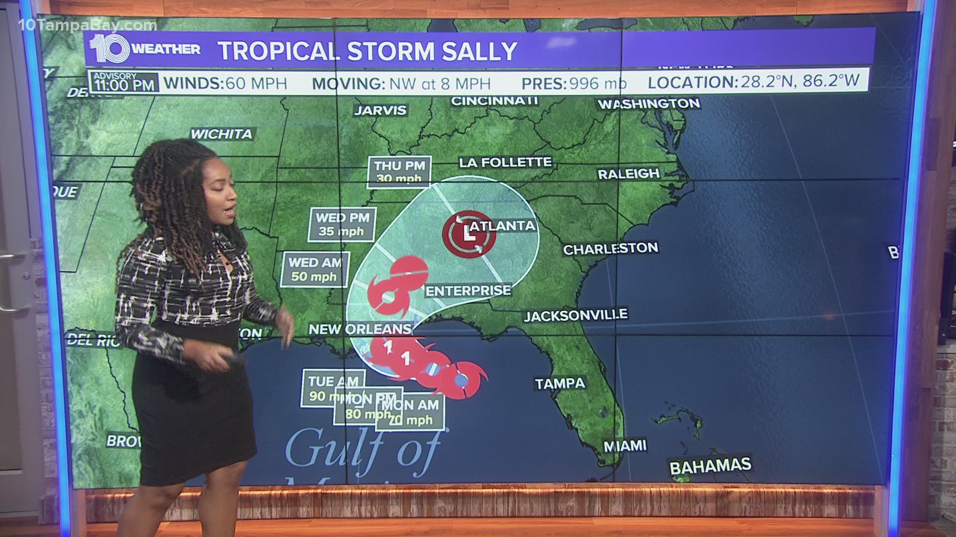
ST. PETERSBURG, Fla. — Tropical Storm Sally continues its trek away from the Tampa Bay area and into the Gulf of Mexico, where it is forecast to become a hurricane before landfall.
It is a 60-mph storm located about 140 miles south-southwest of Panama City, according to the National Hurricane Center's latest advisory. Now moving across warm waters, this will allow the tropical storm to strengthen further in the coming days.
The storm is forecast to eventually decrease in speed and make a northward turn toward the northern Gulf Coast either Monday night or Tuesday. Additional strengthening is expected, the NHC says, and it could become the season's next hurricane by Monday night. Winds are forecast to be of at least 90 mph prior to landfall -- a Category 1 hurricane.
Tropical-storm-force winds currently are extending up to 125 miles outward from Sally's center, according to the NHC.
A storm surge warning is in effect for:
- Port Fourchon, Louisiana, to the Alabama/Florida border
- Lake Pontchartrain, Lake Maurepas and Lake Borgne
- Mobile Bay
A hurricane warning is in effect for:
- Morgan City, Louisiana, to the Mississippi/Alabama border
- Lake Pontchartrain and Lake Maurepas, including metropolitan New Orleans
A hurricane watch is in effect for:
- Mississippi/Alabama border to the Alabama/Florida border
A tropical storm warning is in effect for:
- Mississippi/Alabama border to Indian Pass Florida
- Intracoastal City, Louisiana, to west of Morgan City
A tropical storm watch is in effect for:
- Indian Pass to Ochlockonee River, Florida
Tropical Storm Sally is expected to produce 8-16 inches with isolated amounts of 24 inches over portions of the central Gulf Coast from the western Florida Panhandle to southeast Louisiana from Monday through the middle of the week.
Hurricane-force winds and life-threatening storm surge is possible from Louisiana to the Florida Panhandle as Sally closes in on late Monday to early Tuesday landfall.
With the activity so far this year, it is no surprise we are officially in peak hurricane season. In addition to Tropical Storm Sally there is Hurricane Paulette and Tropical Storm Rene, churning in the Atlantic and multiple areas of interest in the tropics.
The record for the earliest named “S” storm is Stan on Oct. 2, 2005.
The National Oceanic and Atmospheric Administration (NOAA) updated its 2020 hurricane season forecast earlier this month, indicating one of the most active seasonal forecasts that NOAA has produced in its 22-year history of hurricane outlooks.
The updated forecast calls for 19-25 named storms, 7-11 hurricanes and 3-6 major hurricanes. This includes the 18 storms and six hurricanes we’ve already seen.
►Breaking news and weather alerts: Get the free 10 Tampa Bay app
►Stay In the Know! Sign up now for the Brightside Blend Newsletter

