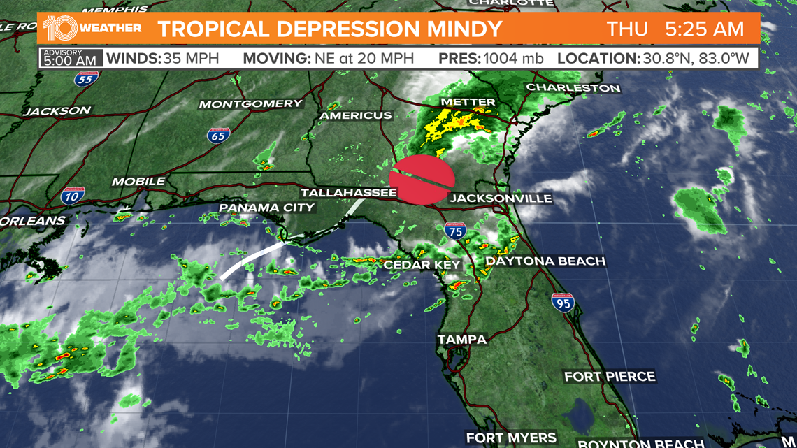
ST. PETERSBURG, Fla. — After making landfall as a tropical storm along the Florida Panhandle, Mindy has weakened to a tropical depression.
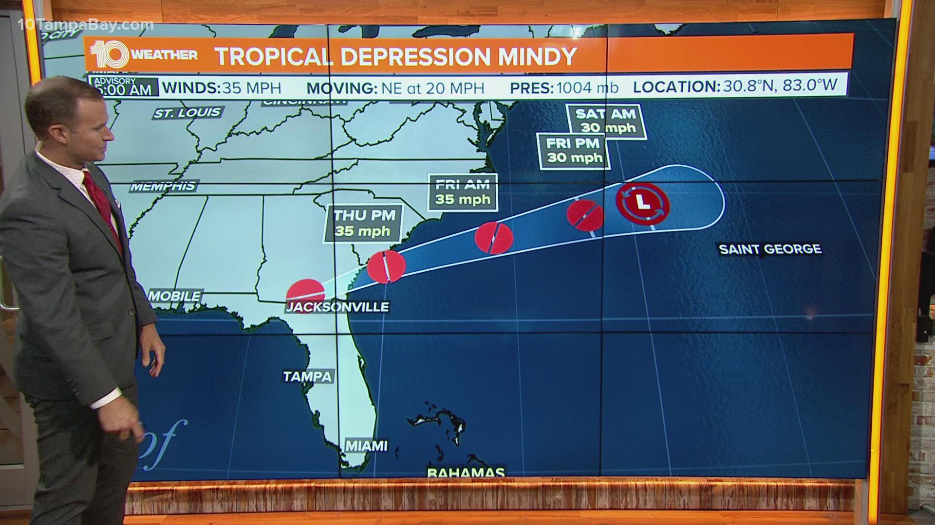
According to the latest advisory from the NHC, Mindy is about 80 miles south-southeast of Valdosta, Georgia. The system has maximum sustained winds of 35 mph and is moving northeast at 20 mph.
Little change in strength is forecast through Thursday, although by Friday the system is expected to weaken. By Saturday, the NHC says Mindy will be a remnant low.
Tropical Storm Mindy made landfall Wednesday evening in St. Vincent Island along the Florida Panhandle.
Once called 91-L, this newest storm produced an area of disorganized showers and thunderstorms in the northeastern Gulf of Mexico.
Earlier Wednesday afternoon, the National Hurricane Center gave the system a high 80-percent chance of development over the next five days as it approaches the Gulf Coast of Florida. It eventually emerges over the Atlantic waters by late Thursday when conditions look unfavorable for any further development.


The storm gives an increased chance of rain for Tampa Bay, but the northern part of the Florida Peninsula and most of the Florida Panhandle has the best chance for tropical downpours that could lead to potential flooding through Wednesday and Thursday.
Elevated rain chances and humidity, especially through the afternoon hours should be expected. Depending on how quickly the system moves northeast, that higher chance of rain could linger into Friday, as well.
The good news for Floridians will be that the system will remain relatively progressive and continue to track northeast and begin to move out of the area for the weekend.
This will result in more of a normal summertime pattern with only a 30-40 percent chance for showers and storms for Saturday and Sunday.

