
TAMPA, Fla. — Tropical Storm Isaac continues to churn in the North Atlantic this weekend, the National Hurricane Center said.
The storm will not be a threat to Florida, as it is currently located about 1,500 miles west of the Azores and 690 miles east-northeast of Bermuda. Issac will continue to track east-northeast over the next several days.
Currently, the models do not show any impact on any land, including Florida. This is now the ninth named storm of the 2024 Atlantic Hurricane Season.
We are also now tracking the tenth named tropical cyclone of the season, Tropical Storm Joyce.
Joyce is on the south side of a narrow subtropical ridge, which is going to weaken and break as a deep-layer trough amplifies over the central Atlantic during the next few days.

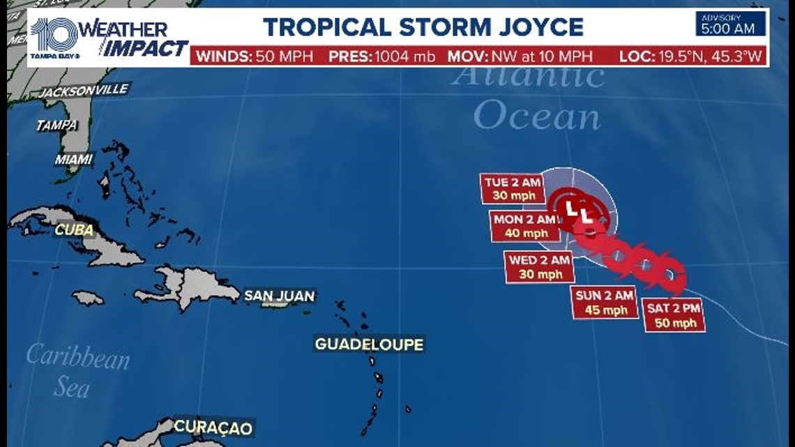
This evolution should cause Joyce to move slowly to the west-northwest and northwest for a couple of days, followed by
an even slower motion toward the north. Joyce is experiencing moderate southerly shear, and the global models forecast this to continue for the next several days.
In addition, the storm will be moving into a gradually drier environment. It is expected to weaken to a post-tropical storm next week.
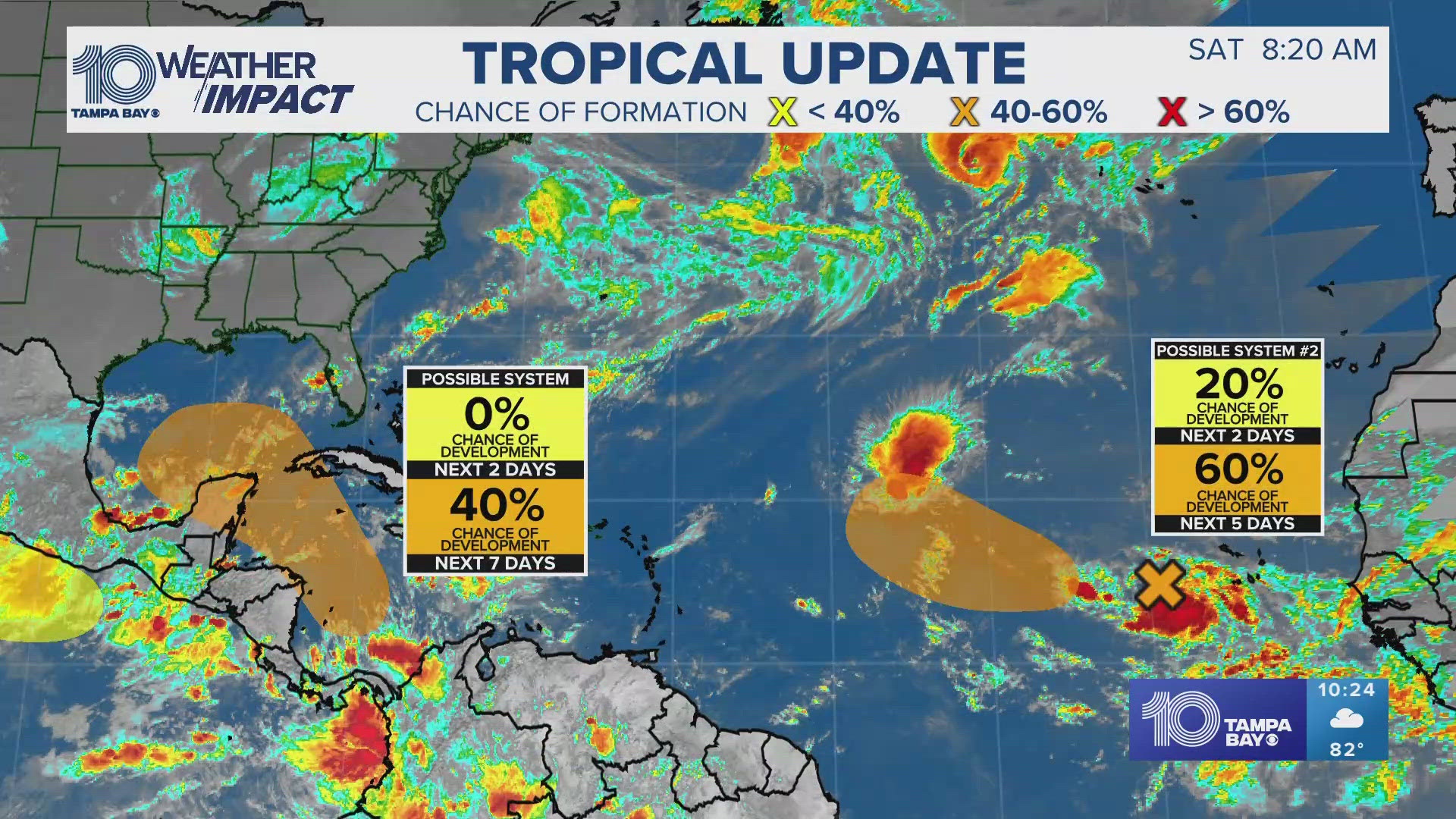
Elsewhere in the tropics, we are watching two other tropical waves. A broad and elongated area of low pressure, associated with a tropical wave, is producing disorganized showers and thunderstorms near and to the west of the Cabo Verde Islands.

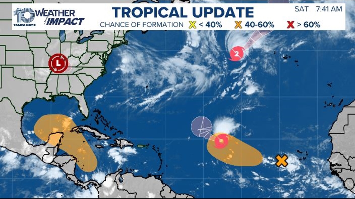
Environmental conditions appear conducive to the gradual development of this system, and a tropical depression could form during the early or middle part of next week while the system moves toward the west and then northwest across the eastern and central tropical Atlantic.
- Formation chance through 48 hours: 20 percent (LOW)
- Formation chance through 7 days: 60 percent (MEDIUM)
Western Caribbean Sea and Gulf of Mexico
An area of low pressure could form over the western Caribbean Sea in a few days. Environmental conditions are expected to be conducive for additional development, while the system moves generally northwestward, and a tropical depression could form during the middle to latter part of next week as the system enters the Gulf of Mexico.
- Formation chance through 48 hours: near zero percent
- Formation chance through 7 days: 40 percent (MEDIUM)