ST. PETERSBURG, Fla. — Tropical Storm Ian has gotten stronger and remains forecast to rapidly intensify and become a hurricane sometime Monday, according to the National Hurricane Center. Forecasters warn that Florida — especially the western Gulf coast, including Tampa Bay — should continue to monitor Ian's progress.
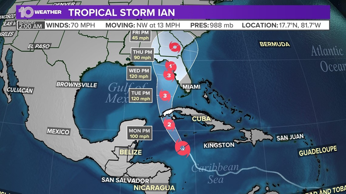
As of the 2 a.m. Monday advisory, Tropical Storm Ian was located about 355 miles southeast of the western tip of Cuba, with sustained winds of 70 mph. Ian's movement is northwest at 13 mph.
NHC also says Tropical Storm Ian is expected to produce significant wind and storm surge impacts in western Cuba.
10 Tampa Bay is keeping you ahead of the storm: Download our free mobile app for real-time storm information and breaking alerts, and download 10 Tampa Bay+ on your Fire TV or Roku devices to stream live coverage.
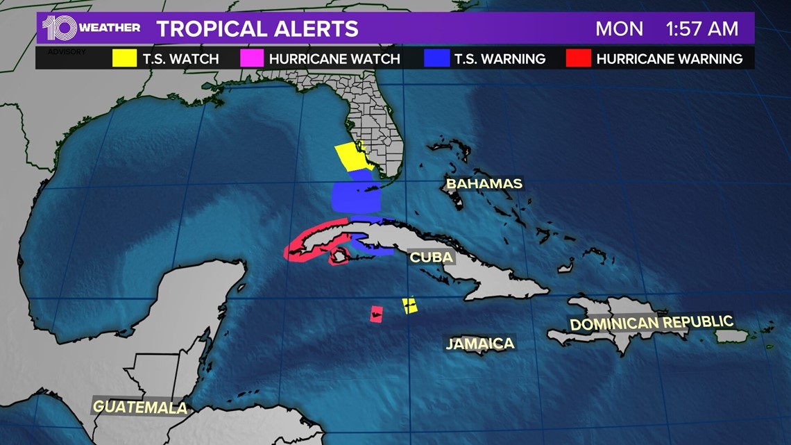
A hurricane warning is in effect for Grand Cayman and the Cuban provinces of Isla de Juventud, Pinar del Rio, and Artemisa. A tropical storm warning is in effect for the Cuban provinces of La Habana, Mayabeque, and Matanzas; plus the lower Florida Keys from Seven Mile Bridge westward to Key West and the Dry Tortugas.
A storm surge watch is in effect for the Florida Keys from the Card Sound Bridge westward to Key West and the Dry Tortugas. It also is in effect for the west coast of Florida from Englewood south to the Card Sound Bridge and Florida Bay.
A tropical storm watch is in effect for Little Cayman and Cayman Brac. Englewood southward to Chokoloskee also is under a watch.


Tropical Storm Ian is forecast to pass near or west of the Cayman Islands on Monday. It'll then near or move over western Cuba into Monday night and early Tuesday. Ian will then emerge from the islands and enter the southeastern Gulf of Mexico on Tuesday.


See the National Hurricane Center's "cone of uncertainty" above. It represents the probable track of the center of a tropical cyclone — note that impacts from a tropical system do occur away from the center and outside the cone.
Forecasters at the National Hurricane Center have since moved the cone slightly eastward following an eastward shift in the weather computer models. This is a change from earlier in the weekend when some models predicted a more westward track.
This change eastward poses a more serious risk for significant storm surge flooding and hurricane-force winds in the Tampa Bay area. Still, some shifts in the forecast can be expected as the storm continues to develop.
Tropical Storm Ian also is anticipated to undergo significant to rapid intensification given a favorable environment for development. This would increase the impacts of storm surge, damaging winds and flooding rains.
Bottom line: Everyone along the western Gulf coast should be keeping a close eye on Tropical Storm Ian given this area outlined in Ian's forecast cone.
Now is not the time to let your guard down. Make sure you have your plan in place and hurricane kit ready at hand. Check out our full list of hurricane hacks here.


