ST. PETERSBURG, Fla. — After weakening from a tropical depression into a tropical wave, Fred has regained tropical storm strength, according to the NHC.
With its current track, the most significant impacts are forecast to be along parts of the Florida panhandle and the state's border with Alabama.
As of the 5 a.m. advisory, the National Hurricane Center said Tropical Storm Fred has maximum sustained winds of 50 mph, with higher gusts, and is moving north-northwest at 6 mph. It is located about 175 miles south of Panama City, Florida.
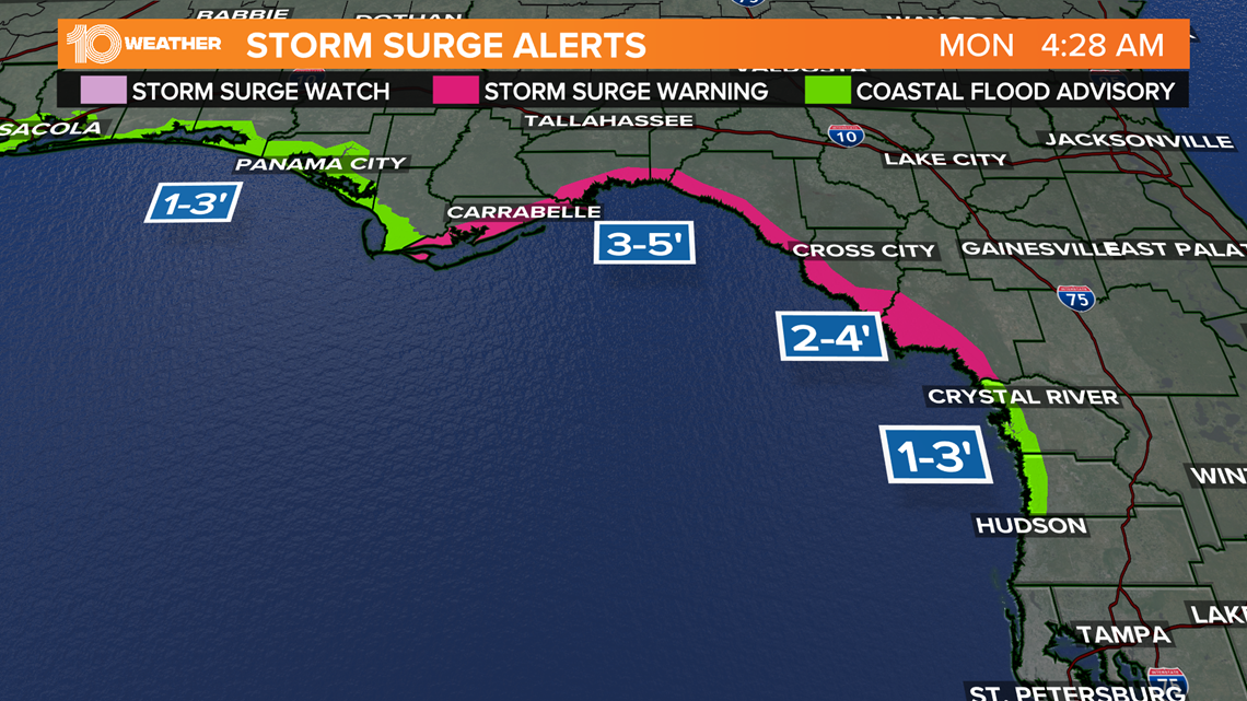
An Air Force reconnaissance aircraft found that Tropical Storm Fred has slowed down a little, but on Monday morning the storm is expected to speed up again before it turns toward the north by the afternoon. Heavy rainfall and a dangerous storm surge are expected along the coast of the Florida Panhandle and Big Bend starting Monday.
On this track, the NHC says by Monday afternoon the storm will turn toward the north. Through Monday Tropical Storm Fred should move across the eastern and northern Gulf of Mexico and then make landfall by Monday night in the western Florida Panhandle.
Tropical Storm Fred is expected to gradually strengthen as it moves over the Gulf of Mexico until making landfall, and then it is expected to quickly weaken.
RELATED: Tropical Storm Fred continues to slow as it nears Florida Panhandle, dangerous storm surge expected
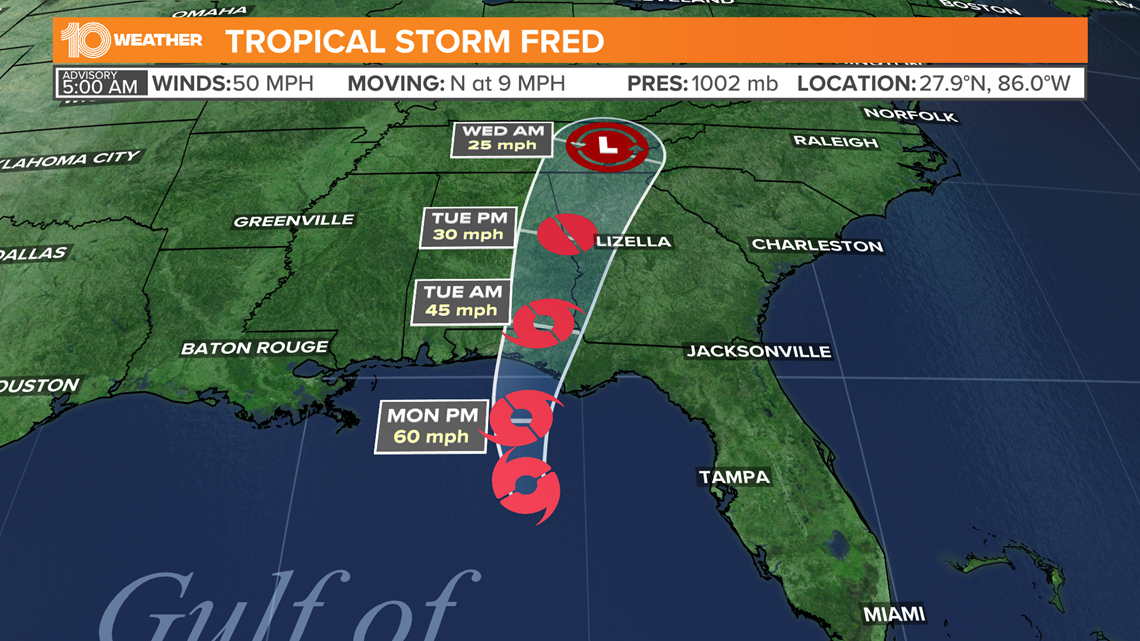
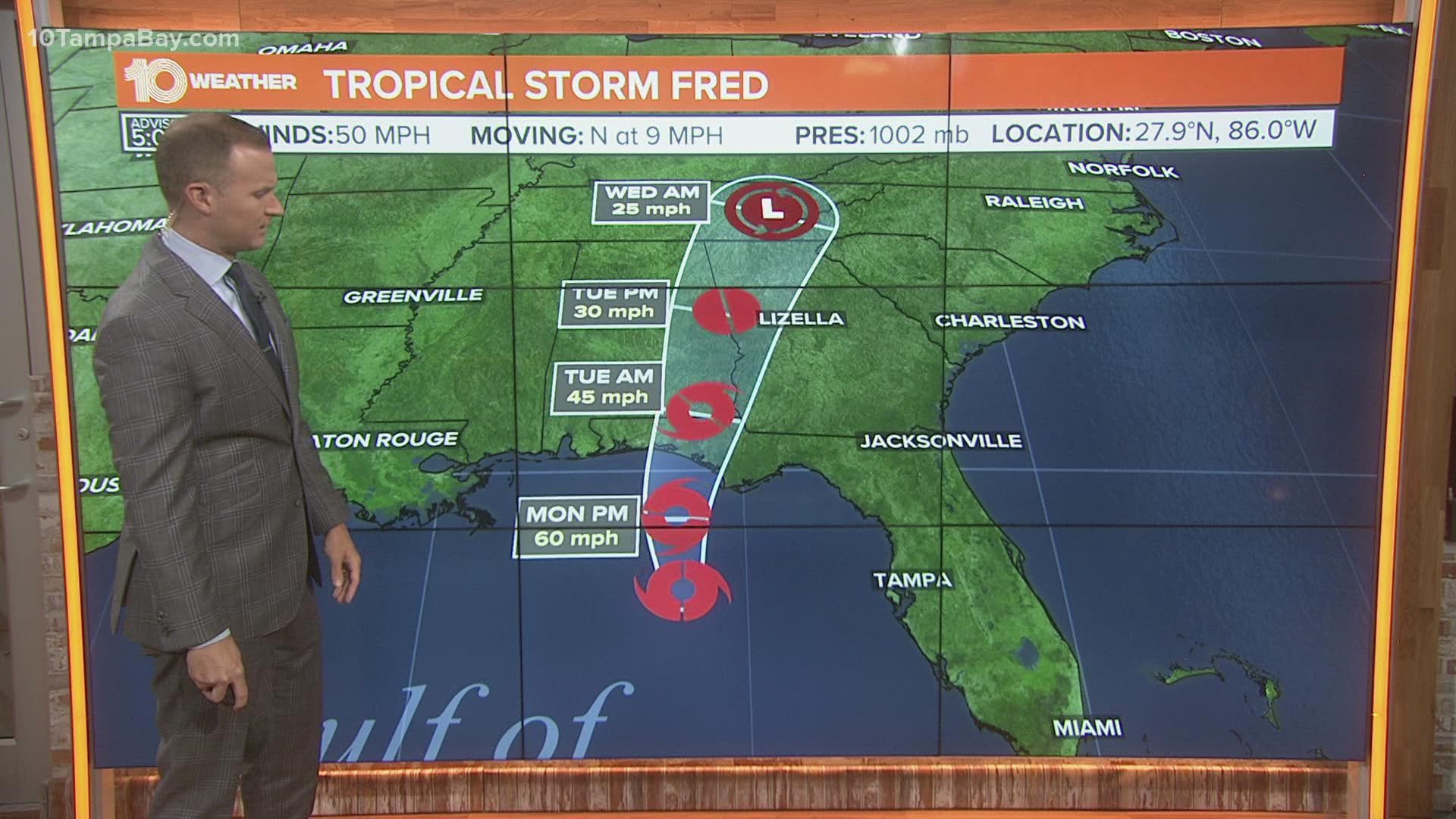
Tropical Storm Fred forecast cone
This is the latest forecast cone — or "cone of uncertainty" — for Fred. The graphic below shows the area where the storm could go, when and how strong it might be at the given time.
Remember: Impacts from a tropical system do occur even just outside the cone, so it's best to be prepared as a storm approaches.


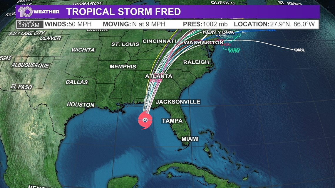
Fred spaghetti models
Resembling spaghetti noodles, each line in a spaghetti model represents a computer's best guess as to where the center of the storm will go. These models, however, do not show expected impacts to areas.


Tropical Storm Fred watches and warnings
A tropical storm warning is in effect for:
- Coast of the Florida Panhandle from Navarre to the Wakulla/Jefferson County line.
A storm surge warning is in effect for:
- Coast of the Florida Panhandle from Indian Pass to Steinhatchee River


10 Tampa Bay is your Hurricane Headquarters:

