
TAMPA, Fla. — Hurricane Francine formed Tuesday night in the Gulf of Mexico as it churns closer to the Louisiana coast.
The National Hurricane Center says life-threatening storm surge and hurricane-force winds are expected in the state on Wednesday.
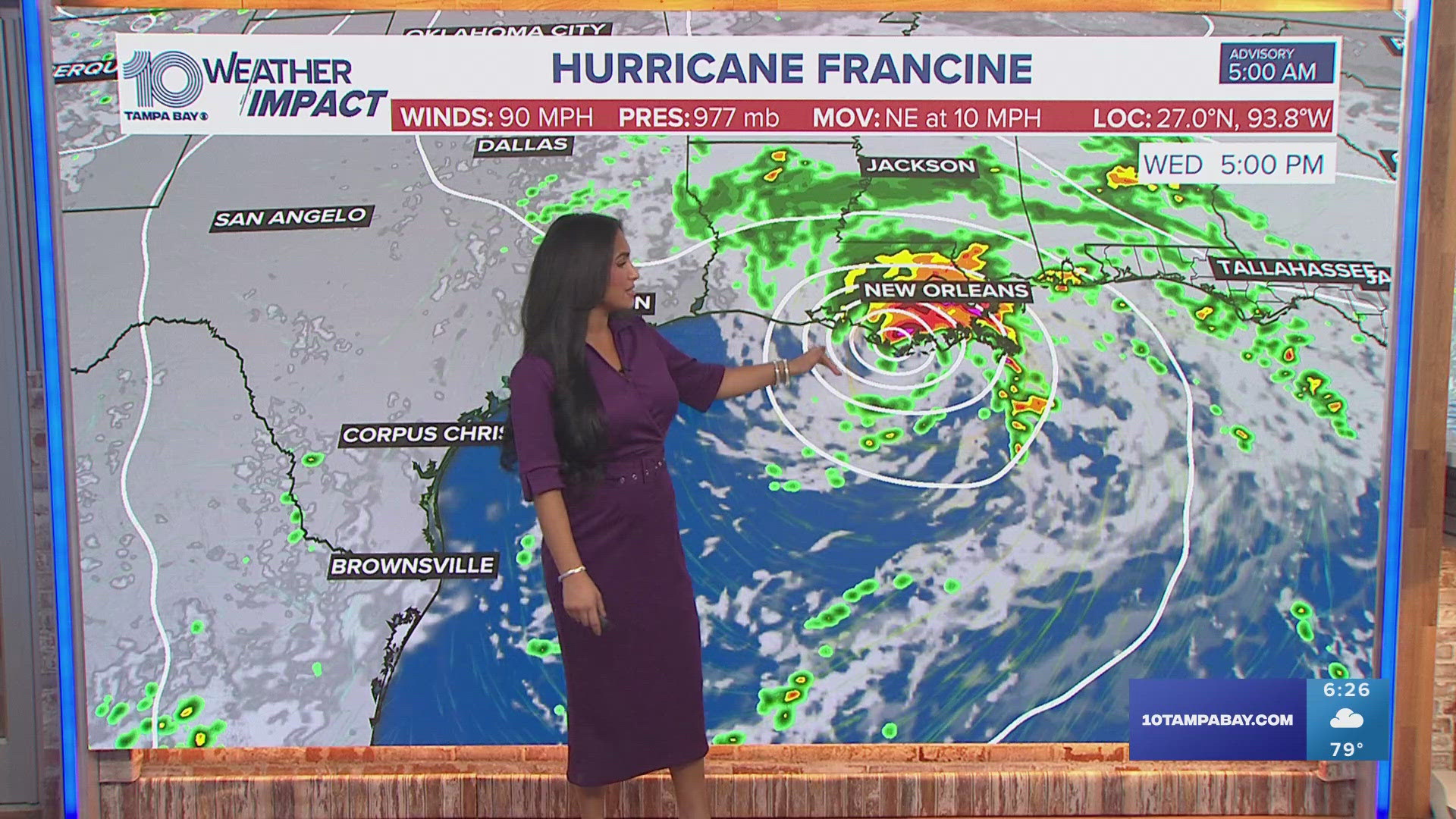
What was once Potential Tropical Cyclone Six, Francine has maximum sustained winds of 75 mph and is located about 150 miles east of the mouth of the Rio Grande and 350 miles southwest of Morgan City, according to the NHC's latest advisory.
For the Florida Gulf Coast, including the Tampa Bay area, this storm will not threaten the region.
"Hurricane conditions are possible within the watch area by Wednesday afternoon, with tropical storm conditions possible by Wednesday morning," the advisory read.
The storm is expected to bring storm total rainfall of 4-8 inches with local amounts to 12 inches. Storm surge and the tide can also cause normally dry areas near the coast to be flooded by rising waters moving inland towards the shoreline. Some parts of Louisiana can see up to 5-10 feet of surge.
This is about the time of year when the Atlantic hurricane season reaches its peak, meaning there's usually more tropical activity now than at any point in the season. It's been several weeks, however, since there has been a named system worth monitoring.
Hurricane center forecasters are keeping an eye on two other disturbances in the far central and eastern Atlantic, and it remains too soon to say whether these will reach the U.S.