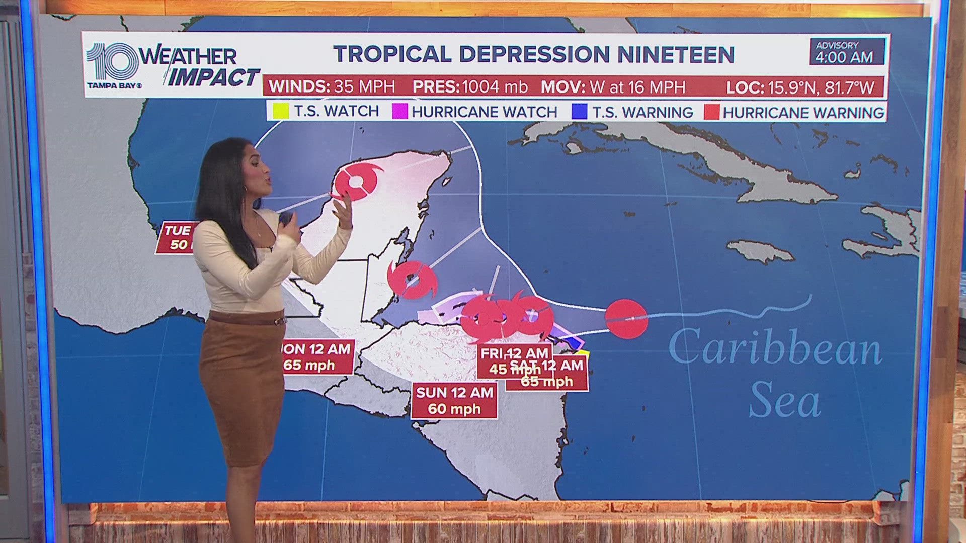
ST. PETERSBURG, Fla. — Tropical Depression Nineteen is becoming better organized and strengthening, and will likely become our next named storm, Sara, by this afternoon.
As of this morning, the system continues to show signs of strengthening as it approaches Honduras. At the surface level, things remain broad and disorganized.
Tropical Depression Nineteen will soon develop into Tropical Storm Sara by later today and then from there, it will meander and spin through Central America for a few days due to weaker steering currents.

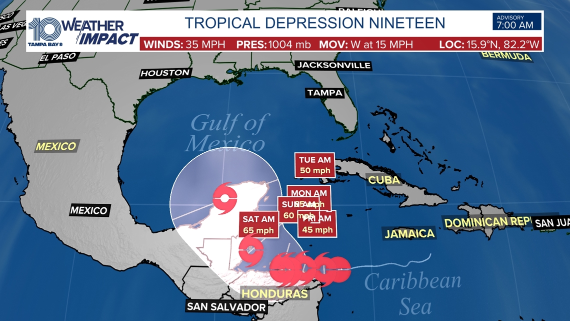
If timing and placement play out as models currently suggest, an area of high pressure over us in Florida will keep tropical activity further south. By next week, after looping along the coast of Central America, the system will continue on a gradual westward motion approaching Belize and the Yucatan Peninsula where it could approach hurricane strength dependent on its interaction with land and steering currents. The system will spend much more time over land and away from its energy source the warm Caribbean waters, meaning we will have a much weaker system overall.

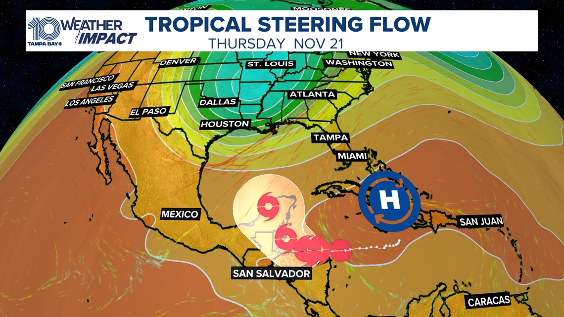
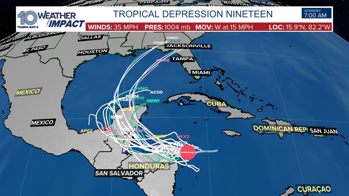
It is too soon to determine if Florida will see this system brush against the west coast as suggested by earlier model runs or what impacts, if any, this system could bring to the eastern Gulf of Mexico.

This is a good reminder that our hurricane season continues until Nov. 30 and that we still can have landfalling hurricanes here in Florida, even if it's rare.
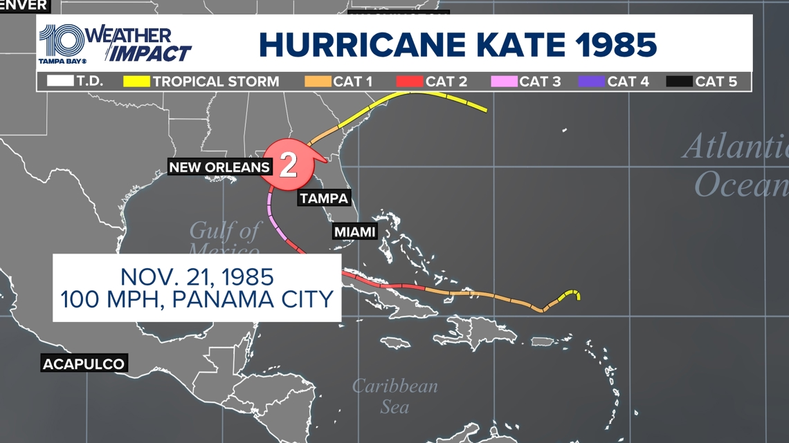
The hurricane that made landfall latest in the season along Florida's Gulf Coast was Hurricane Kate on Nov. 21, 1985. Sustained winds were near 100 mph in Panama City at landfall.

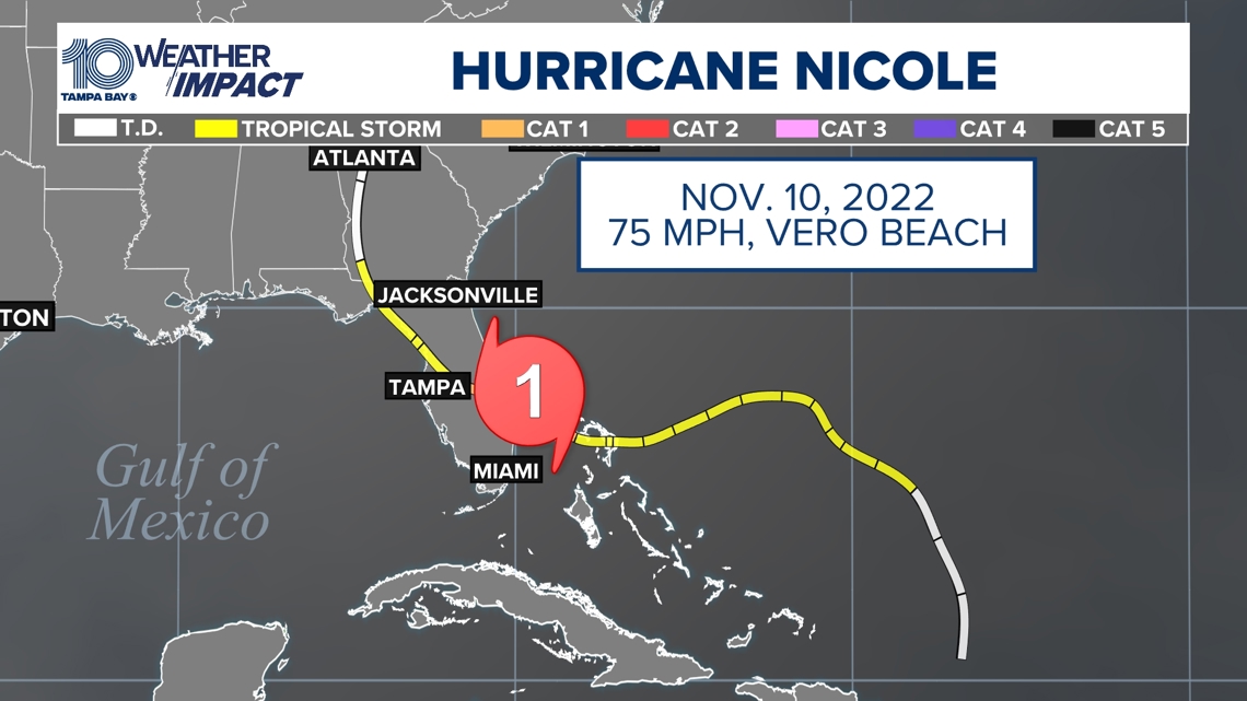
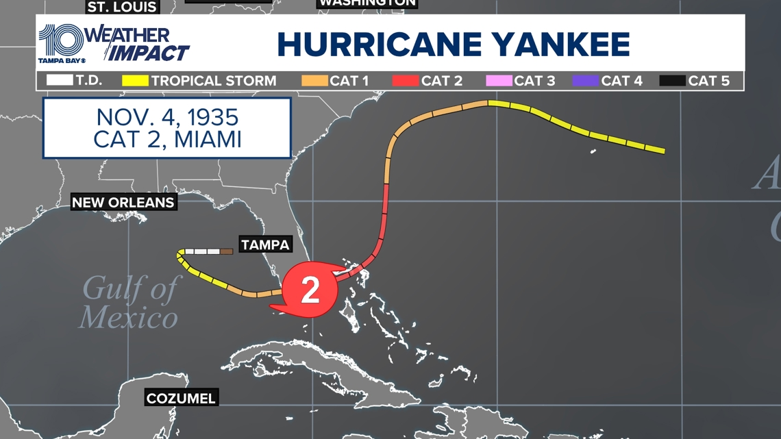
Two other hurricanes that made November landfalls in Florida include Hurricane Yankee in 1935 and Hurricane Nicole in 2022.


Remember we are still in the 7-10 day range, so we will have changes to the timing, track, and intensity of a potential tropical system. Make sure to keep checking back, and we will continue to keep you informed, prepared and connected.

