
TAMPA, Fla. — We are tracking one more flurry of activity in the tropics before the holidays. This is a good reminder the 2024 Atlantic Hurricane season does not officially end until November 30th.

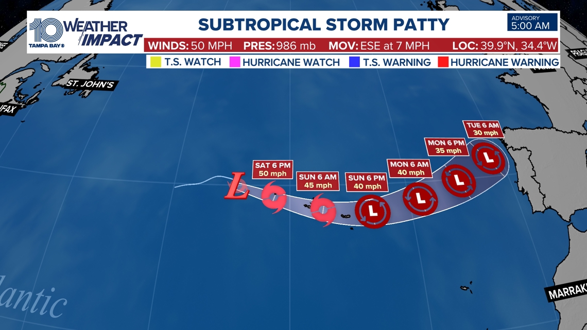
The National Hurricane Center is issuing advisories on newly formed Subtropical Storm Patty, located over the northeastern Atlantic Ocean. It is heading toward Europe this week and poses no threat to us at home. A hatched are of yellow near the Dominican Republic will have a very low chance of development as it becomes absorbed into a front next week. The area to watch is the Caribbean our weather team has been talking about for more than a week.

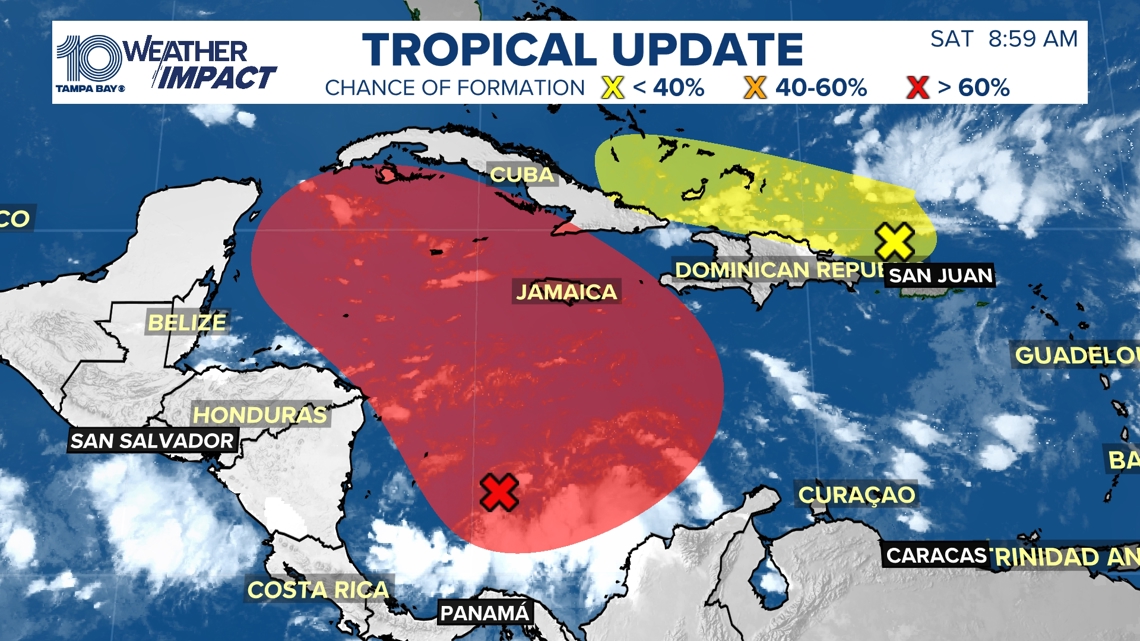
In the Southwestern Caribbean Sea: Disorganized showers and thunderstorms over the southwestern
Caribbean Sea are associated with a broad area of low pressure. There is a high likelihood of gradual development of this system and a tropical depression is likely to form within the next few days while the system moves generally northward to northwestward over the central and western Caribbean Sea. Regardless of development, locally heavy
rains are possible over portions of the adjacent land areas of the western Caribbean, including Jamaica, Hispaniola, and Cuba.

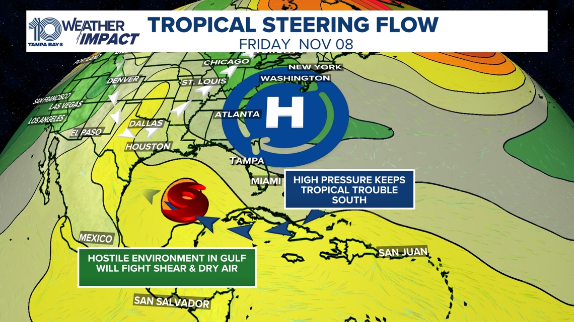
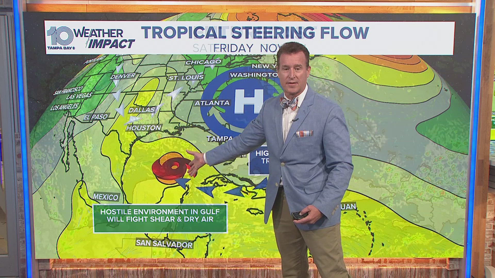
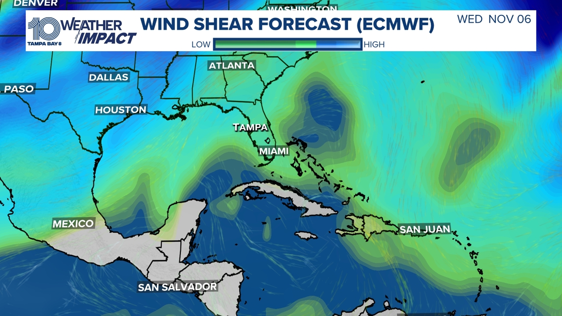
Right now the atmospheric steering currents are more favorable for anything that develops to stay well south and west of us here at home. You can thank a sprawling high pressure for keeping the eastern Gulf of Mexico closed for business. We will keep an eye on it of course especially for our friends in Mexico and possibly even Texas if it survives dry air and wind shear.

Our 10 Tampa Bay team will continue to keep a close watch on this developing system for you, so continue to check in on air and online for the latest updates and information.