x
Breaking News
More () »

Monitoring 3 disturbances for potential tropical development

We're keeping an eye on three areas of development in the tropics but there are no threats to Florida at this time.

ST. PETERSBURG, Fla. — There are now three different areas we are monitoring for the possibility of tropical development

The first disturbance is in the central Atlantic and will likely become a fish storm, which means it will not impact any landmass. It includes remnants of Gordon, which was the latest tropical storm to form. A tropical depression or storm could re-form in a few days. There's a 40 percent chance for development over the next seven days, with a 20 percent over the next two days. 

The second area, located in the west-central Atlantic, has a low chance for development at 20% over the next week and 10% in the next two days. It's expected to stay over open waters. 

The third area of development possible is in the Caribbean Sea. This is the area we NEED to watch as we could have a storm by next Thursday in the Gulf.

Right now, the slow-moving disturbance has a low chance over the next week of forming a low-pressure system over the northwestern Caribbean. There's no immediate development chance and it has a 40 percent chance over the next seven days. 

However, we need to watch this portion of the Caribbean closely because of something called the "Central American Gyre," which starts to become active in the late spring into the early fall. 

The Central American Gyre, a large area of weak, low pressure, is active over Central America. This system can occasionally spin off more areas of compact, low pressure that can eventually become tropical storms or even hurricanes. 

Credit: 10 Tampa Bay

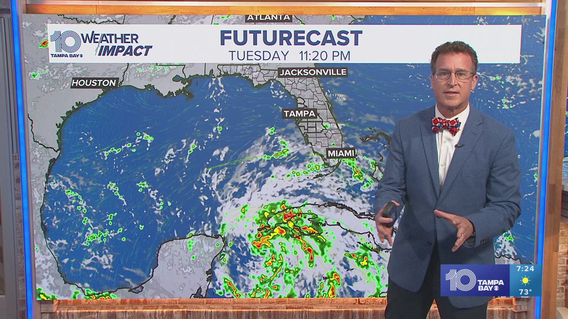
We could see development in the Caribbean that pushes into the Gulf by late next week. The models are not in agreement since the timing is so far out. With that in mind, it is much too soon to determine what is going to form, the intensity, or the track past the next seven days.

Still, there is a high likelihood we could see a tropical system in the Gulf of Mexico next week.

The European model brings that system to the western portion of the Gulf and away from us. Meanwhile, the American model brings the tropical system more northward with potential impacts to Florida. Thankfully, there is no immediate threat, but it's still a good idea to double-check your hurricane kits just in case.

We will know much more by the end of this weekend into early next week. 

Before You Leave, Check This Out