The National Hurricane Center (NHC) is tracking Disturbance #1 but gives it just a 10 percent chance of further development.
While the storm may have some development over the weekend, it is expected to be moving into an increasingly bad environment for development beyond that.
While tropical cyclone development can’t be ruled out, we’re in a period that it is less likely. This is due to something called a suppressed rainfall phase of the Madden-Julian Oscillation (MJO). The MJO is an eastward-moving area of increased uplift (resulting in more rainfall and winds) that circles the globe in the tropics. In general, it takes this disturbance 30-60 days to circle the globe and return to its starting point.
There are two phases associated with the MJO. A convective (enhanced rainfall) phase, and a suppressed rainfall phase. These phases normally cover roughly half the globe, so the result is roughly half the planet sees enhanced rain and storms and half the planet sees suppressed rain and storms.
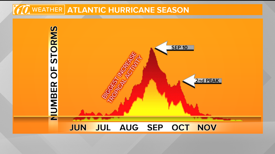
This suppressed phase of the MJO is expected to weaken for the last 10 days or so of August. This coincides with a time that the Atlantic Basic hurricane season really starts moving into the active climatological part of the Atlantic hurricane season. Roughly 85 percent of major hurricanes (category 3 or higher) happen after August 20.
For everything you need to prepare for hurricane season, visit the 10 Tampa Bay hurricane page at www.10TampaBay.com/tropics.


