
ST. PETERSBURG, Fla. — The peak of hurricane season arrives Sept. 10th but it will remain unusually quiet for this time of year. Most long-range models show a much busier period of weather in the tropics by late September and early October. But as always stay prepared and check in with us daily.
Southwestern Gulf of Mexico:
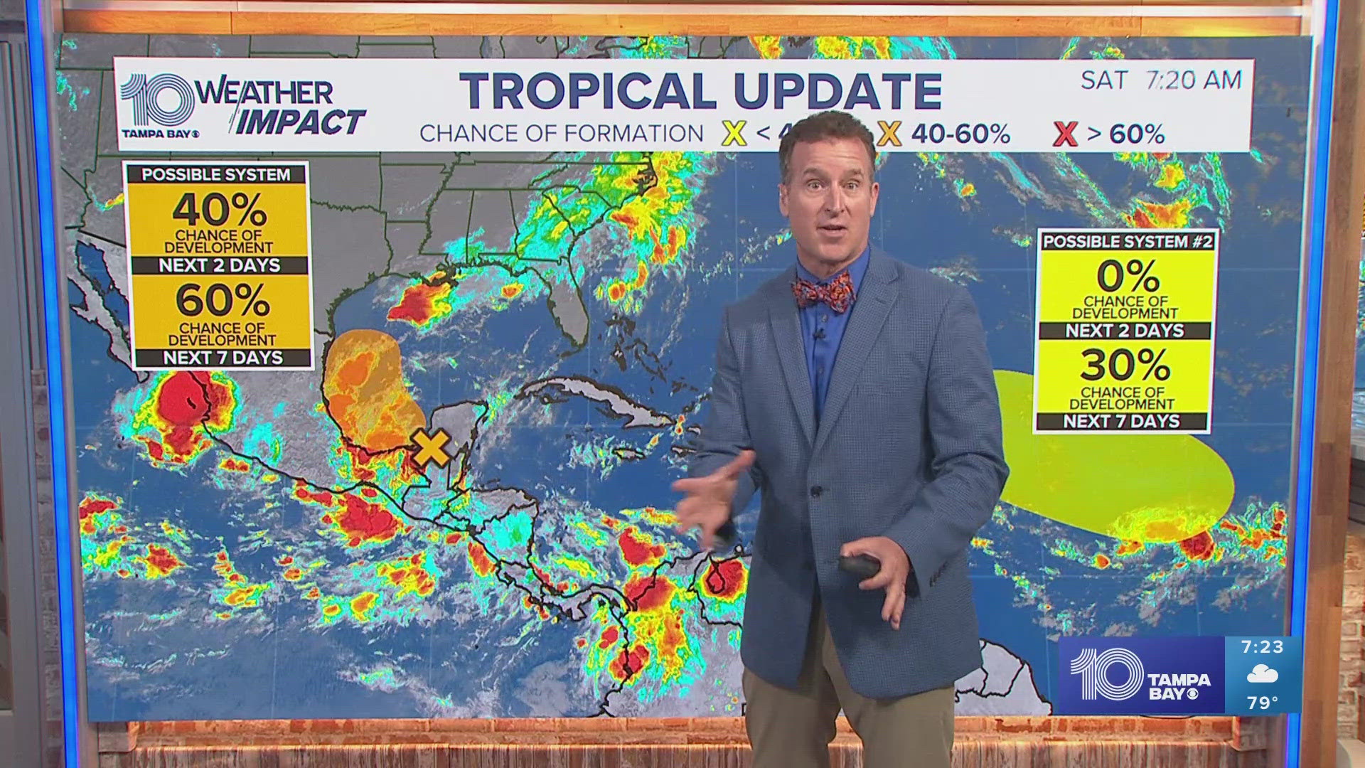
A tropical wave over the Yucatan Peninsula of Mexico is producing
disorganized showers and thunderstorms over Guatemala, southeastern
Mexico, and the adjacent waters of the southwestern Gulf of Mexico.
The wave is expected to move over the Bay of Campeche later today,
and an area of low pressure is forecast to develop while interacting
with a frontal boundary. Environmental conditions are forecast to be
conducive for development, and a tropical depression could form
during the early or middle part of next week while the system moves
slowly northwestward over the southwestern Gulf of Mexico.
* Formation chance through 48 hours...medium...40 percent.
* Formation chance through 7 days...medium...60 percent.
Eastern and Central Tropical Atlantic:
An elongated trough of low pressure over the eastern and central
tropical Atlantic is producing a broad area of shower and
thunderstorm activity. A more well-defined area of low pressure may
form within this region during the next few days. Some slow
development of this system is possible while the disturbance
meanders through the early part of next week, then begins to move
west-northwestward across the central tropical Atlantic during the
middle to latter part of next week.
* Formation chance through 48 hours...low...near 0 percent.
* Formation chance through 7 days...low...30 percent.
Our 10 Tampa Bay weather impact weather team will continue to monitor the tropics to keep you informed, prepared and connected.