ST. PETERSBURG, Fla. — Hurricane season technically runs from June 1 through the end of November, though there should be a heightened sense of alertness in our neck of the woods for the next couple months.
Climatologically speaking, September and October can be an active period for Tampa Bay and Florida's Gulf Coast when it comes to the development of tropical systems and where they end up going.
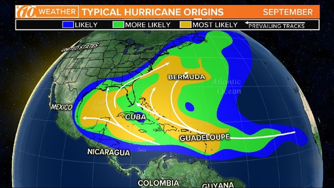
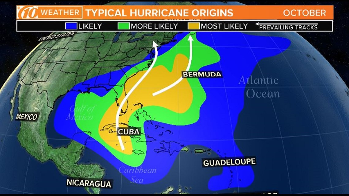
Check out the images below. Areas highlighted in orange show the most likely zones of origin for hurricanes, and the lines indicate a general direction.
An important caveat from the National Hurricane Center: The areas outlined are averages, and hurricanes can and do originate in different locations and travel in different paths from the average.
►Stay informed with all tropical weather: Check out our must-have interactive Hurricane Headquarters guide here.
September


October


For example, in the month of September, a storm that develops in the Caribbean Sea tends to move to the northwest, enter the Gulf of Mexico and potentially impact land on the coastline.
It all trends eastward in October largely because the subtropical high over much of the Atlantic Ocean tends to break down, lessening its influence in steering hurricanes westward and deflecting them to the south.
Having a hurricane plan in place all season long will, hopefully, lessen the impact any storm could have should it threaten.
What other people are reading right now:
FREE 10NEWS APP:
►Stay In the Know! Sign up now for the Brightside Blend Newsletter


