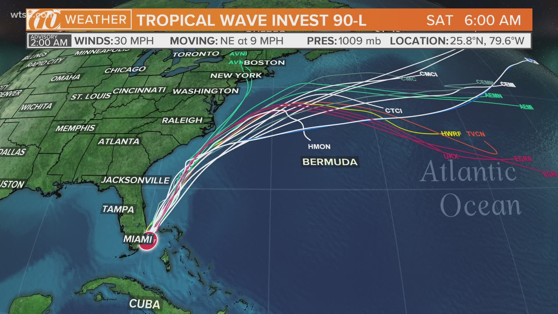
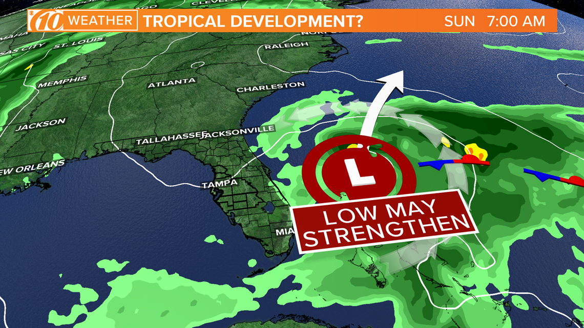
ST. PETERSBURG, Fla. — It's that time of year when our eyes shift from tracking cold fronts moving in from the north to the tropics. In the current case, it's a merger of both of those focuses where a cold front positioned south of Florida could help generate an area of low pressure that may have some tropical characteristics this weekend.
A trough of low pressure that was located over the Straits of Florida on Friday has shifted offshore of the southeast coast of Florida, producing disorganized shower activity and gusty winds across east-central Florida and the northwestern Bahamas.
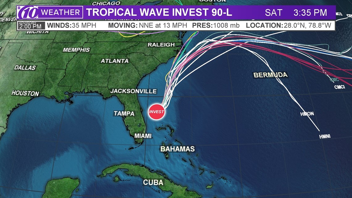
This broad cluster of storms has developed into tropical wave invest 90-L. While a fully tropical low-pressure system is not expected, a subtropical system (partially tropical) is possible as the area of low pressure continues to develop Saturday northeast of the Bahamas.
If the system were to become a subtropical storm, it would be named Arthur.
Heavy rains and some strong winds were measured Thursday in the Keys, which spread into south Florida Friday, then the Bahamas late Friday night into Saturday.
The invest is moving north-northeast and several models have been continuing to forecast this system drifting further to the northeast in the days to come. An Air Force Reserve Hurricane Hunter aircraft investigated this system Saturday morning.

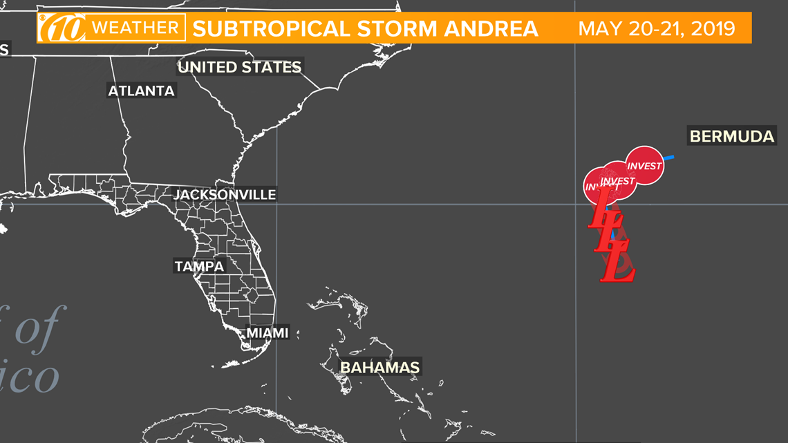
Just last year a similar setup through mid-late May produced Subtropical Storm Andrea east of the Bahamas.

Regardless of development, the counter-clockwise flow around the area of low pressure would help spread increased moisture and the chance for scattered showers and storms into Tampa Bay on Saturday. More widespread showers with periods of tropical downpours will be possible across southeastern Florida.

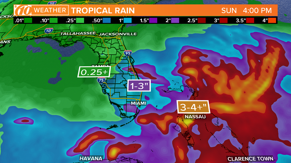
Forecast models then show the area of low-pressure tracking northeast away from the state of Florida dropping the chance of rain later in the day on Saturday into Sunday.
Continue to check back with 10 Tampa Bay as the setup for this development evolves over the next couple of days.

What other people are reading right now:
- Publix expands store hours, gets rid of designated shopping times for seniors
- Here's how many Americans have filed for unemployment
- Is something already brewing in the tropics before hurricane season?
- Florida vacation home owners sue Gov. Ron DeSantis over ban on rentals
- Lakeland temporarily allows outdoor dining and shopping
►Stay In the Know! Sign up now for the Brightside Blend Newsletter

