
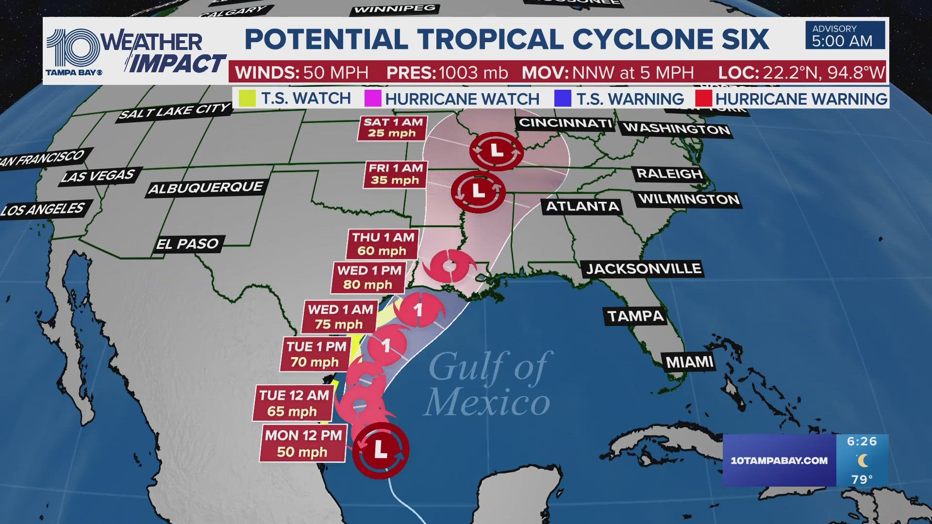
ST. PETERSBURG, Fla. — Potential Tropical Cyclone Six is expected to become a tropical storm on Monday, the National Hurricane Center said in its latest update.
The disturbance formed Sunday after in the southwestern Gulf of Mexico, the NHC confirmed.
The system is expected to organize into Tropical Storm Francine by Monday as it moves northwest along the Gulf of Mexico coast.
At this time, the system is reportedly located about 295 miles south-southeast of the mouth of the Rio Grande.
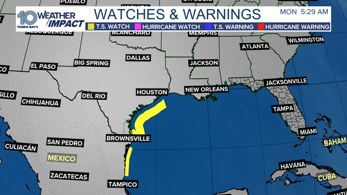
A Tropical Storm Watch has been issued from Barra del Tordo, Mexico northward to the mouth of the Rio Grande. Another Tropical Storm Watch is in effect for extreme southern Texas from Port Mansfield southward to the mouth of the Rio Grande.

NHC forecasters say tropical storm conditions are possible within the watch area along the northern coast of Mexico starting Tuesday. Potential Tropical Cyclone Six is reportedly expected to bring storm total rainfall of 4 to 8 inches with local amounts to 12 inches.
That rainfall is expected to range from the coast of far northeast Mexico northward along portions of the Texas coast and into Louisiana through Thursday, leading to a risk of flash and urban flooding.
The storm is expected to strengthen to hurricane status ahead of making landfall near the northern Gulf Coast closer to the middle of this week. Interests along the Texas and Louisiana coastline should monitor the progress of Tropical Cyclone Six.
Additional watches or warnings may be issued as the system drifts north-northwest. There are no threats to Florida at this time.