TAMPA, Fla. — It is looking more like August in the tropical Atlantic as the National Hurricane Center continues to monitor three potential areas of development this week.
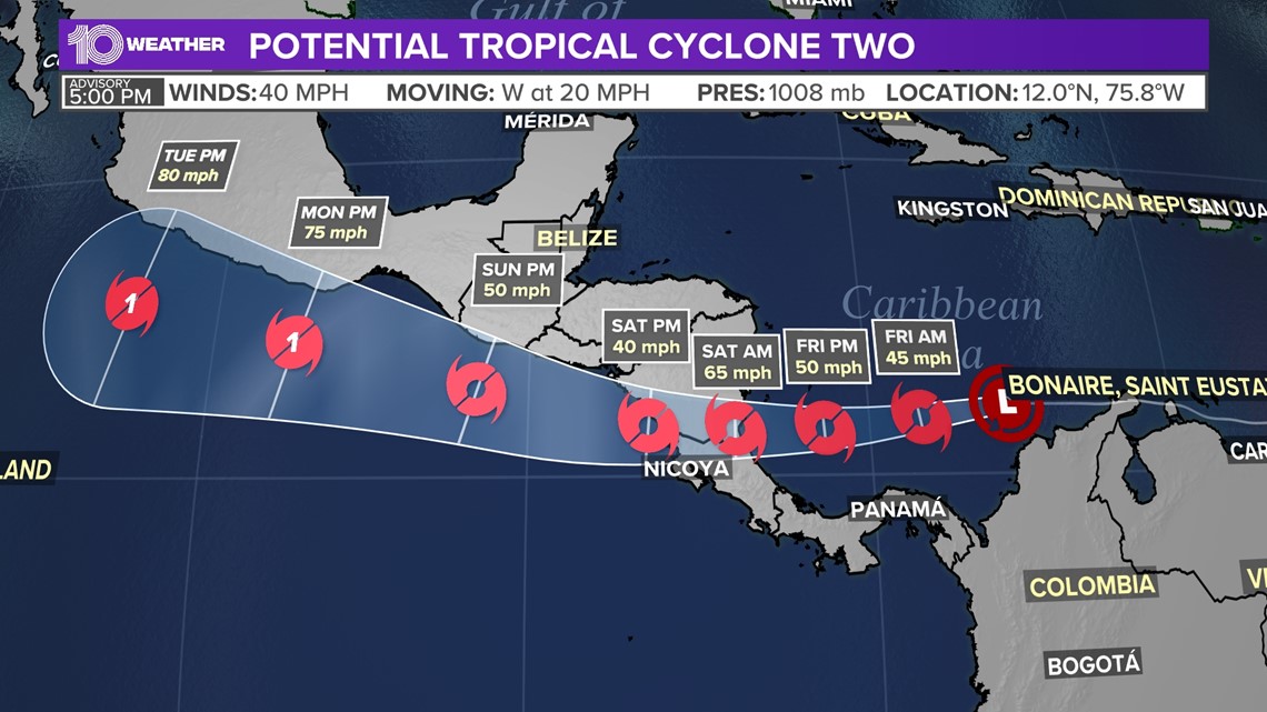
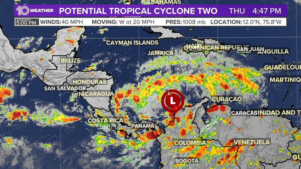
First, let's chat about Potential Tropical Cyclone Two. The system is located off the coast of Colombia with maximum sustained winds of 40 mph, according to the National Hurricane Center's 5 p.m. Thursday advisory.
As the disturbance continues to zoom very quickly to the west along the Colombian coast, it still lacks a defined, closed circulation. That is the missing criteria needed for PTC Two to be considered a tropical cyclone. With its 40-mph winds technically at tropical storm strength, it is still on track to become Tropical Storm Bonnie within the next day or so as it moves back into open waters and becomes better organized.


The system is forecast to strengthen slightly moving past the northern coastline of South America, nearing hurricane strength. If the forecast holds, it may impact Central America.
Forecasters sometimes give tropical features a "potential tropical cyclone" designation when there is a decent chance that they will develop further into a tropical depression or storm. By doing so, people in the path can receive a proper heads-up in the form of watches and warnings for impacts within 48 hours.


A Hurricane Watch is in effect for the Nicaragua/Costa Rica border to Laguna de Perlas Nicaragua.
Tropical storm warnings are in effect for the coast of Venezuela and the coast of Colombia. Tropical storm watches are in effect for the Limon Costa Rica northward to the Nicaragua/Costa Rica border and North of Laguna de Perlas to Sandy Bay Sirpi Nicaragua.
If Bonnie does form, it would be the second named storm of the 2022 hurricane season.
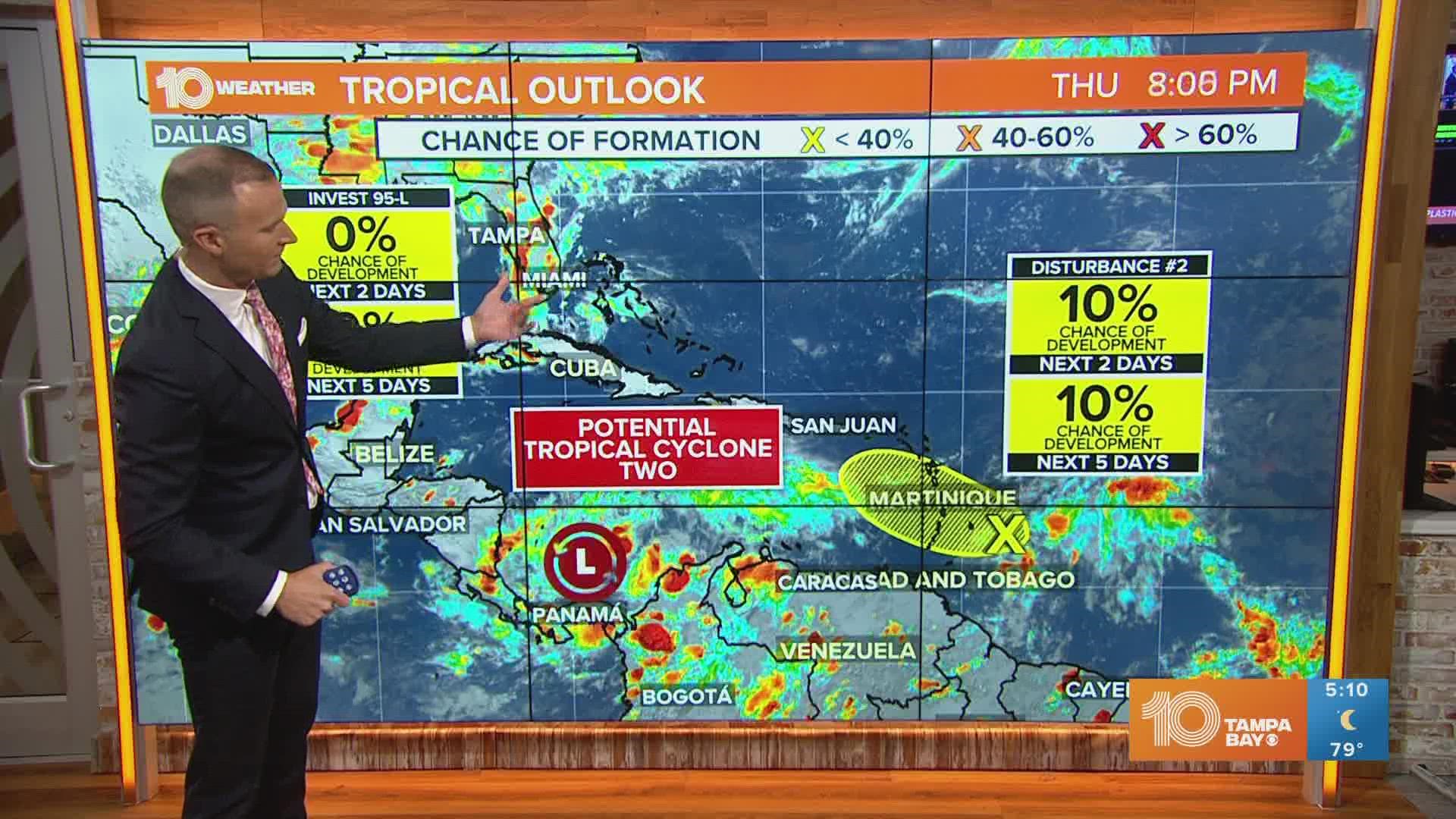
Next up is a disturbance in the western Gulf of Mexico that NHC forecasters have designated as Invest 95-L.
As of Thursday, this area of potential development has a 40% chance of becoming a depression or storm in the next five days as it heads slowly to the west toward the southern Texas coast.
Even though development has been very slow over the last few days, 95-L could organize a bit more and become a short-lived tropical depression before it moves onshore. Regardless of development, rounds of heavy rain are likely for parts of Texas through the weekend.
Lastly, right on the heels of PTC Two, another tropical wave is headed toward the Caribbean.
The NHC is giving this disturbance a low 10% chance of development over the next five days as it pushes northwest into the Windward Islands. Conditions look to become unfavorable for development once this disturbed weather moves into the eastern Caribbean Sea by the weekend.

