ST. PETERSBURG, Fla. — Tropical Weather Highlights (8 p.m. Monday):
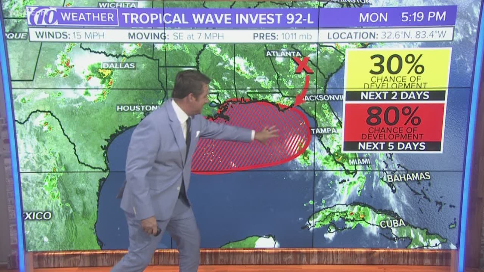
- A trough of low pressure is producing disorganized showers over south-central Georgia.
- The disturbance will likely move south or southwest Tuesday or Wednesday
- A broad area of low pressure is expected to form over the northeastern Gulf of Mexico on Wednesday.
- Current conditions mean there's a good chance of a tropical depression forming by the end of the week.
- Heavy rainfall may occur along parts of the northern and eastern U.S. Gulf Coast late this week.
- The chance of this strengthening into a tropical depression in the next 48 hours is 30 percent. But, it's 80 percent in the next five days.
Full Tropical Weather Forecast:
Tropical development is possible during the next several days in the Gulf of Mexico.
The National Hurricane Center says a low-pressure area could form this week off the Florida Panhandle. It could strengthen as it hangs over the northern Gulf.
As of 8 p.m. Monday, the NHC said there is an 80-percent chance of a tropical cyclone formation during the next five days. Earlier this weekend, the hurricane center had given the system a lower chance of forming.
The European and the American computer models, GFS, are starting to come to an agreement in taking this storm west away from Tampa Bay. However, increased chances for heavy rain and gusty winds will be possible, especially Wednesday through Friday.
The tides might rise 2-3 feet higher than normal high Wednesday through Saturday.
If the storm becomes named, it will be Tropical Storm Barry.
In any event, we're well into the swing of hurricane season. It's not too late to prepare a hurricane kit and have a plan in place should a storm threaten the area.
10News is your Hurricane Headquarters:
►Track the weather and get severe alerts when they happen: Download
the 10 News app now.
Have a news tip? Email tips@wtsp.com, visit our Facebook page or Twitter
feed.

