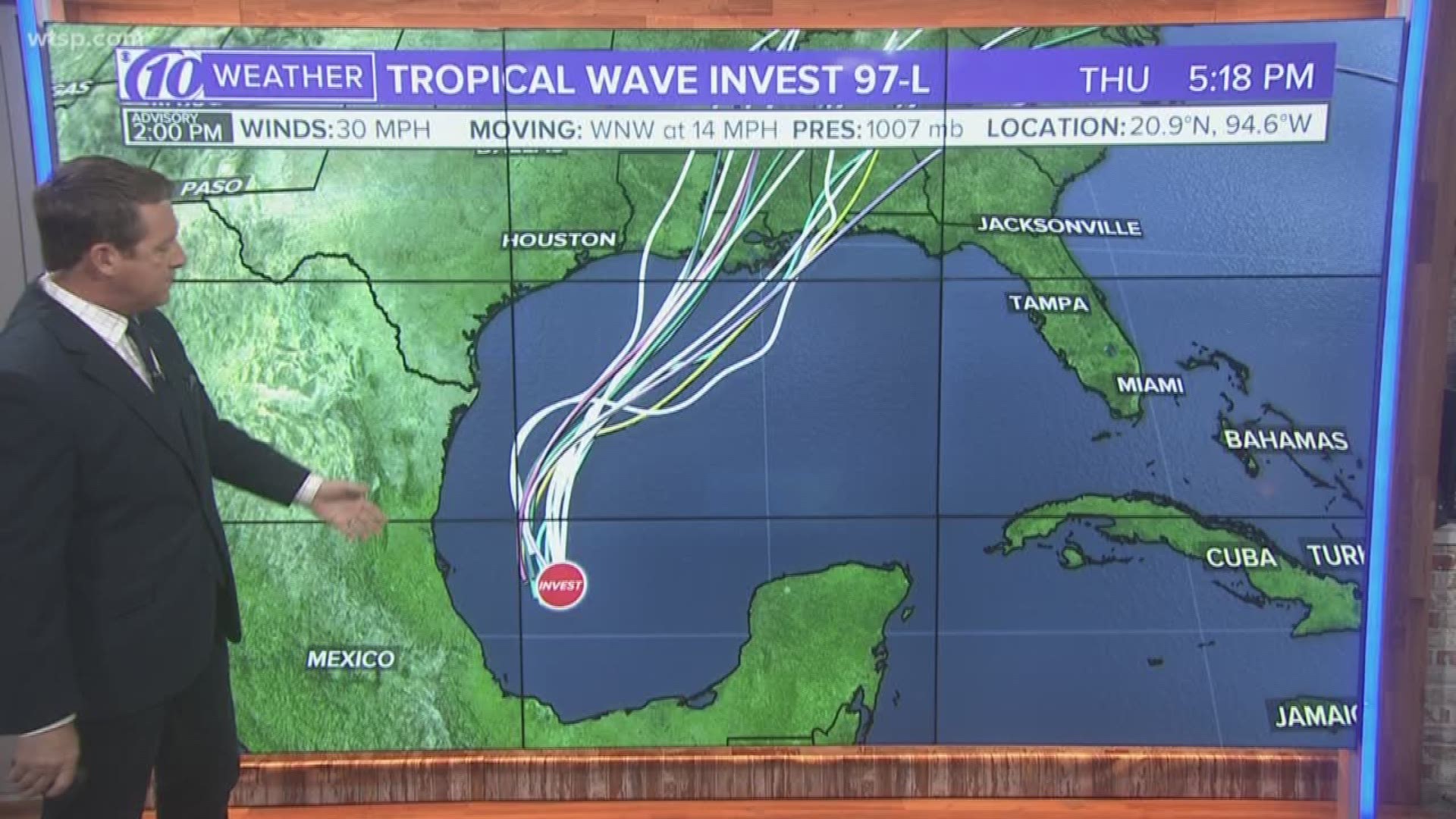
You've likely heard about a new tropical disturbance that's developed, called 97-L. Guess what? It's eerily in the same area that Tropical Storm Nestor developed. Of course, Nestor is the storm that brought waves of heavy rain and dangerous tornadoes to Tampa Bay last weekend. However, this storm is different, and here are three reasons why:
1. The track. Invest 97-L is expected to track farther west than Tropical Storm Nestor. Nestor was expected, and did, make landfall in the Florida panhandle. Invest 97-L is expected to take a more northerly route. This would take its tropical moisture into the central Gulf states.
2. Approaching cold front. A strong cold front will approach Invest 97-L and actually merge with the tropical energy. During Tropical Storm Nestor, the atmosphere allowed the storm to stay organized as a tropical storm as it made its way into Florida.
3. Lower chances of tropical development. With Tropical Storm Nestor, the National Hurricane Center gave the system an early 90 percent chance of further development. Invest 97-L sits at a 70 percent chance of development into a depression or named storm.
BOTTOM LINE: While Invest 97-L may become a tropical depression or maybe even a named storm, we don't expect it to bring any significant weather to Tampa Bay. Oh, if it were to become a named storm, the next name on the list is Olga.
RELATED: 'The walls started heaving in and out': Custodian describes being inside school hit by tornado
What other people are reading right now:
- Woman claims she was groped by a scare actor at Scream-a-geddon
- Local man claims he was abused by Catholic Priest in Denver
- Largo boy found sleeping outside, couple accused of beating him
- People not washing their hands likely behind recent spread of E. coli superbug
- Tampa Theatre spooking people with events leading up to Halloween
FREE 10NEWS APP:


