ST. PETERSBURG, Fla. — We're right in the middle of hurricane season — slightly just past the peak now, which was on Sept. 10.
So, are we now on the down-slide to normalcy again? We won't go that far as the tropics are showing signs of life once again.
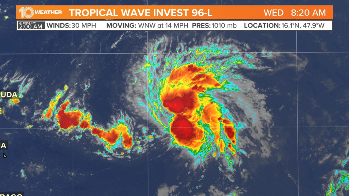
A tropical wave that emerged from the African coast last week is now a little more than halfway across the Atlantic. This tropical wave, designated as Invest 96-L, Tuesday has continued to show signs of organization over the last 24 hours and now has a high chance of becoming a tropical depression.


Located about 800 miles east of the Lesser Antilles in the far eastern Caribbean, the showers and thunderstorms associated with Invest 96-L maintained overnight into Wednesday morning and are showing more signs of organization.
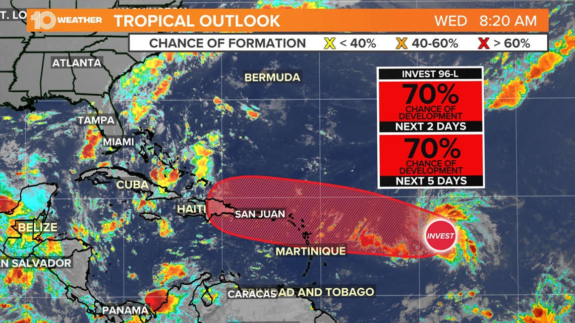
This is all in the face of a fair amount of wind shear which typically acts to inhibit tropical development. That said, only a little more organization would result in this system becoming a tropical depression. As of 8 a.m. Wednesday, the National Hurricane Center gives the system a 70-percent chance of becoming a tropical depression in the next few days.


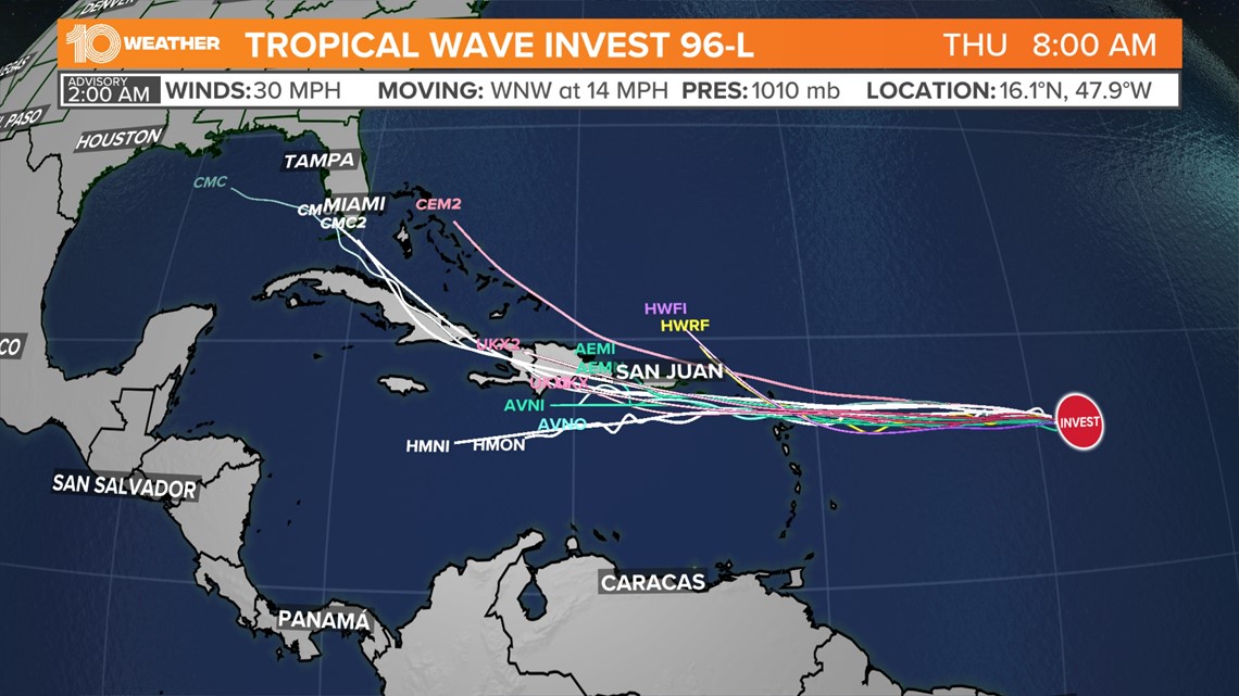
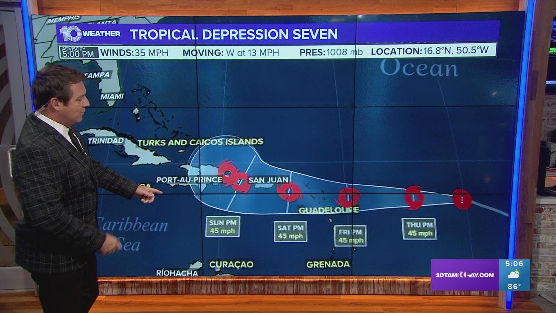
Whether the system develops into a tropical depression or not, the system is forecast to track generally to the west over the Atlantic Ocean toward the Leeward Islands on Friday into Friday night.
Even if the system doesn't become a tropical depression, it will likely bring gusty winds, locally heavy rainfall to the Leeward Islands, the Virgin Islands, and Puerto Rico.


From there it is still too far out to say with much confidence the fate of the system. Many forecast models do steer the system to the north into the second half of next week, but it's impossible to say whether or not the system will steer back out into the open waters of the Atlantic or if the U.S. coast will be in play.
Regardless, this system will need to be monitored as it continues to try to develop and tracks toward the Caribbean.
We have been very lucky, so far, this hurricane season that nothing major has threatened the state of Florida — Tropical Storm Alex was eventually named after soaking South Florida in June. But we are constantly keeping an eye on the tropics to give you an early warning if (and when) something does pop up.

