
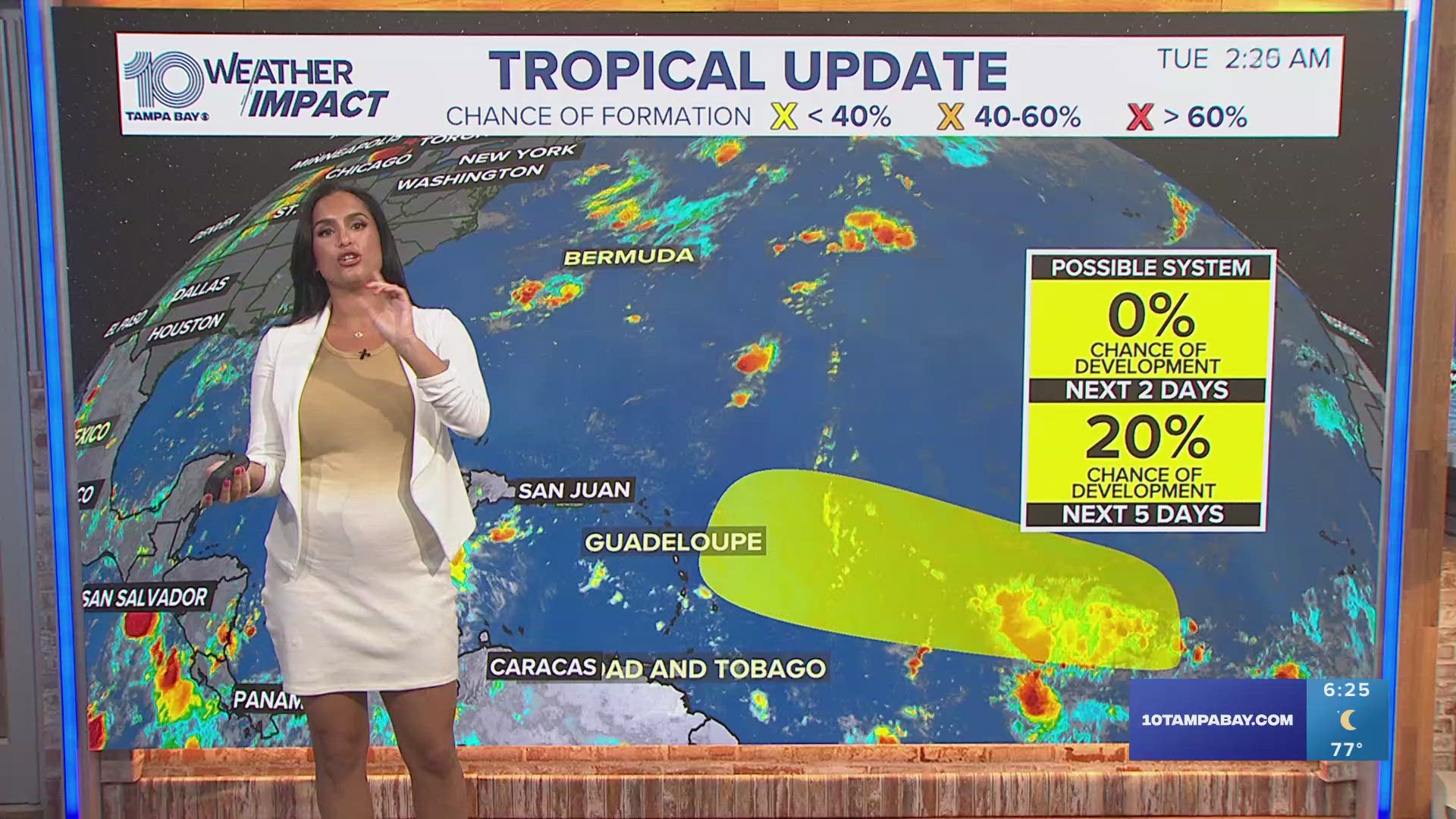
ST. PETERSBURG, Fla. — The 2024 Atlantic hurricane season has entered a quiet lull with little to forecast on the map. An area of low pressure could form in a few days although, at this time, it has a low chance of development.
So it begs the question: Where's the tropical activity as we approach the peak of hurricane season?
The 2024 Atlantic season saw activity begin in June only to become quite historic with Category 5 Hurricane Beryl. Less than a month later, Hurricane Debby made landfall in Florida and Ernesto brought heavy rainfall to Puerto Rico and the eastern Caribbean.
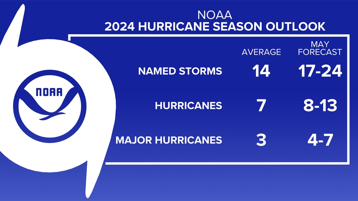
By the numbers, the current state of the season is slightly below average. Most long-range forecasts heading into hurricane season called for a historically busy season with at least 17 named storms expected.
Over the last 30 years, we average 14 named cyclones, seven tropical storms and three major hurricanes.

Why is hurricane season quiet now?
One of the big reasons things have been so quiet, relatively speaking, is the state of the atmosphere and ocean connection. The water temperature in the equatorial Pacific Ocean has not cooled as quickly as expected, and we are officially still in what is called a neutral pattern.
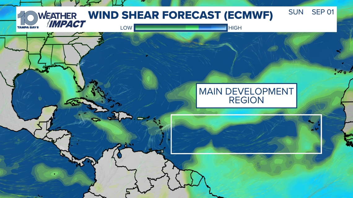
La Niña had been expected to develop by now, ushering in water temperatures well below average in the eastern Pacific. This is still anticipated to happen but likely not until later this fall and, until it does, more wind shear is expected. Wind shear acts to tear developing tropical seedlings apart before they develop.
Notice the bright green and blue areas in the Atlantic showing plenty of shear — that includes the main development region we typically watch very closely heading into peak hurricane season.

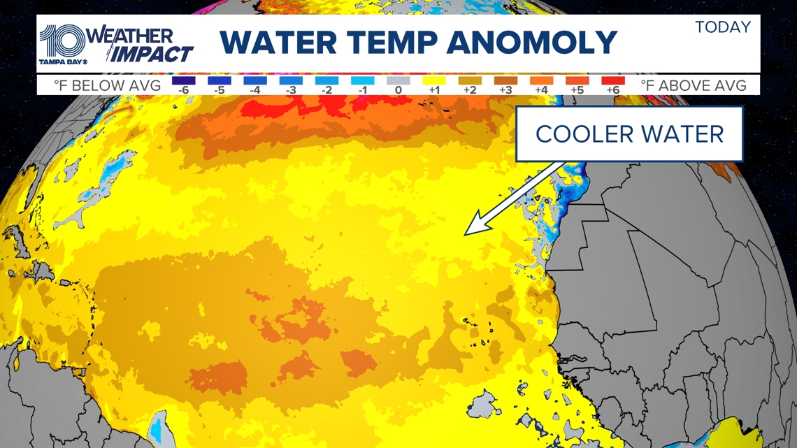
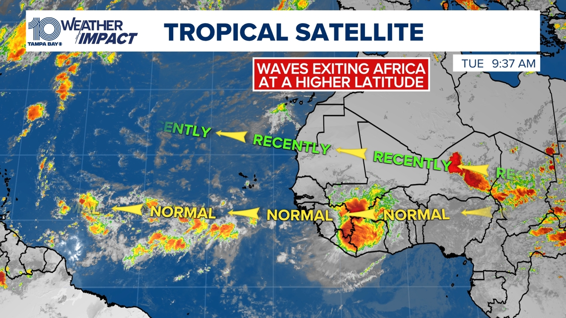
Meanwhile, there are cooler water temperatures in the Atlantic Ocean and a shift in the Intertropical Convergence Zone — an area of converging winds and storms in the atmosphere much farther north. This has caused storms emerging off the coast of Africa to fizzle out over the cooler waters. We watch these storms closely as they could ultimately become tropical waves that develop into full-fledged tropical storms and hurricanes.
Indications are that this pattern will continue to break down and these tropical seedlings we track will have a much better chance of developing.

We are already seeing a transition back to more of a normal pattern off the African coastline — and notice the storms really firing up with the African monsoon. This means as we head to the peak of our hurricane season, on Sept. 10, there could be an increase in activity.

10 Tampa Bay keeps you ahead of the storm: Download our free mobile app for real-time storm information and breaking alerts, and download 10 Tampa Bay+ on your favorite streaming device for live updates.