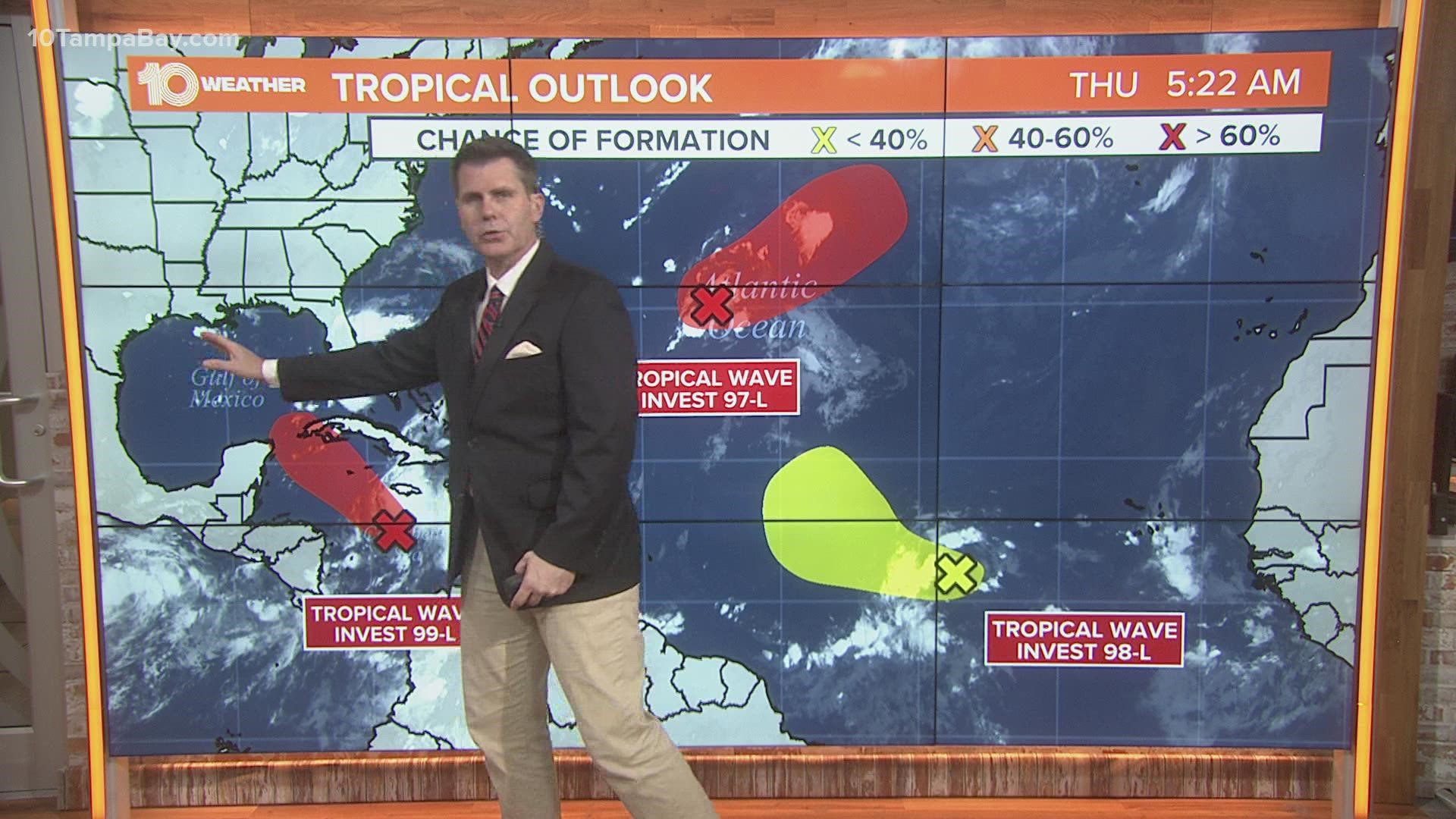
TAMPA, Fla. — The National Hurricane Center (NHC) is monitoring three areas for tropical development — two of them are likely to become a depression or a storm within the next five days.
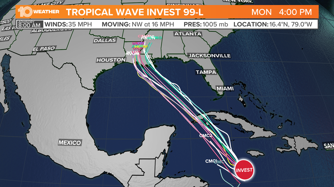
Let's start with Invest 99-L. As of Thursday morning, the disturbance is still disorganized, lacking a closed circulation. A broad area of low pressure is expected to form over the western Caribbean Sea by late Thursday or Friday.
Global models develop the storm into a potential hurricane by the weekend, with a potential landfall near Louisiana. The exact track and intensity will likely change, so all interests in the north Gulf of Mexico should watch this storm closely.


The NHC gives the disturbance a 90 percent chance of development within the next 48 hours.
It does not look like it will have impact in Tampa Bay.
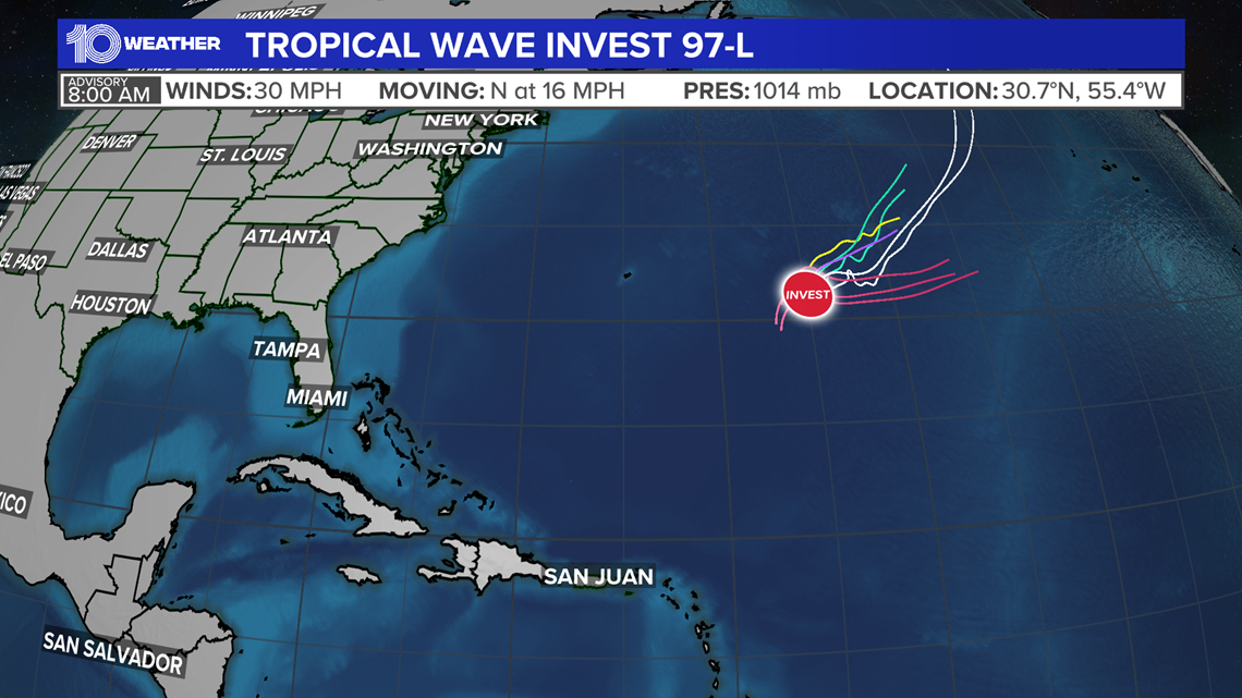
The next disturbance is Invest 97-L. It resides over the central tropical Atlantic about 600 miles southeast of Bermuda. It's expected to develop into a tropical depression by late this week or weekend.
Invest 97-L is expected to move northeast away from the United States.


The NHC gives the disturbance a 40 percent chance of development within the next 48 hours but a 70 percent chance over the next five days.
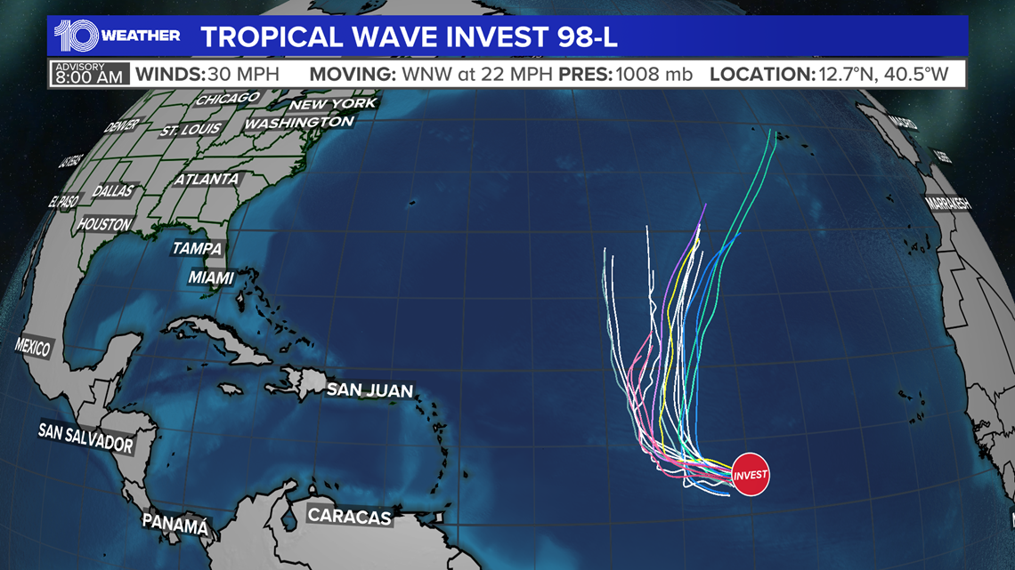
Finally, a tropical wave in the far eastern tropical Atlantic located about 1,000 miles west-southwest of the Cabo Verde Islands is producing a disorganized area of showers and thunderstorms, according to the NHC.
It's possible the system will develop some over the next few days as it moves west-northwestward over the eastern tropical Atlantic.


From there, however, upper-level winds make it less conducive for the system to develop. The NHC gives it a 40 percent chance of development over the next 48 hours and a 50 percent chance over the next five days.
The next storm names on the list are Ida, Julian and Kate.
The Atlantic hurricane season runs from June 1 through Nov. 30. The "peak" of the season falls on Sept. 10.

