ST. PETERSBURG, Fla. — As hurricane season winds down, it's been relatively quiet in recent weeks.
While it's more uncommon for tropical storms or hurricanes to form this late in the season, it's not impossible. Just last year, Hurricane Nicole barrelled through the state.
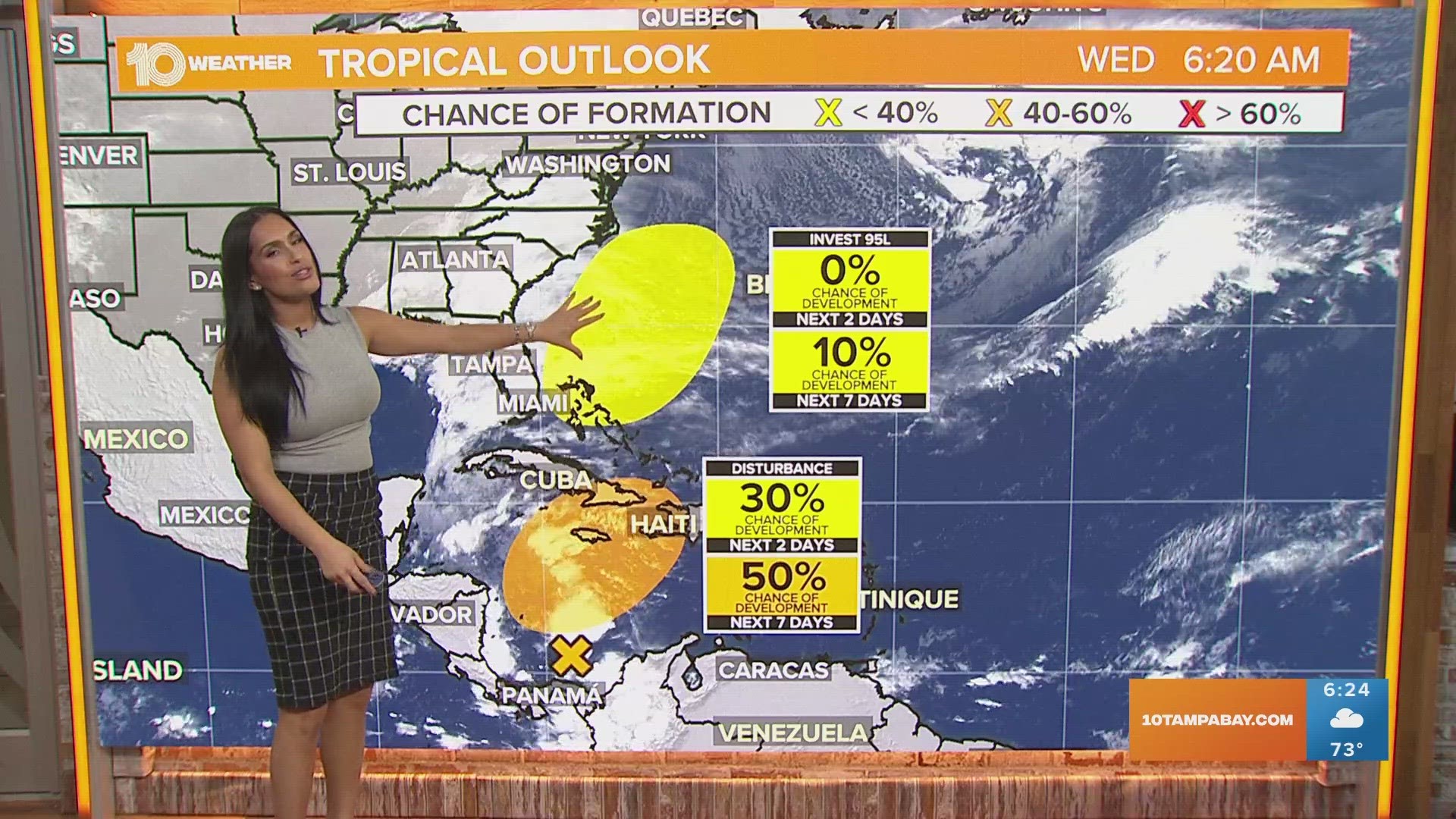
While there isn't a high chance for development over the next week, we are tracking an area of low pressure that will move across Florida over the coming days. From there, it has about a 10 percent chance of gaining tropical characteristics off Florida's East Coast.
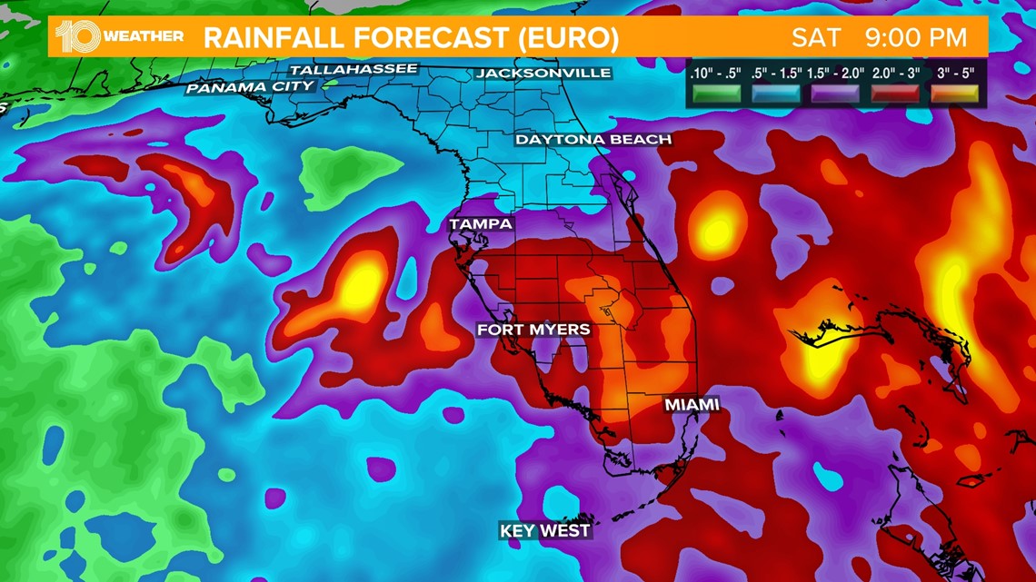
This same low-pressure system is what's been bringing much-needed rain this week to the Tampa Bay area. Even more impacts could be felt on the East Coast as the system continues moving.


Regardless of whether the low-pressure system gets tropical characteristics or not, it's still going to bring some nasty and gloomy weather to the East Coast into the weekend. People living in the area will likely see gusty winds and heavy amounts of rain, which could cause flooding.
As the low-pressure system moves away from the Tampa Bay Area, our conditions will rapidly improve into the weekend with rain chances dropping and sunshine returning along with slightly cooler temperatures.


The other area of low pressure we're tracking in the Caribbean will not pose a threat to the Tampa Bay area. Even with a 50 percent chance for development, the models are in great agreement if anything does form it will stay far south of Florida.
It will proceed to move through the Caribbean and move out to the open Atlantic. Nov. 30 is the official end of hurricane season but activity is still possible even after that date. With that in mind, we need to continue to keep our guard up for any late-season tropical trouble in the last couple of weeks because anything is possible.

