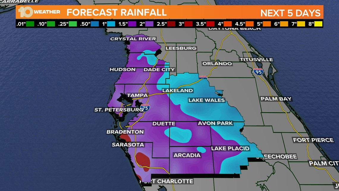
ST. PETERSBURG, Fla. — The Tampa Bay area, desperate for some rainfall after a dry summer, could get its wish later this week with a kick from the tropics.
It'll take a couple of days before those rain chances ramp up. The cold front that brought us cooler weather, next to zero humidity and some cloudy skies has pushed into southwest Florida — even Fort Myers will be in the low 80s today!
But it's that front that'll increase the odds for some good rainfall.
It's now considered a stationary front as the cooler air remains locked in place north of the boundary while relatively warmer air hangs just south. The front itself isn't moving in any direction, hence the name "stationary."
By midweek, especially Wednesday into Thursday, it will move north as a warm front and touch off showers and storms.

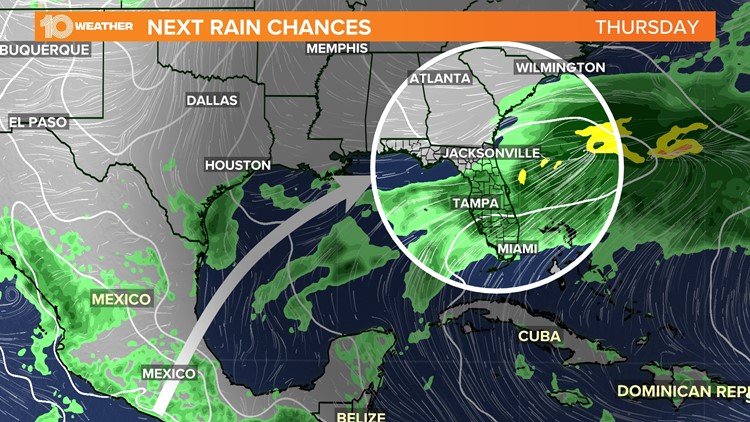
Then there's the tropical element to this forecast: The National Hurricane Center is watching an area of disturbed weather in the southwestern Gulf of Mexico. Forecasters say the disturbance has a low chance of additional development in the coming days, but it's likely that it will merge with the coming warm front.
Weather computer models, including the American GFS and European, both show a surge of moisture pressing into the Florida Panhandle and Nature Coast by Thursday. While rain chances are higher there, much of the Sunshine State will have a shot of seeing wet weather.
The latest report from the U.S. Drought Monitor shows at least a severe drought existing in Manatees and Sarasota counties.