
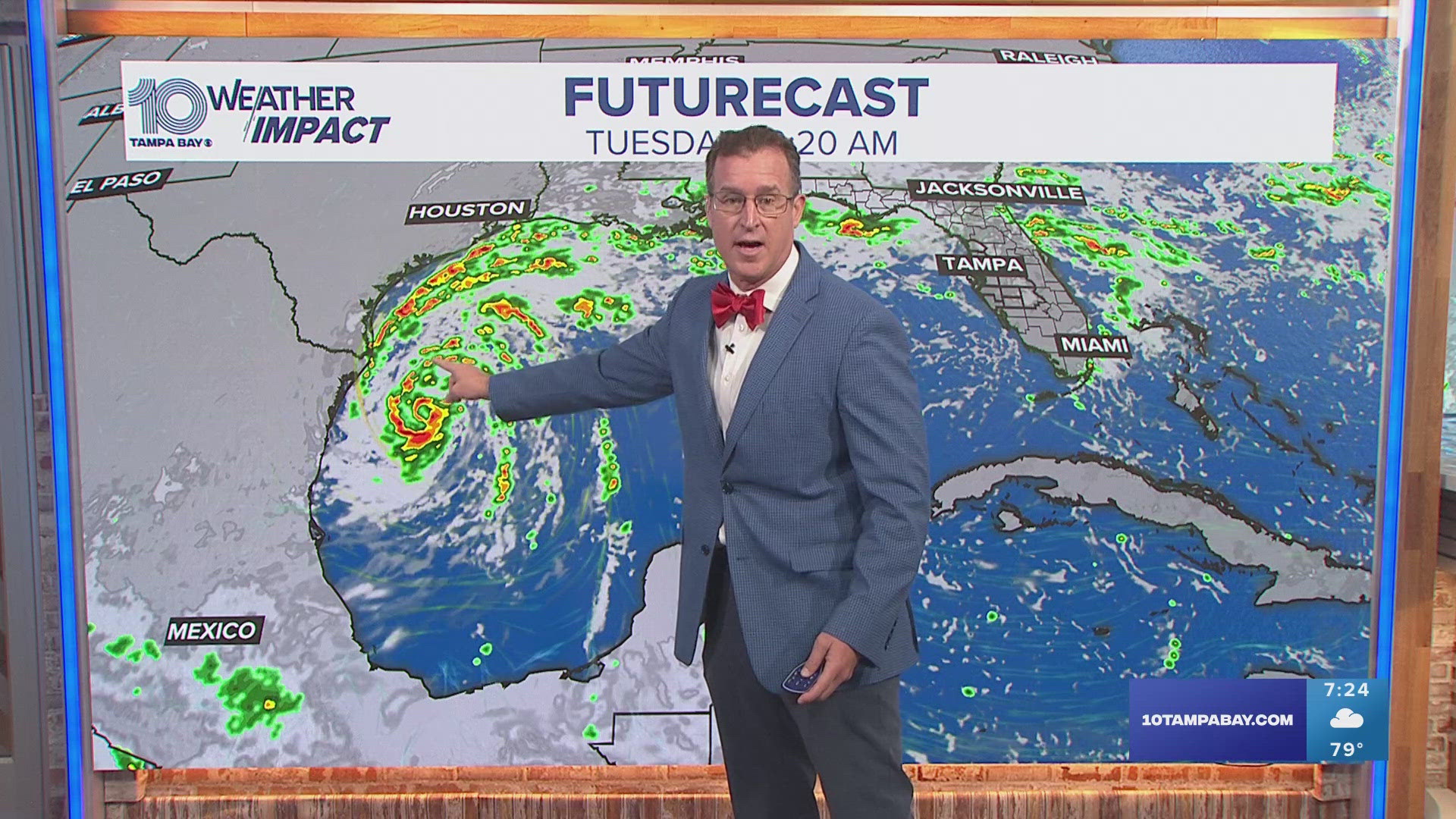
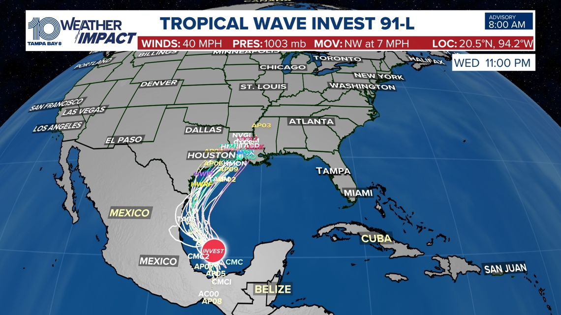
ST. PETERSBURG, Fla. — An area of low pressure (Invest 91-L) located over the Southwest Gulf of Mexico now has a high chance of development as it continues to produce showers and thunderstorms. A closed circulation may develop late Monday or Tuesday and may get a name (Francine).
As of Sunday, models point to the disturbance organizing into a tropical depression or tropical storm by the beginning to middle of next week. The National Hurricane Center has this system with a 80% (high)chance of development through the next 48 hours and an 90% (high) chance for development within the next week.
Invest 91-L is forecasted to move northward near or along the Gulf coast of Mexico and Texas through the middle of next week with weak steering currents. The western Gulf of Mexico coast should continue to monitor the progress of this disturbance. Currently, there is no threat to Florida with this system.

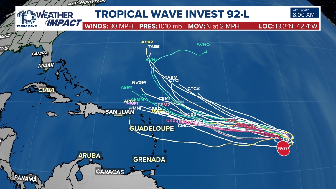
There are two additional areas in the central Tropical Atlantic being watched for formation. As of Saturday night, neither system is posing any threat to land. Invest 92-L has a 40% (medium) chance for development in the next 2 days and a 60% (medium) chance for development over the next week.

The area of low pressure located southwest of the Cabo Verde Islands has a 50% chance for development through the next week.

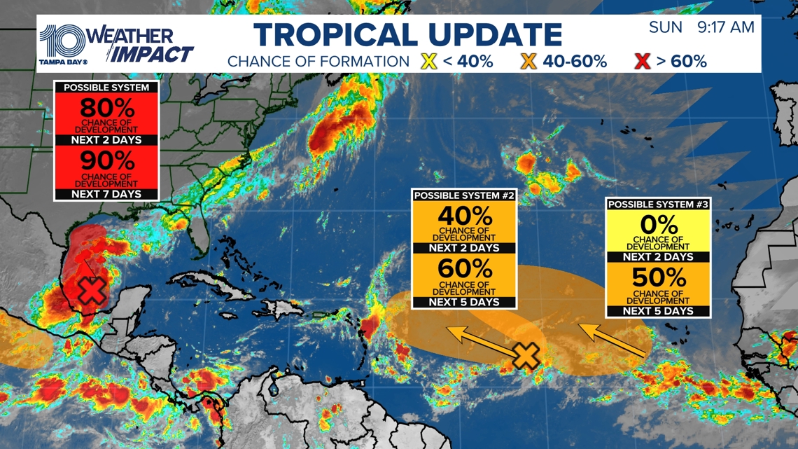
If we were to see a Tropical Storm form, the next name on the list would be Francine.