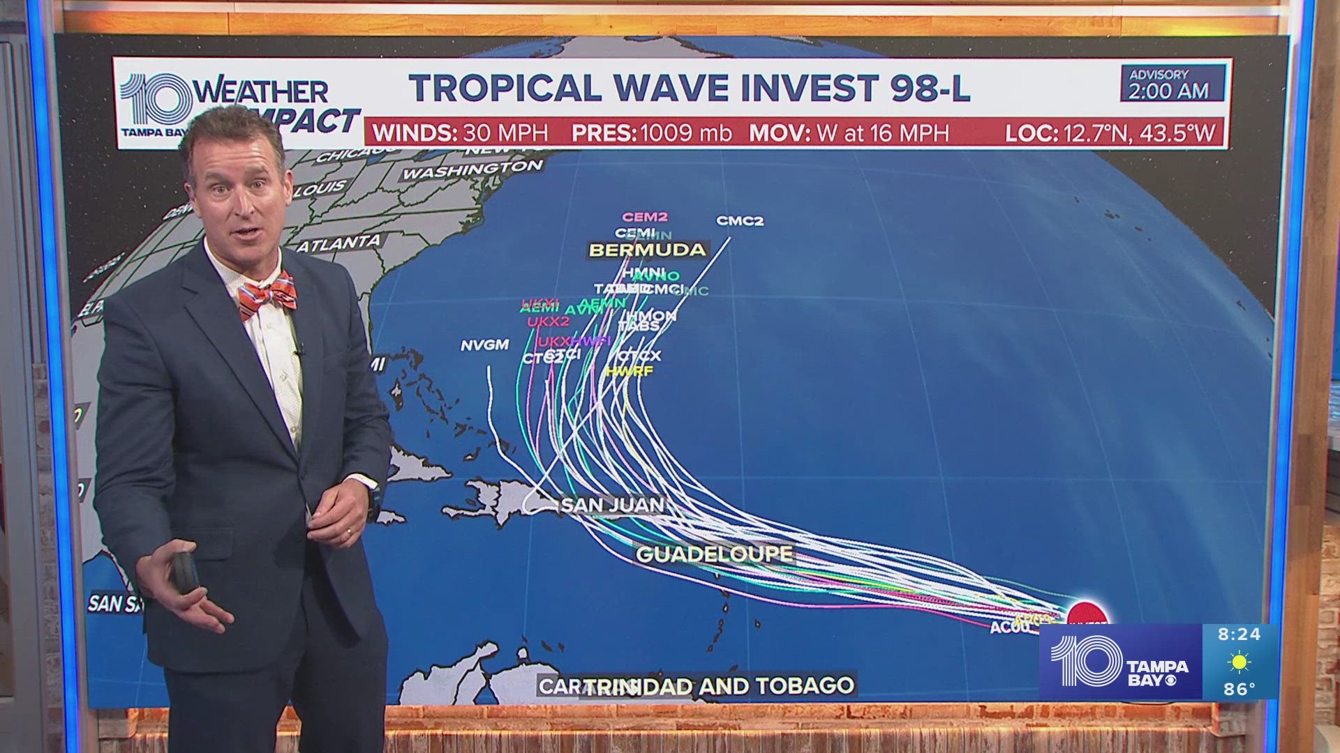
ST. PETERSBURG, Fla. — The National Hurricane Center has highlighted an area in the eastern tropical Atlantic for a 90% chance of development over the next seven days.
Shower and thunderstorm activity is starting to become better organized in association with the tropical wave located roughly midway between the Cabo Verde Islands and Lesser Antilles while it moves westward into the central Atlantic.
Conditions become more conducive for development by early next week, and a tropical depression could form when it approaches the Lesser Antilles. The system is expected to move west-northwest gradually and is forecast to reach the Greater Antilles by the middle of next week.
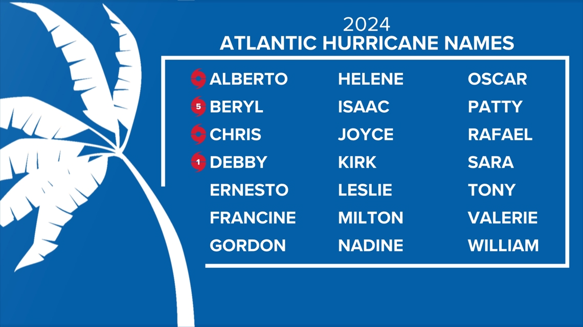
If this wave were to develop into a named system, the next name on the list would be Ernesto.

This system comes in the wake of Tropical Storm Debby, which continues to bring the threat of storm surge, flooding and tropical storm-force winds to portions of the North Carolina coast.
Back home in Tampa Bay, breezy westerly winds blowing in from the Gulf of Mexico in the wake of Debby leave us with tropical humidity and rough surf. Several local rivers continue to sit at flood stage and will slowly return to normal levels by the weekend.
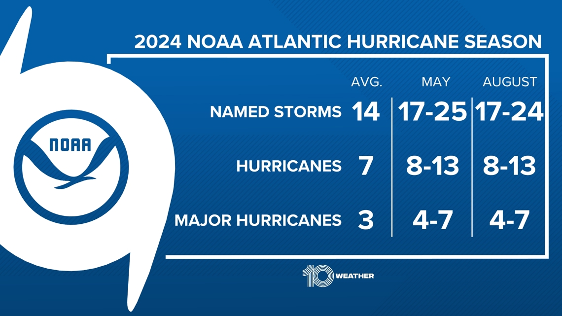
NOAA forecasters updated their 2024 Hurricane season outlook, keeping an above-normal outlook for the remainder of the season, predicting the following activity:
- 17-24 named storms (average is 14)
- 8-13 hurricanes (average is 7)
- 4-7 major hurricanes (Category 3 or higher) (average is 3)