ST. PETERSBURG, Fla. — It's very busy in the Atlantic right now, with the map lighting up with activity. Over the past 48 hours, four tropical storms formed — Emily, Franklin, Gert and Harold.
Emily has already dissipated and Gert is barely hanging on as a tropical depression. Harold formed overnight into Tuesday.
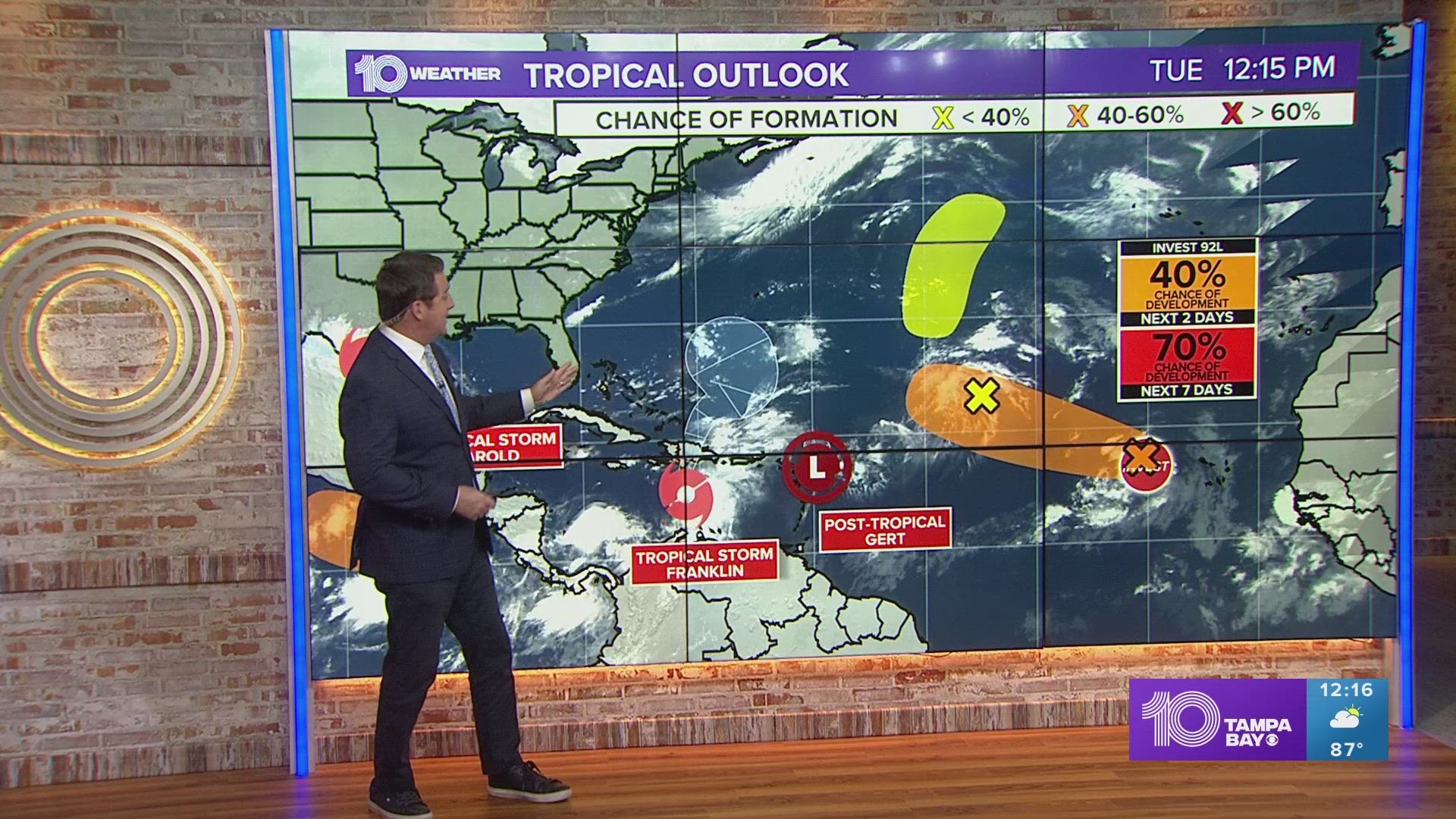
There are two other disturbances we and the National Hurricane Center are also tracking for development off the coast of Africa and in the central Atlantic. That means our tropics maps are showing up bright red, yellow and orange, and that might be making some of you uneasy.
So let's break it down and look at what's really going on in the Atlantic right now.
The good news first — currently, none of this tropical activity is going to directly impact Florida and the Tampa Bay area.


Let's start with the tropical wave in the eastern Atlantic to the west of Africa. It currently has a 50 percent chance for development over the next seven days with the latest forecast. It is expected to move toward the west and northwest into the middle Atlantic — no threat to Florida.
Another tropical wave in the central Atlantic is actually the remnant of what was once Tropical Storm Emily. It only has a 20 percent chance of development over the next seven days. Re-development for this system is possible later this week.
Gert, downgraded from a tropical storm to a tropical depression Tuesday, is now a remnant low, according to the NHC. It'll likely be the last we'll hear about this tropical system.
Tropical Storm Franklin is currently holding steady moving northwestward and is forecast to crossover Hispanola this week as a tropical storm, which has prompted a tropical storm alert and is bringing potentially life-threatening flash flooding to the area.
Thereafter into this weekend, it will be another fish storm moving into the Atlantic and intensifying potentially into a Category 1 Hurricane.


Lastly, in the Gulf of Mexico, disorganized thunderstorms have come together enough to trigger the NHC into calling it Tropical Storm Harold. Harold made landfall along the South Texas coast, bringing heavy rains and tropical-storm-force winds to the area for several hours, NHC forecasters say. The system is pushing westward and has prompted a tropical storm warning.
It is no threat for Florida; however, Texas and Mexico are experiencing impacts from this tropical system.
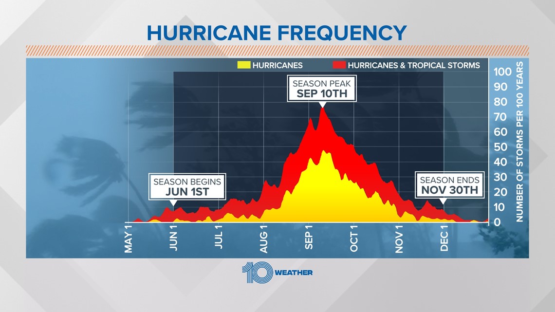
Although we see a lot of red on the map, we are in NO danger — but now is the time to prepare because things could change quickly as we approach the official peak of the season.


