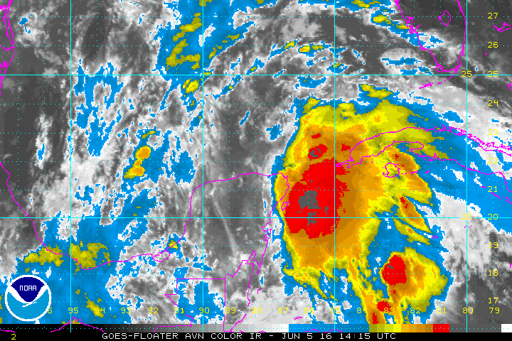
The National Hurricane Center in Miami issued its first advisory on Tropical Depression 3.
The tropical storm warning spans the Gulf Coast from Indian Pass to Englewood.
The first wind events from TD 3 will hit the shore by Monday afternoon.
An expected 3 to 5 inches of rain is forecast with maximum totals of 8 inches in isolated areas across Florida.
The storm surge is expected to be 1 to 3 feet from Indian Pass to Tampa Bay. South of Tampa Bay, the storm surge is 1 to 2 feet.
According to the NHC, tornadoes could be possible "across portions of Florida and far southern Georgia."
TD 3 should produce heavy rain & possible flooding in Florida during the next few days. More:https://t.co/tW4KeFW0gB pic.twitter.com/imAO9TUklH
— NHC Atlantic Ops (@NHC_Atlantic) June 5, 2016
A Tropical Storm Warning has been issued for the Florida coast from Indian Pass to Englewood https://t.co/tW4KeFW0gB pic.twitter.com/U3f4Db7ezf
— NHC Atlantic Ops (@NHC_Atlantic) June 5, 2016
Download our app for radars and more live video:
iPhones --> http://apple.co/26SKuII
Android --> http://bit.ly/1SYfvnh


