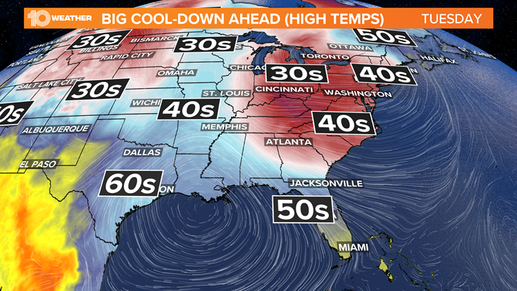
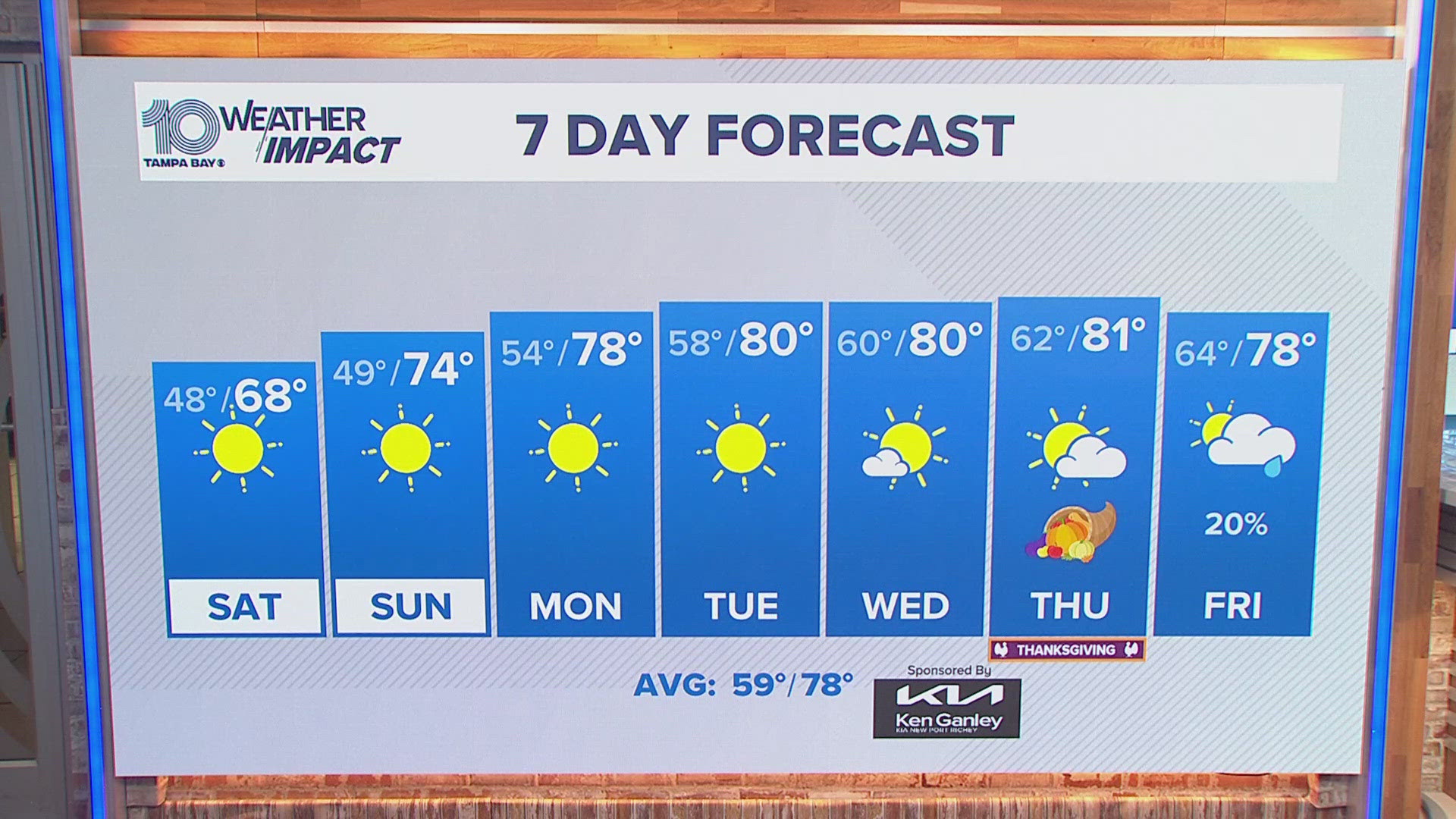
ST. PETERSBURG, Fla. — 'Tis the season for sweaters and jackets...unless you live in Florida, right? Well, this week is about to bring some very winter-like changes to the Tampa Bay area!
A developing storm system in the western Gulf of Mexico will spread east on Sunday before approaching the area on Monday. Along with it is the increasing chance for a few showers and storms before much cooler air starts to spill in from the north.
The timing of our best storm chances will be 5-11 a.m. Monday morning, from north to south. The immediate bay area could see the greatest chance for storms around 7-8 a.m.

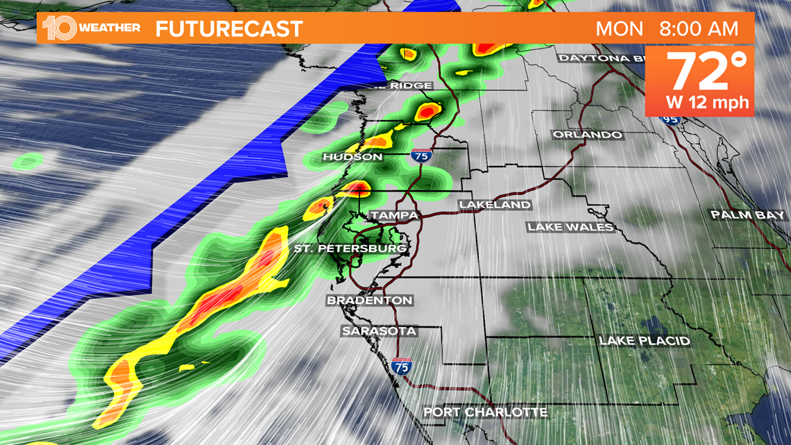
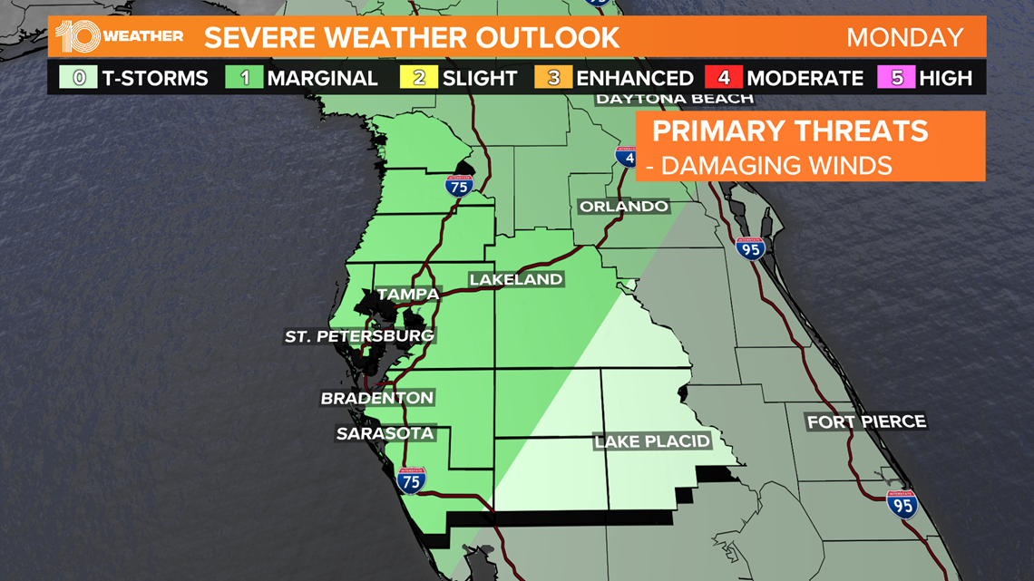
We'll need to stay weather aware Monday morning as some storms could become strong, or even briefly severe, with damaging winds being the main concern.
This threat is rather low and isolated though, and all activity will move in and out of the region relatively quickly.

The cooler air behind Monday's system will start to arrive Monday night, dropping temperatures into the low 50s by Tuesday morning. Despite increasing sunshine on Tuesday, high temperatures Tuesday afternoon will only make it in the low 60s, with some areas north struggling to even climb out of the 50s.

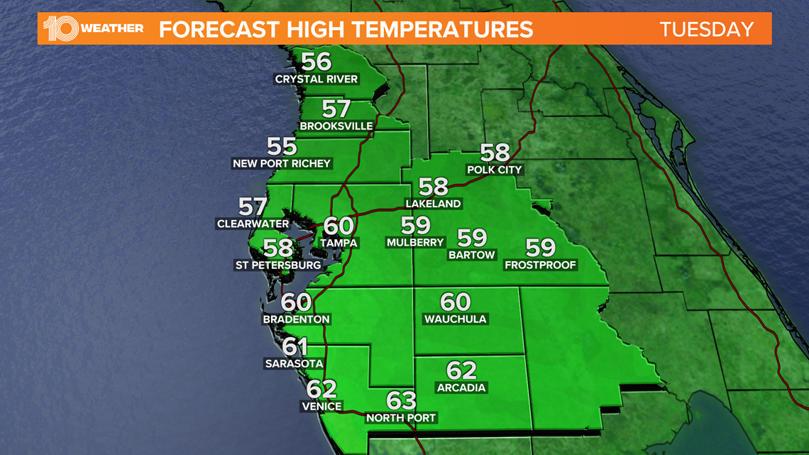
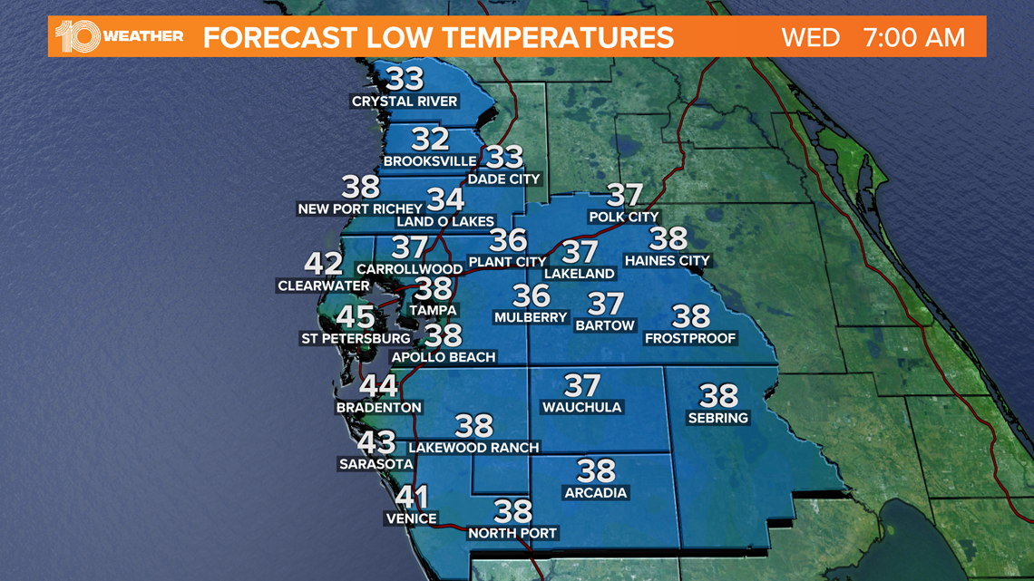
Wednesday morning will be even cooler, with 30s and 40s across the area.
We will need to closely monitor the potential for freeze watches or frost advisories, especially for our northern counties.

- Debunking common COVID-19 vaccine myths with USF virologist
- Florida hunters have duck stolen by massive gator
- 12 Christmas light displays to see this year around Tampa Bay
- How to save the most money shopping online this holiday season
- Side effects from COVID-19 vaccine likely will be unpleasant, doctors warn
►Breaking news and weather alerts: Get the free 10 Tampa Bay app
►Stay In the Know! Sign up now for the Brightside Blend Newsletter


