ST. PETERSBURG, Fla. — While the rest of the country has been enduring the firm grip of Old Man Winter, Tampa Bay has been simply enjoying arguably the best weather of the year.
Recently, that has consisted of plenty of sunshine and warmer-than-normal temperatures going back to late January. This past week, each day has been warmer than the last with high temperatures Wednesday afternoon in the low-middle 80s.
This will all come to an end as a cold front begins to sag into the Southeast on Thursday into Friday. Showers and storms ahead of this front started to move into the Florida Panhandle early Thursday morning and will continue to move east through the day. As the front continues east, it will stall out across the northern part of the state and keep most of the showers and storms out of Tampa Bay for just a little longer.

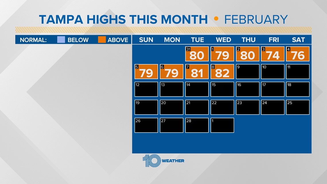
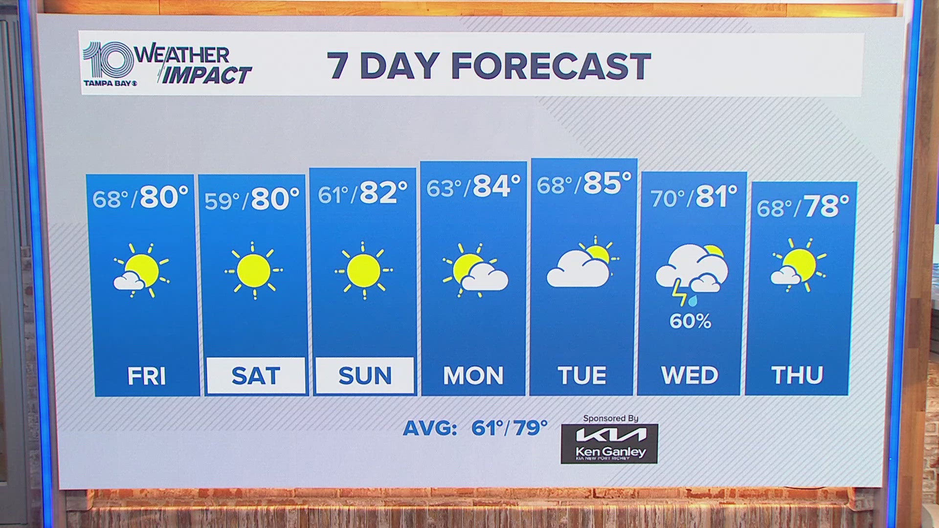
Thursday and Friday will remain unseasonably warm in Tampa Bay with high temperatures returning to the low and middle 80s. The normal high temperature for the middle of February is 74 degrees.
Into Friday, the winds will increase out of the southeast from 5-15 mph with gusts to 20 mph at times. By Friday evening, the cold front will begin to make a little more progress and could start to spread some showers into the area before midnight.
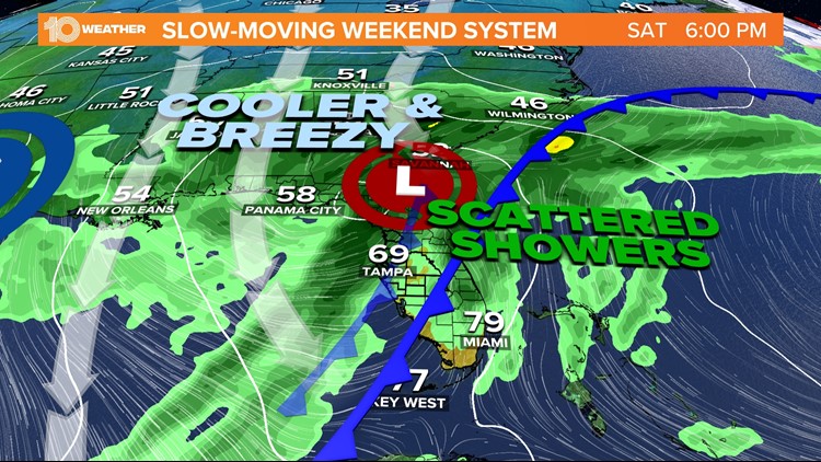
The system will continue to advance east into Saturday and increase the chance for scattered showers and a few thunderstorms. The front, however, looks to remain north of Tampa Bay for most of the day, which should still allow temperatures to stay in the 70s despite increased cloud cover and a 60 percent chance of rain.

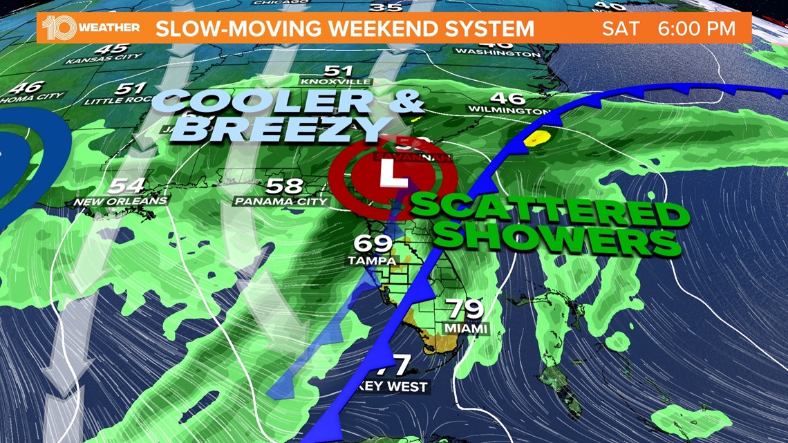
By Saturday night, however, a strengthening low-pressure system along the cold front will develop off the Southeast coast and help to sweep the cold front through the region. This will move the rain out and begin to usher in cooler and even windier conditions for Sunday.
Winds on Sunday will shift to the northwest and increase to 20-25 mph and gusty to 30+ mph. As the winds shift to the northwest, the cooler air will then begin to spill into Tampa Bay. High temperatures Sunday afternoon, despite mostly sunny skies, will struggle to climb into the middle 60s.

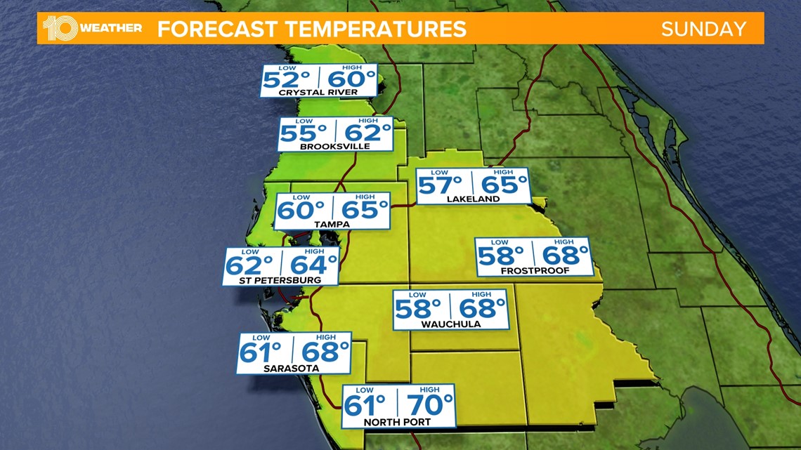
By Sunday night, the coldest temperatures will arrive with lows expected in the upper 40s across Tampa Bay. Some upper 30s and low 40s will be possible inland and on the Nature Coast.

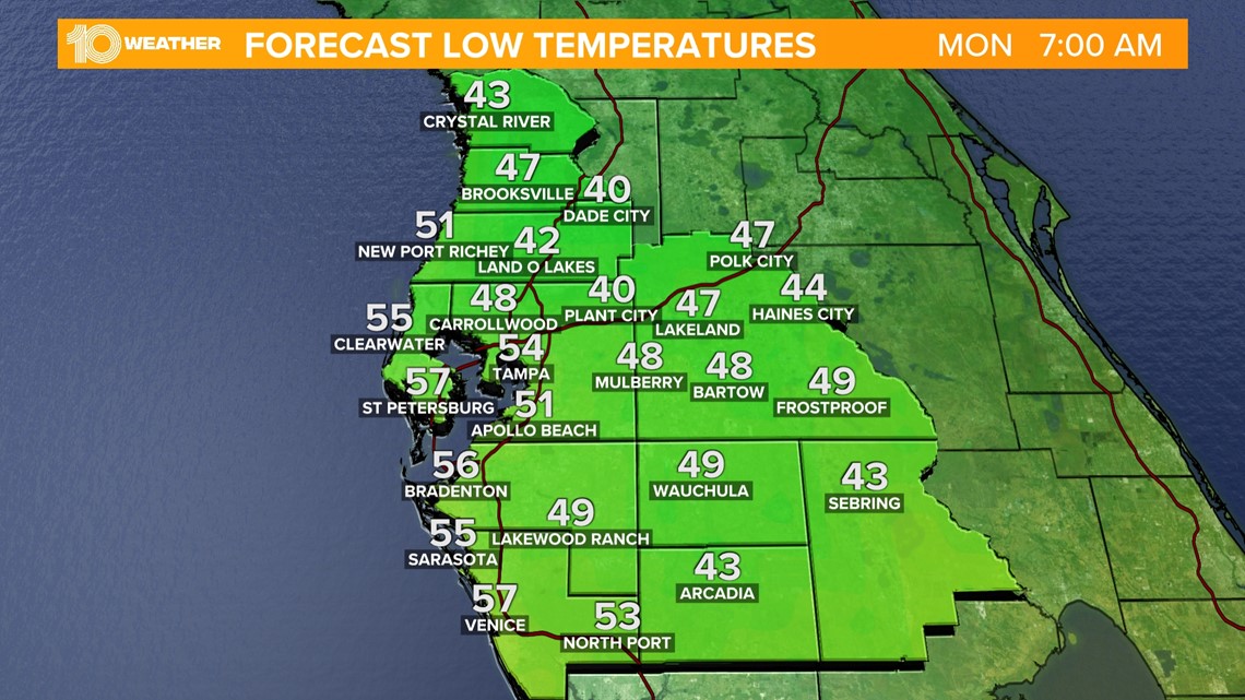
A new high-pressure system will take hold into next week, which will start to warm things up through the week. High temperatures on Monday will be in the upper 60s and then rebound back into the mid-upper 70s just in time for Valentine's Day on Tuesday.

