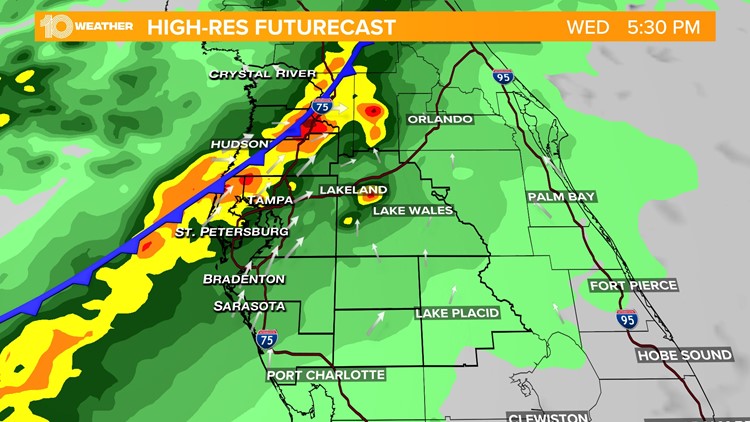
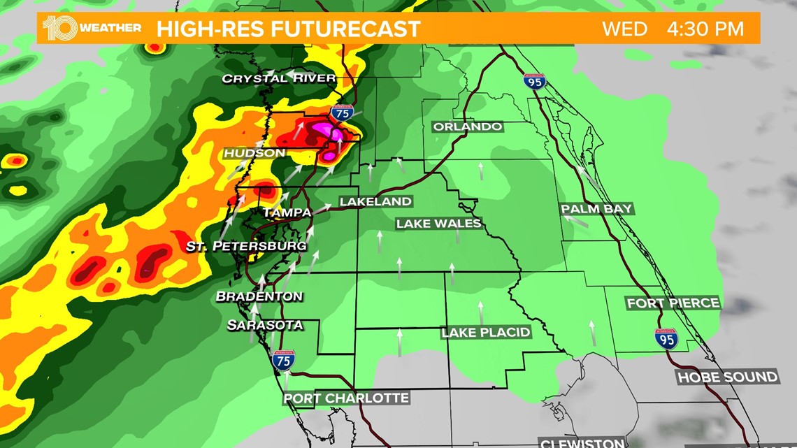
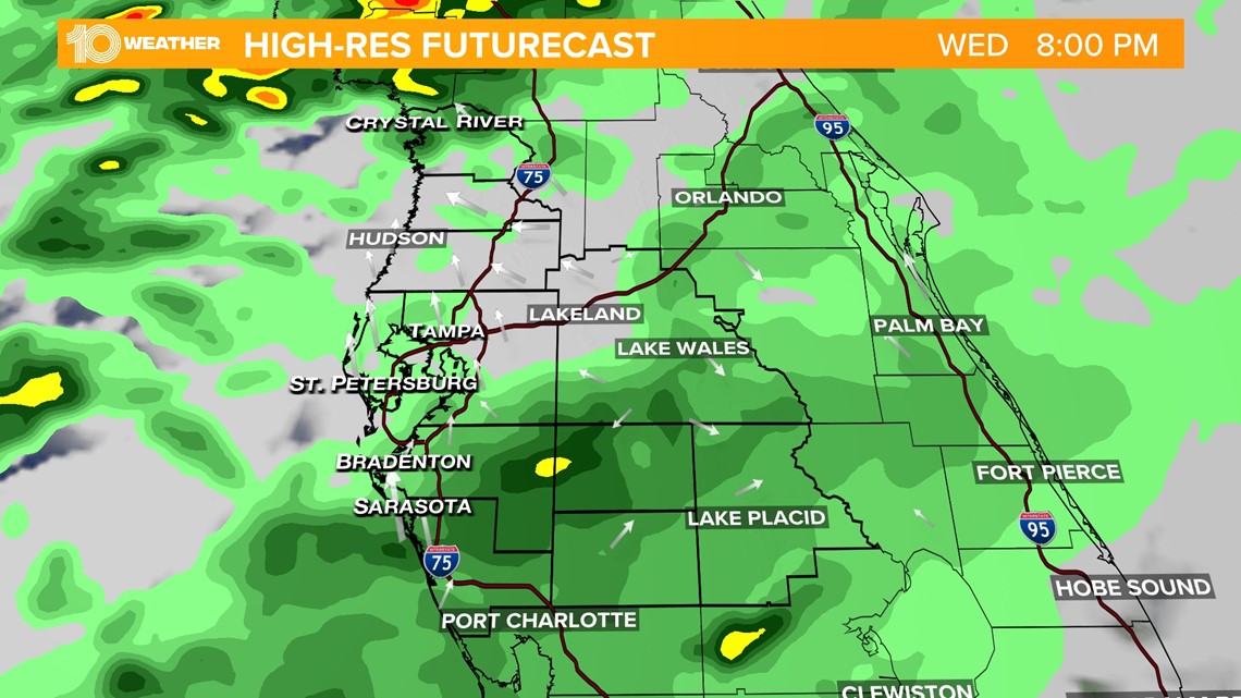
ST. PETERSBURG, Fla. — Following a warm, muggy and breezy start, the skies will open up for widespread rain and storms, primarily along our Nature Coast, starting around 2 p.m. Wednesday.
This system is tied to an area of low pressure that has pushed across the Deep South, pulling a cold front with it and bringing anticipated unsettled weather to our doorstep.
As we approach the evening hours, things become a little disorganized meaning that rain and storm chances will be more scattered for the Tampa Bay area, with the best timing for most of us to see a few downpours between the hours of 4-7 p.m.

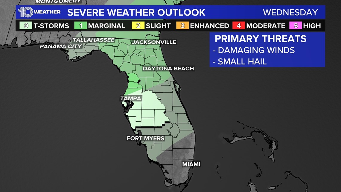
The best opportunity for strong to severe storms with the threat of damaging winds and small hail exists for our northernmost counties such as Pasco, Citrus and Hernando counties.
These areas have been placed under a marginal risk (Risk level 1 out of 5) for severe weather by the Storm Prediction Center.

This line of activity will weaken overnight Wednesday into Thursday morning with nuisance showers lingering for a bit. However, by Thursday daybreak, the frontal boundary will get another spark of energy from early morning light allowing for another quick round of showers and storms before the front exits by the early afternoon.

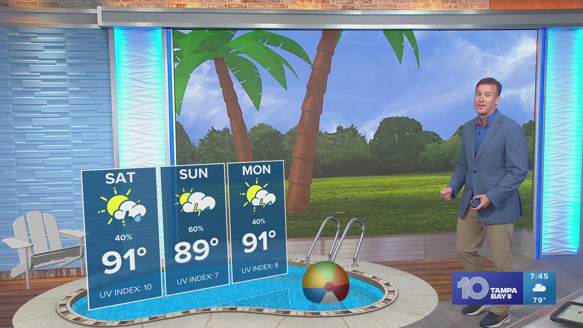
After this line of unsettled weather moves out - cooler, drier and less humid air with sunshine is in store for the weekend!