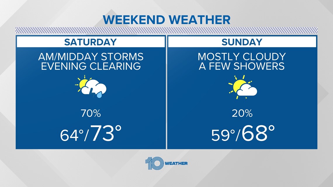
TAMPA, Fla. — After a wild week of ups and downs, our Tampa Bay area forecast is looking rainy for parts of the weekend ahead.
This is all in part due to our very active El Nino pattern, which has sent a series of disturbances and cold fronts our way. This week, this weekend, and next week will be no exception.
This Saturday, we're tracking an 80% chance of rain and potentially strong storms to head our way.

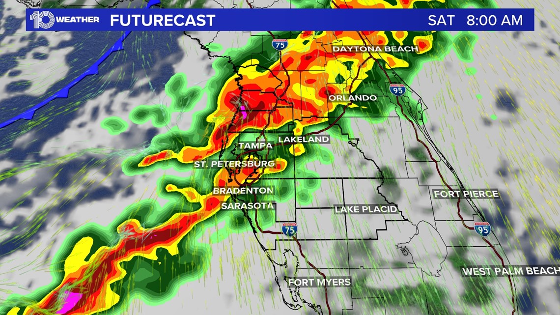
The general trend from our latest computer models suggests the best chances of rain and storms to arrive morning through midday before drifting east through the early afternoon.

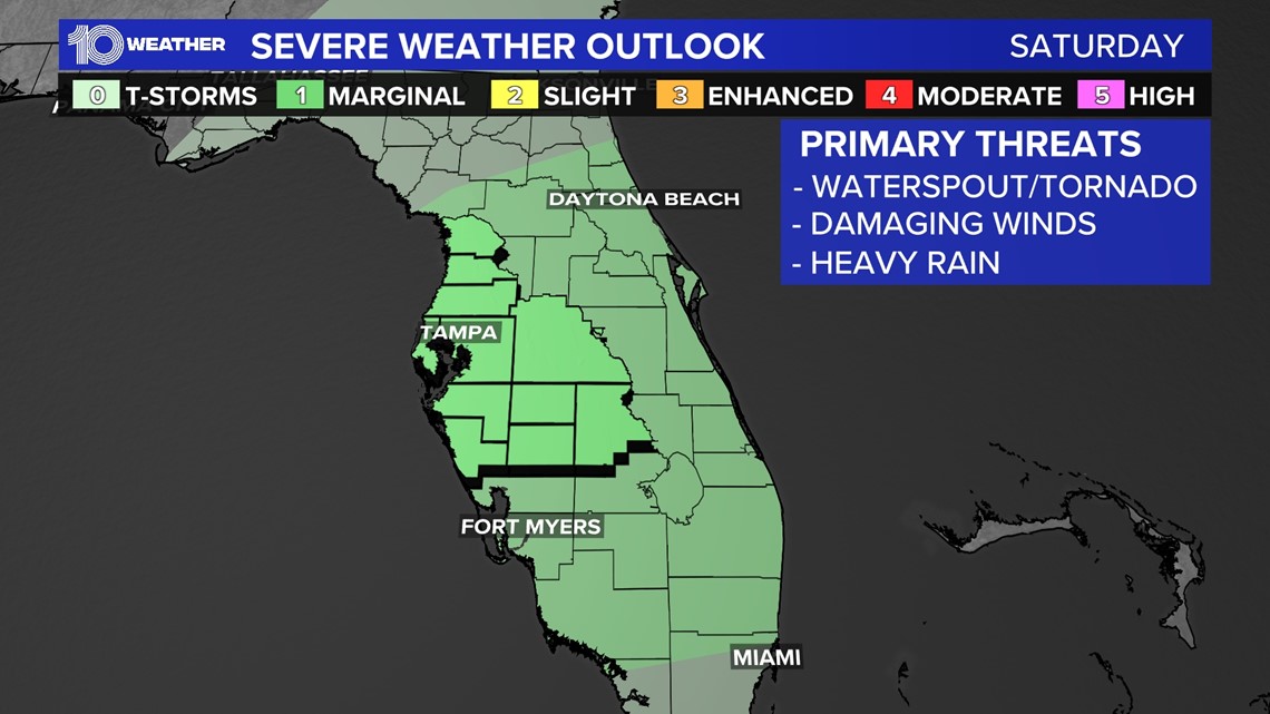
There's a marginal risk (1 out of 5) that Saturday's line of storms could produce an isolated severe storm or two.
The earlier the storms arrive, the less daytime heating we will endure, meaning less instability in our atmosphere to prompt severe weather. However, if the bulk of this energy slows down and arrives towards midday, we could see a slightly better chance for strong storms and damaging winds.

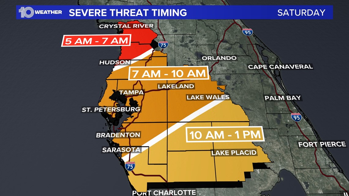
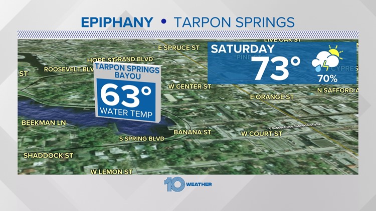
Due to the potential timing of these storms on Saturday, we'll closely need to monitor for impacts on outdoor events such as the 118th Epiphany celebration and cross dive in Tarpon Springs.
Once the storms clear out, a cold front will follow behind through Saturday evening, helping to dry us out and cool down our temperatures by Sunday.

