ST. PETERSBURG, Fla. — Get ready for a little bit of a change in the weather script from what Tampa Bay had for most of this past week.
After a string of days with morning fog, afternoon sunshine and warmer-than-normal temperatures a large storm system moving across the country will bring a few changes to the weather across Tampa Bay through the weekend.
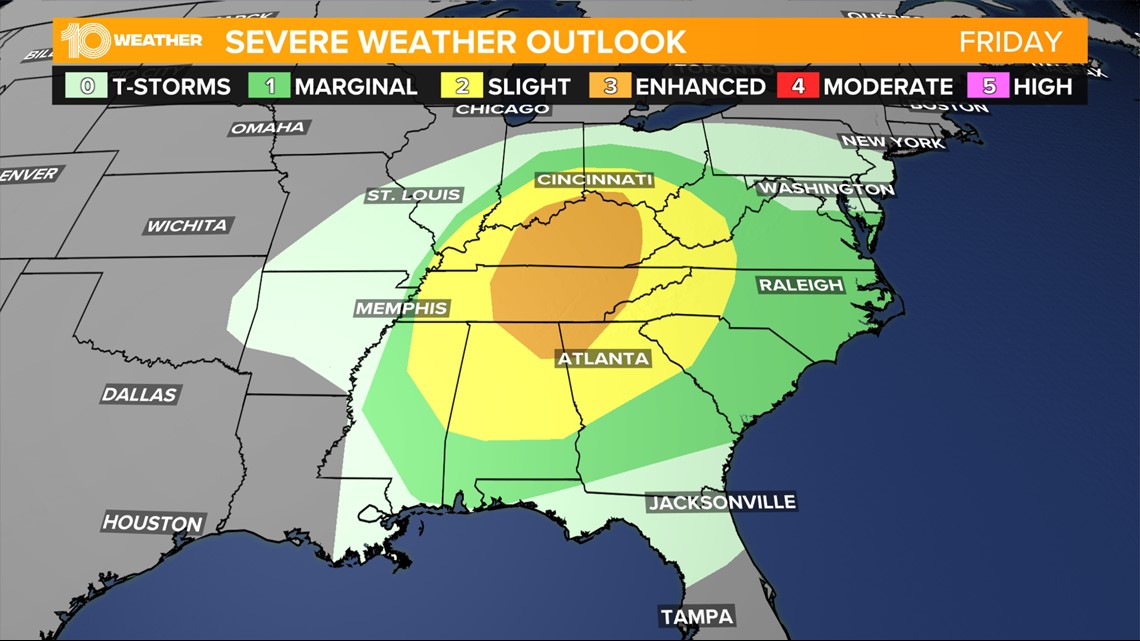
A strengthening low-pressure system will track northeast out of the southern Plains into the Midwest on Friday. After producing hundreds of severe weather reports across the Aklatex on Thursday, as the system moves through the mid-Mississippi Valley on Friday, another round of severe is expected throughout the eastern United States.
The greatest threat for severe weather will be across central Tennessee and Kentucky on Friday with an elevated threat for tornadoes.

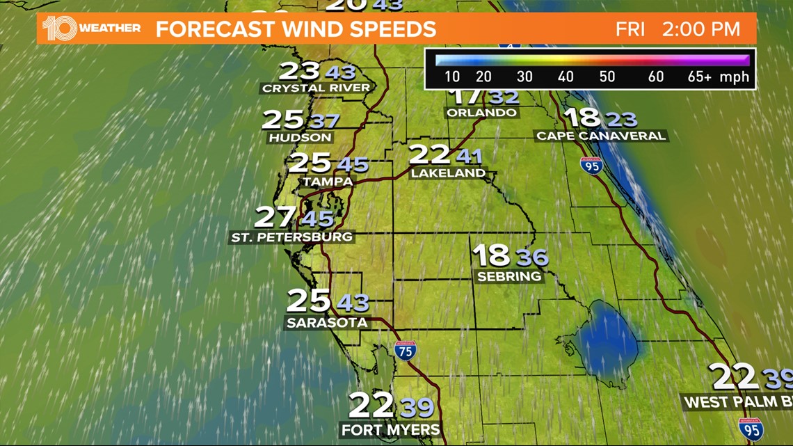
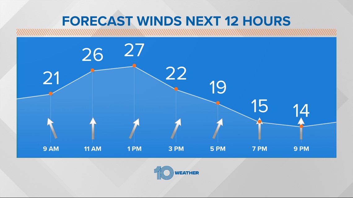
In the meantime, the strengthening low-pressure system to the north of Tampa Bay will cause the wind to increase into the second half of the day. Winds out of the south-southwest will increase to 20-25 mph with wind gusts reaching as high as 40-45 mph.
The winds will be strongest closer to the water, but it'll be windy across the entire region.

A high surf advisory and high rip current risk advisory have been issued for the Tampa Bay coast through the day on Friday due to the windy conditions. Elevated winds at the top of Sunshine Skyway Bridge will also be a concern for commuters this afternoon.
Make to drive with caution and check for any advisories before heading out.

Another factor to watch with the winds will be their impact on red tide. Medium to high concentrations of red tide have been reported along the coast of Tampa Bay, and those higher concentrations may be driven farther north by strong southerly winds.
Moreover, a slight westerly component could inject some of the red time bloom into the mouth of the Bay. The Florida Fish and Wildlife Conservation (FWC) will release its updated red tide report Friday afternoon with its next report next due next Wednesday.

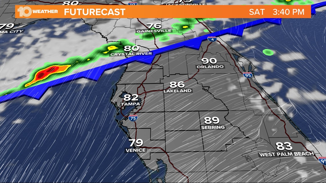
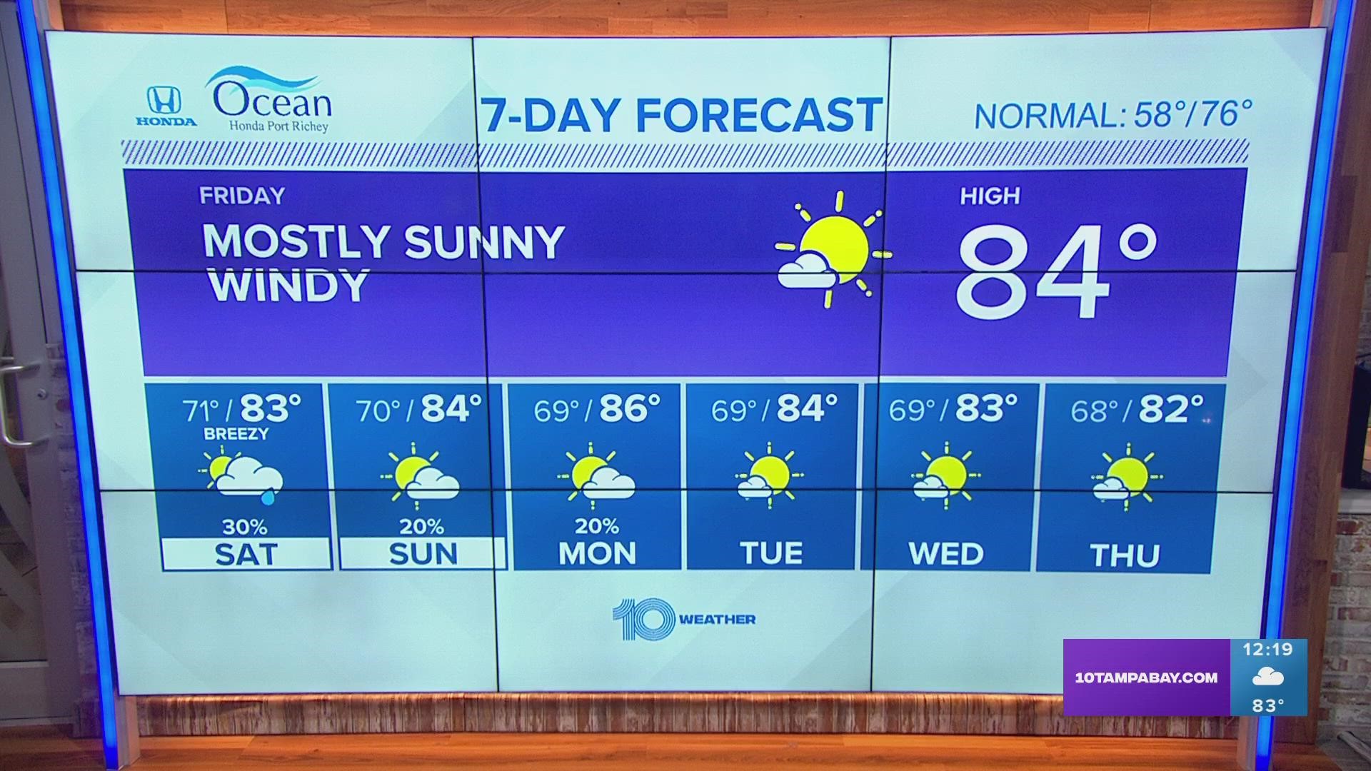
While the main low-pressure system will track well north of Tampa Bay, its associated cold front will swing south and sag into central Florida through the day on Saturday. An area of showers and a few thunderstorms will be possible as the front moves through.
The front, however, won't completely clear the area on Saturday and the chance for a few showers will linger into Sunday and possibly even into Monday.

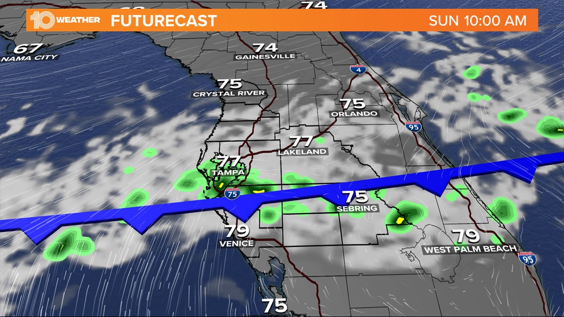
Aside from the small chance of rain through the weekend, temperatures will still remain well above normal despite the fact that a cold front will be meandering through the region. The normal high temperature for early March is 76 degrees, but high temperatures into next week will remain in the middle to even upper 80s in areas inland.

