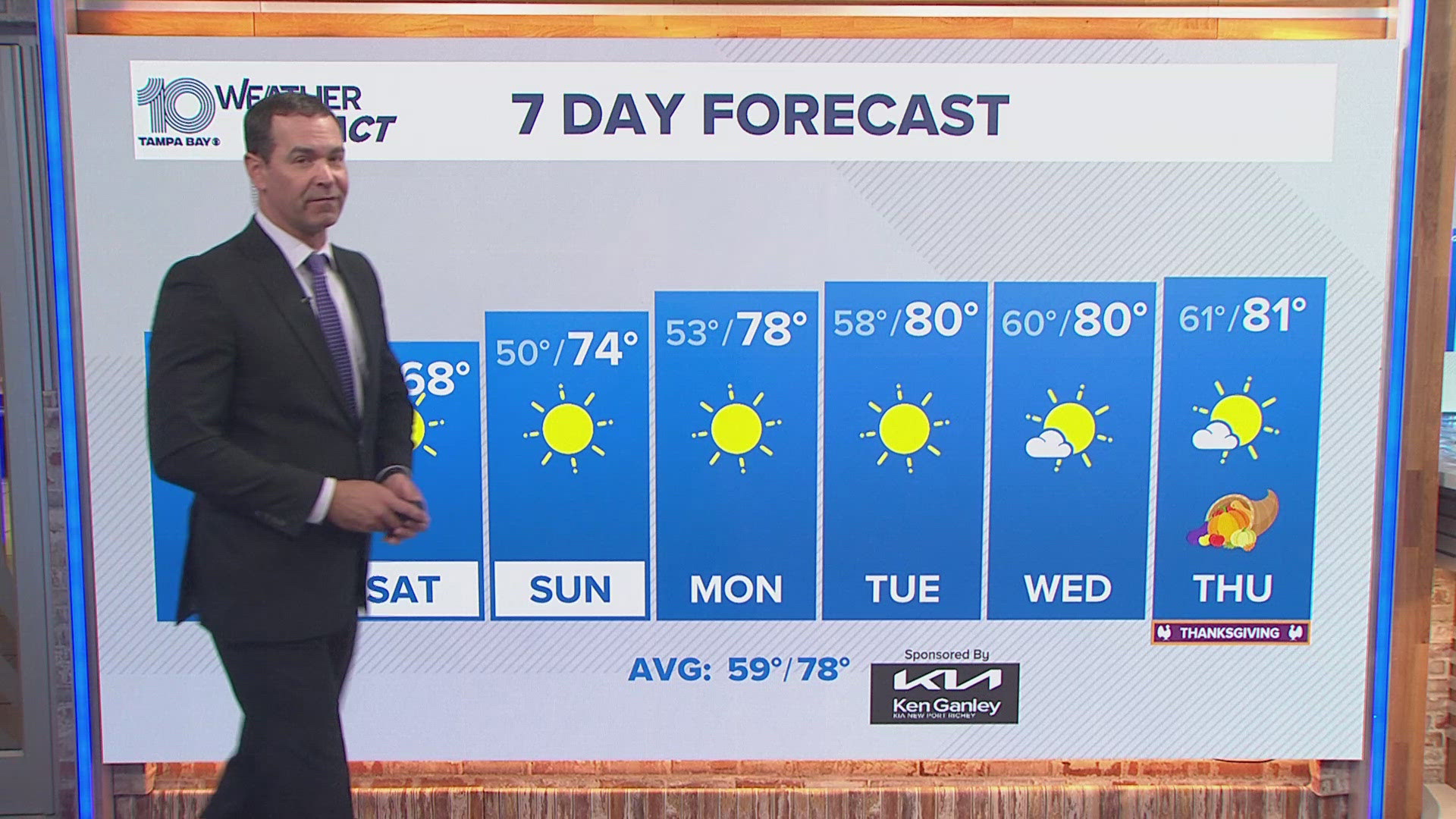
FLORIDA, USA — This weekend, some of the chilliest air of the season will spill into the Tampa Bay area, leaving us with morning temperatures in the upper 40s Saturday morning! Although this will be a short-lived cold spell, is this a sign of things to come for the winter season?
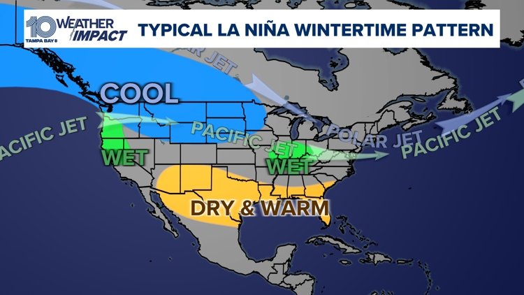
According to the Climate Prediction Center, La Niña is expected to make an appearance this winter, potentially influencing temperatures, precipitation and even storm activity in the Sunshine State.
What is La Niña?
La Niña is a climatic phenomenon that occurs when sea surface temperatures in the central and eastern Pacific Ocean drop below average, affecting global weather patterns.
In the southeastern United States, including here in Florida, La Niña is typically associated with warmer and drier-than-average conditions during the winter months.
For Tampa Bay, this translates into a higher likelihood of above-average temperatures and below-average rainfall.
Temperature Trends for Tampa Bay
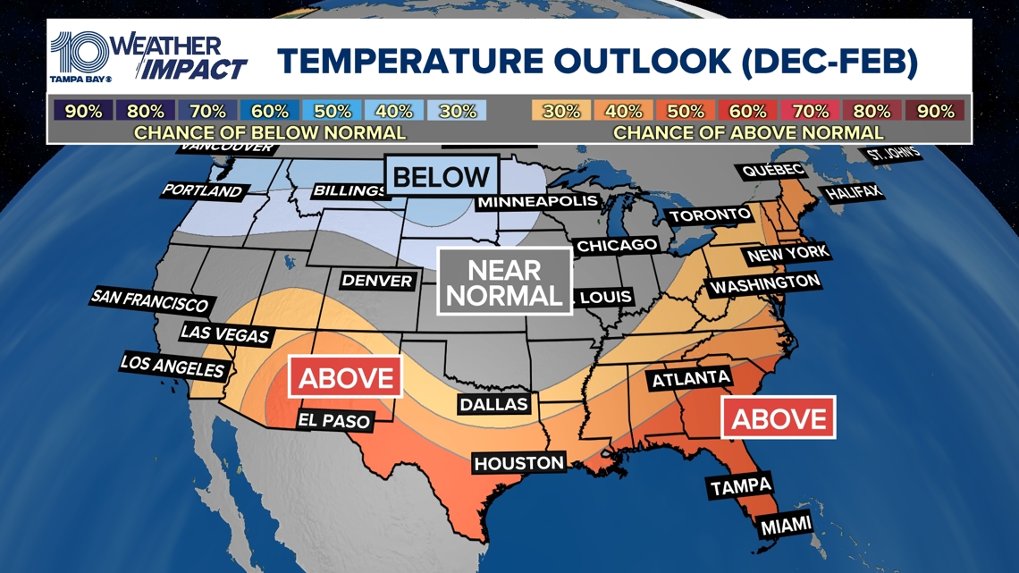
The National Weather Service's three-month outlook for Florida predicts that La Niña will contribute to warmer-than usually temperatures, sunnier days and fewer cold fronts. While cold spells are always a possibility in Florida, the chance for freezing temperatures is less likely during a La Niña winter.
For those hoping for more days featuring crisp winter air, this season may disappoint.

Drier conditions ahead
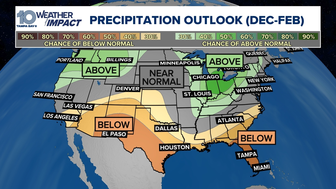
The second significant impact of La Niña in the Tampa Bay area will be a reduction in rainfall. The National Weather Service has forecast a drier winter for much of Florida, and Tampa Bay is no exception.
While some localized showers and storms will still occur, the frequency and intensity of the seasonal storms are expected to be lower than usual. This could pose a challenge for farmers and residents relying on winter rainfall.
Dry conditions could also increase the risk of wildfires in certain areas, as the lack of rain dries out vegetation and fuels fire activity. Be sure to stay aware of local burns or restrictions once we approach wildfire season which usually peaks in early Spring from March to May.

Storms, severe weather and ....snow?
One of the key factors associated with La Niña is a shift in the jet stream, which usually drifts further north during this time. A La Niña pattern trends to create conditions favorable for a more active Atlantic hurricane season. Thankfully, cooler sea surface temperatures in November allow for less activity. The Atlantic Tropical Storm season ends Nov. 30.
As for severe weather, although a stronger cold front during the winter months could spin up a tornado, severe weather is less likely to occur during a wintertime La Niña pattern.
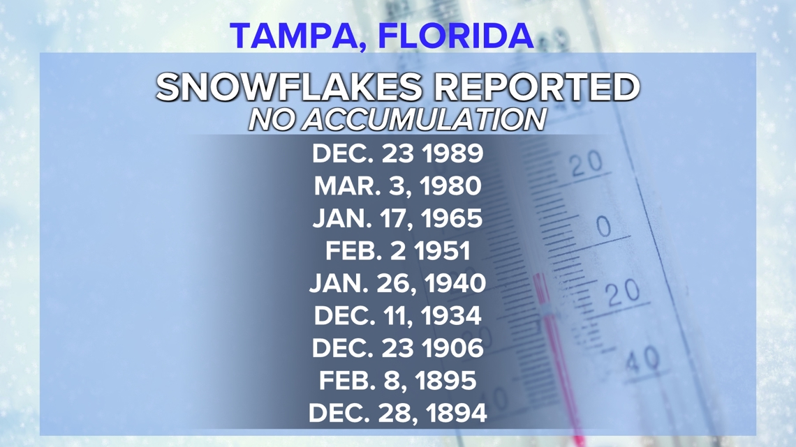
As for the chance of snow in Tampa Bay, La Niña will make the prospect even more unlikely. Snow is a rare occurrence in Florida, and La Niña winters further reduce the chances of this cold-weather event.
The last time Tampa Bay experienced measurable snowfall was on Jan. 19, 1977. While the snow didn't accumulate significantly, it was an extraordinary occurrence. Temperatures that day were unusually cold, with lows dipping to 30°F in the wake of an arctic cold front that moved through the state.

Looking ahead
While La Niña may not bring a dramatic shift in weather for Tampa Bay, this winter will generally be drier with warmer-than-usual temperatures. So, if you're hoping for a cold and rainy winter season... you may need to look elsewhere. Florida's sun will be shining just a little brighter this upcoming winter season.


