TAMPA, Fla. — Our first cold front since May brings us a little relief from the summer swelter.
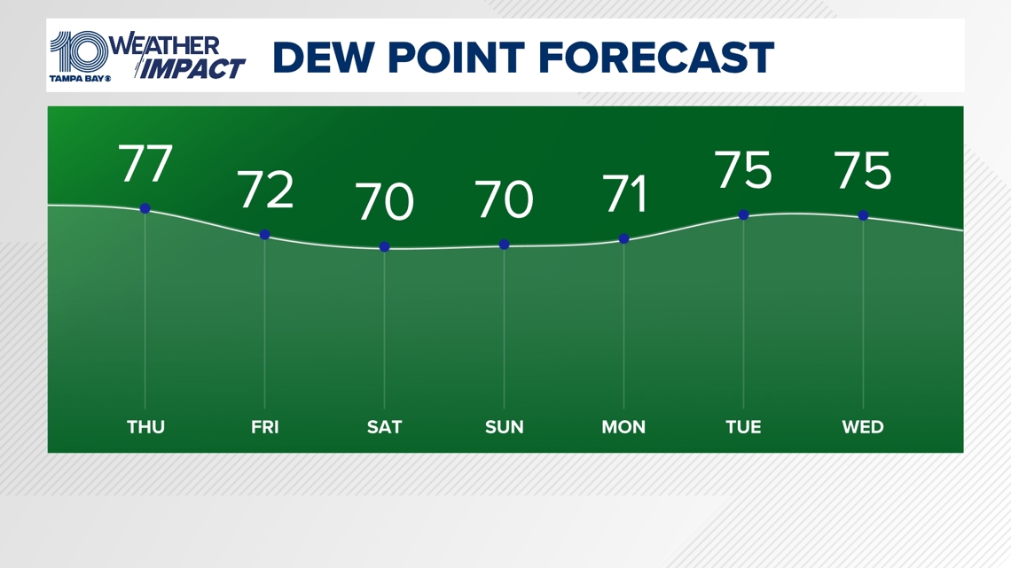
So far in August, the Tampa Bay area has had on average the warmest lows on record with overnight lows holding in the middle 70s to near 80. This is due to extremely high dew points.
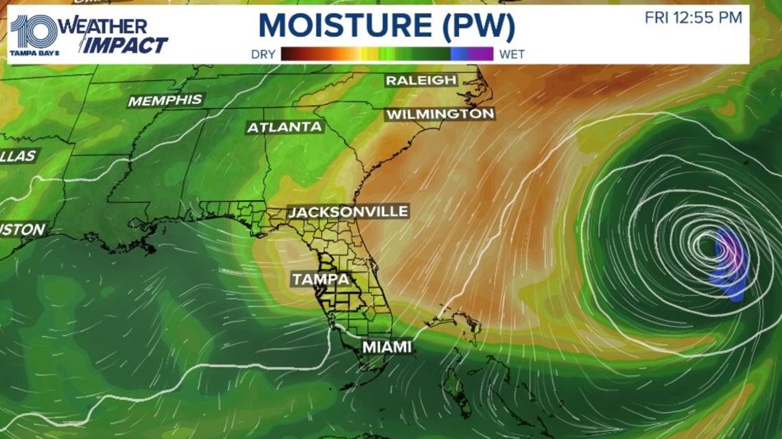
But a nice change is on the way thanks to a surge of drier air and lower humidity. This drier air comes to the area because of Hurricane Ernesto. The dew points go from off the charts to more in the normal range.
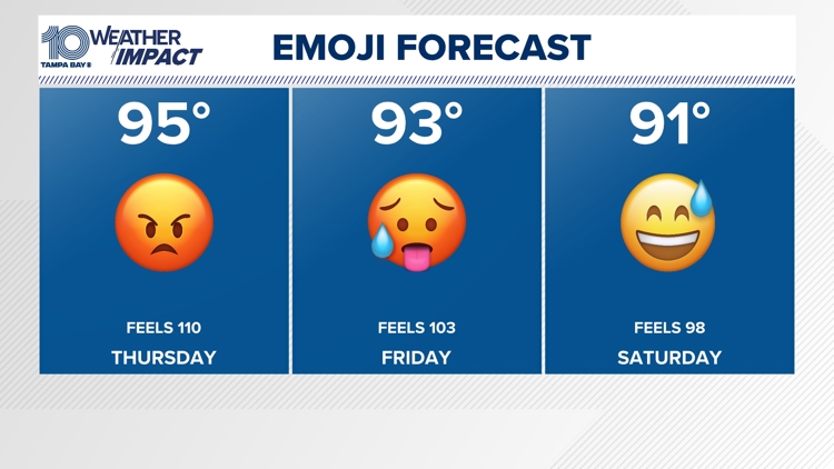
The higher the dew point, the more muggy it feels. Our feels-like temperatures have been pushing in the 105-110 range throughout the month of August.
But by late this week and early weekend, we do get a break in the triple-digit heat indices.

As Hurricane Ernesto moves north to near Bermuda, the counterclockwise flow will turn the wind northeast, bringing us fresh breezes by late Thursday afternoon into the first part of the weekend, giving us a break from the "air you can wear."

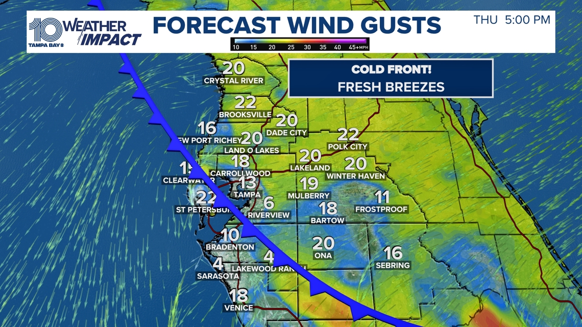
It will still be hot during the day with highs near 90, but it will feel much more bearable with our feels-like temperatures sitting about 10 to 15 degrees cooler.

The lower humidity and mostly clear skies will allow nighttime temperatures to actually fall to their coolest levels since the middle of May.
The Nature Coast will have lows in the middle 60s to near 70 in Tampa. It is a big tease because it will not last very long with our tropical dew points, heat and humidity back in the forecast by Sunday into early next week. Enjoy it while you can!