ST. PETERSBURG, Fla. — Strong to severe thunderstorms, including the threat of tornadoes, are possible Tuesday as Tampa Bay's roller coaster weather pattern continues this winter season.
A cold front associated with a strengthing low-pressure system is forecast to sweep through the area. At this point, the time frame of most concern will be during the afternoon and evening hours.
On land and sea, there are multiple threats: strong to severe storms with damaging winds, isolated tornadoes, large hail, heavy rainfall, coastal flooding and high surf. The area's Gulf beaches have suffered significant beach erosion from many storms, namely since Hurricane Idalia, and additional damage is possible due to the potential for a small surge.
The 10 Tampa Bay weather team will keep you ahead of the storm. Download the free 10 Tampa Bay app for breaking news and weather alerts.
Let's break down the threats and timing:


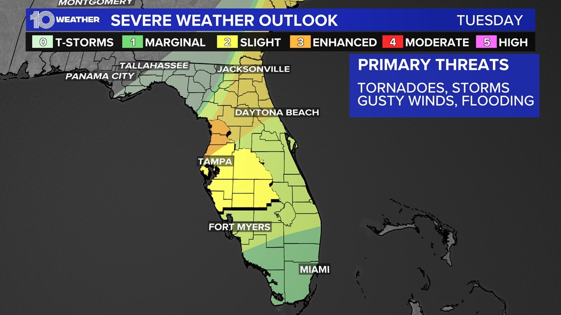
Storm Prediction Center forecasters have highlighted the immediate Tampa Bay area under a slight risk of a threat of severe weather. That's a level two out of five, meaning that scattered severe storms are possible.
A greater risk of severe weather exists north and west of the immediate Tampa area, where the area is highlighted under an enhanced risk — a level three out of five. Numerous severe storms are possible there.
The primary threats continue to be damaging winds, isolated tornadoes and large hail.
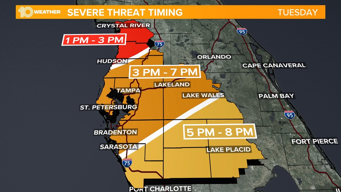
Those storms are expected to roll in from the Gulf of Mexico during the afternoon and evening hours, first impacting Citrus and Hernando counties.


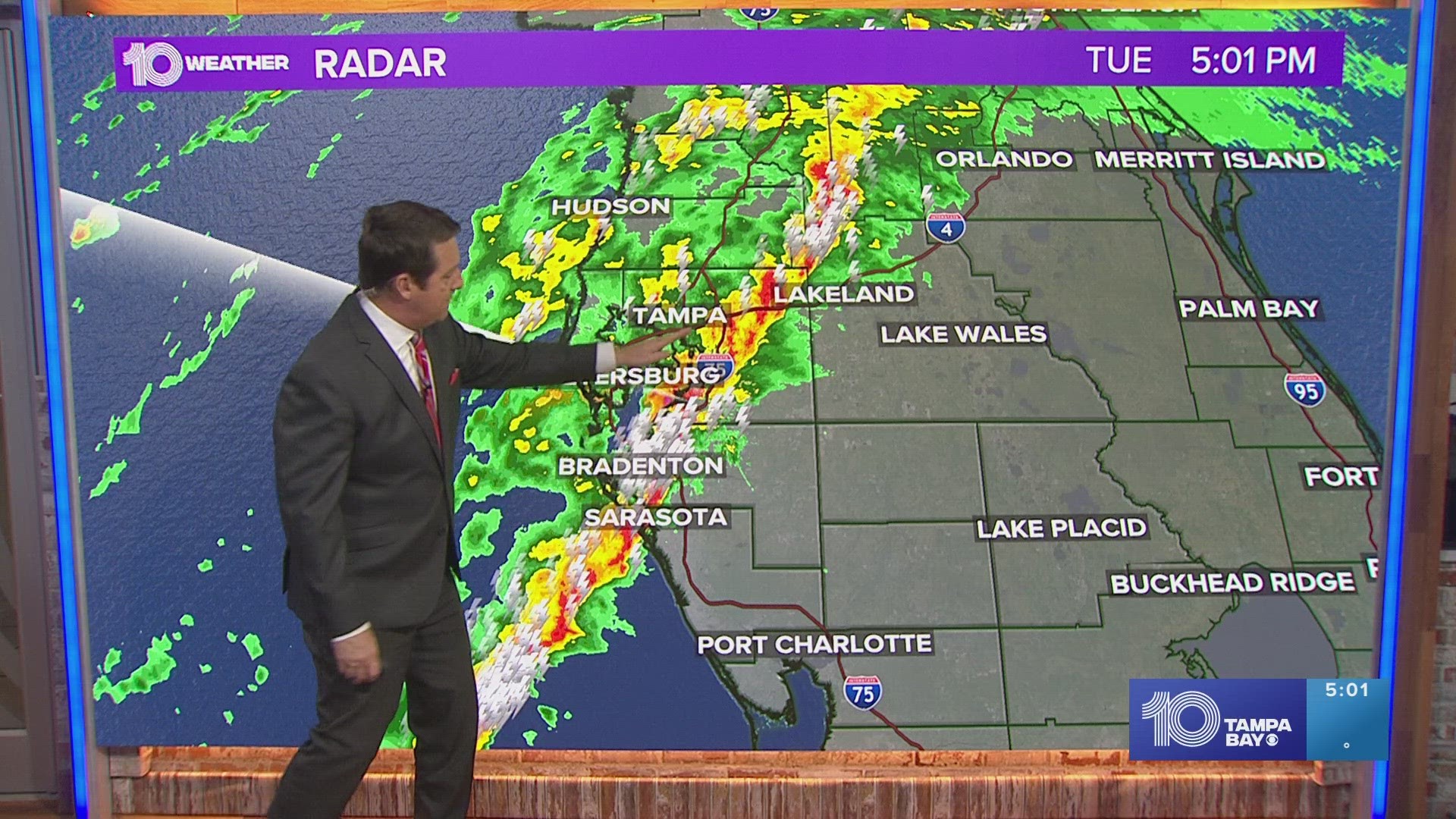
The storms will progress from the northwest to southeast, impacting the immediate Tampa Bay area from roughly 3-7 p.m. and then the southeastern portion of the viewing area after 5 p.m.
Everyone will need to stay weather-aware should some of the stronger storms turn severe.


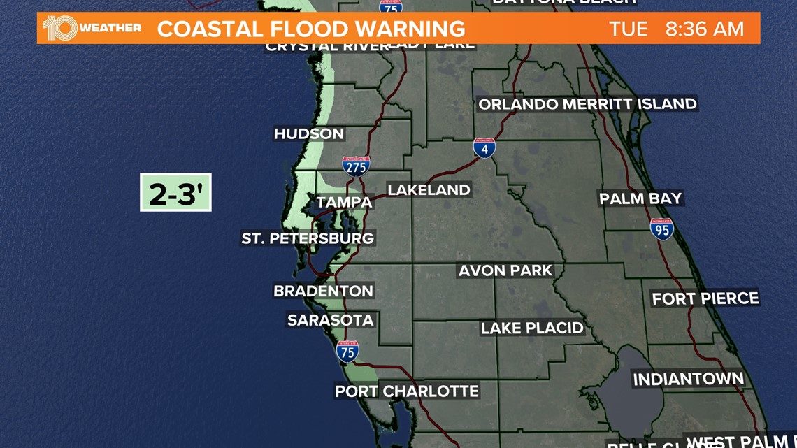
Areas of coastal flooding are possible roughly from Tuesday afternoon through early Wednesday morning. A gale warning is in effect overnight Tuesday, and a coastal flood warning has been issued starting Tuesday.
- Citrus County northward: 2-4 feet
- Hernando, Pasco, Pinellas, Hillsborough, Manatee, Sarasota and Tampa Bay: 2-3 feet
- South of Sarasota County: 1-2 feet
Before that, the Gulf will start to look angry, with waves building 6-8 feet. This high surf, combined with relentless wave action, could lead to some beach erosion.
Sandbag sites in Tampa Bay
A few sandbag sites will be open Monday in St. Petersburg ahead of the potential for coastal flooding this week, the city announced.
The following sites were open for some time over the weekend and are open through 6 p.m. Monday:
- Stormwater Pavement Traffic Opps HQ, 1744 9th Ave. N.
- Mangrove Bay Golf Course, 875 62nd Ave. NE.
- Lake Maggiore Shelter Area, 3601 Dr. MLK St. S.
In Pasco County, two sites are open 24/7:
- Magnolia Valley Golf Course, 7223 Massachusetts Avenue in New Port Richey
- Pasco County Public Works (C-Barn), 30908 Warder Road in San Antonio
This site will be open from sunrise to sunset through Tuesday:
- Veterans Memorial Park, 14333 Hicks Road in Hudson
In Manatee County, several self-service locations are available:
- Manatee Beach, 4000 Gulf Drive in Holmes Beach
- Coquina Beach, 1465 Gulf Drive South in Bradenton Beach
- Manatee County Utilities Building, 4700 66th St. West in Bradenton
Keep checking back with 10 Tampa Bay on air, online and on 10 Tampa Bay+ from your favorite streaming device.

