ST. PETERSBURG, Fla. — The severe thunderstorm watch in effect for the Tampa Bay area has been canceled. The severe threat has ended for the day on Wednesday, May 15.
Still, scattered showers and storms are not out of the question.
The previous story is below.
---
After strong thunderstorms moved through the region on Tuesday, the Tampa Bay area is facing another threat of severe weather on Wednesday.
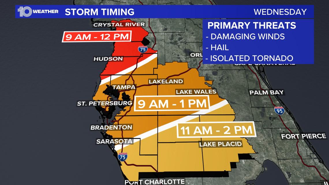
A severe thunderstorm watch is in effect until 5 p.m. for the entire area due to the threat of damaging winds, small hail and isolated tornadoes. A tornado watch earlier in effect has been allowed to expire.
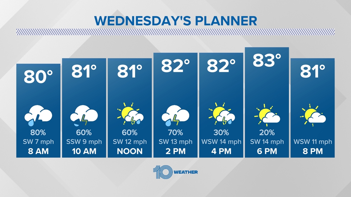
This time of year, cold fronts aren't quite as successful with making it across the state. And if they do clear the state, temperatures don't cool down much, or for very long, before heating up again. This is exactly what we can expect with this next rain-maker. But at least we'll see some much-needed rain!
Ahead of our next frontal boundary, very warm and moist air settles in while winds stay breezy overnight through Wednesday morning. The development and coverage of rain increases overnight through early Wednesday morning.
A few storms could be on the strong to severe side, mainly along and north of Tampa Bay, so be sure to stay weather-aware through your morning commute! Downloading our free 10 Tampa Bay app is a great way to stay informed, prepared and connected.
On Wednesday, this "cool" front will stall out and produce a few rounds of scattered showers and storms through the morning hours and into the afternoon.
The Storm Prediction Center has us at a "slight risk" (2 out of 5) for severe thunderstorms on Wednesday, with our main threats being damaging wind gusts and possible flooding to low-lying areas, especially around the Interstate 4 corridor Wednesday morning through the early afternoon.
The National Weather Service says hail and an isolated tornado or waterspout also cannot be ruled out.

Most rain and thunderstorm activity shifts south later in the afternoon, leading to gradual clearing from north to south by Wednesday night.