ST. PETERSBURG, Fla. — Update: All severe weather has calmed down for Thursday.
All tornado warnings earlier in effect for parts of the Tampa Bay area have been canceled or allowed to expire.
At this time, there are no reports of significant damage from these afternoon storms.
Just east of downtown St. Petersburg, a waterspout was captured on Tampa Bay. It, too, prompted a couple of tornado warnings that no longer are in effect.
See below for Thursday's severe weather potential:
---
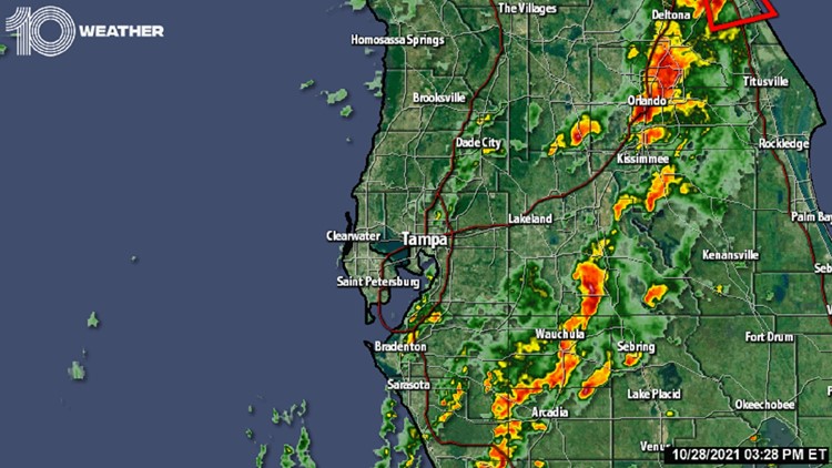
Thunderstorms pushing inland from the Gulf of Mexico have the potential to produce waterspouts and tornadoes for the next several hours.
The Storm Prediction Center has issued a tornado watch for this threat, which is in effect now until 5 p.m. for an area mostly north of the Tampa Bay area. This includes the cities of Bradenton, Lakeland, Sarasota, St. Petersburg, Tampa and locations northward.
A strong cold front is quickly moving east across the South, pushing warm moisture ahead of it and cool drier air behind it across the Gulf of Mexico and onto the west Florida coast into Thursday.
After a small break in the rain, a second and gustier line of storms moves onshore well after lunchtime, through the mid-afternoon, between 3-5 p.m.
The Storm Prediction Center placed much of west-central Florida at a "slight risk" of severe weather Thursday — a level two out of five.
Enough instability, a warm and moist low-level flow and wind shear (a change of wind speed and/or direction with height) could lead to a few strong to severe storms, especially around and north of the Tampa Bay area, with damaging winds and an isolated waterspout or tornado among the main threats.
Localized flooding will also be possible, with some of the heftier storms capable of producing 1-3 inches of rainfall.
It would be wise to stay weather aware and have a way to get alerts through the day on Thursday. You can download the 10 Tampa Bay app for breaking news, weather alerts and live interactive radar.


