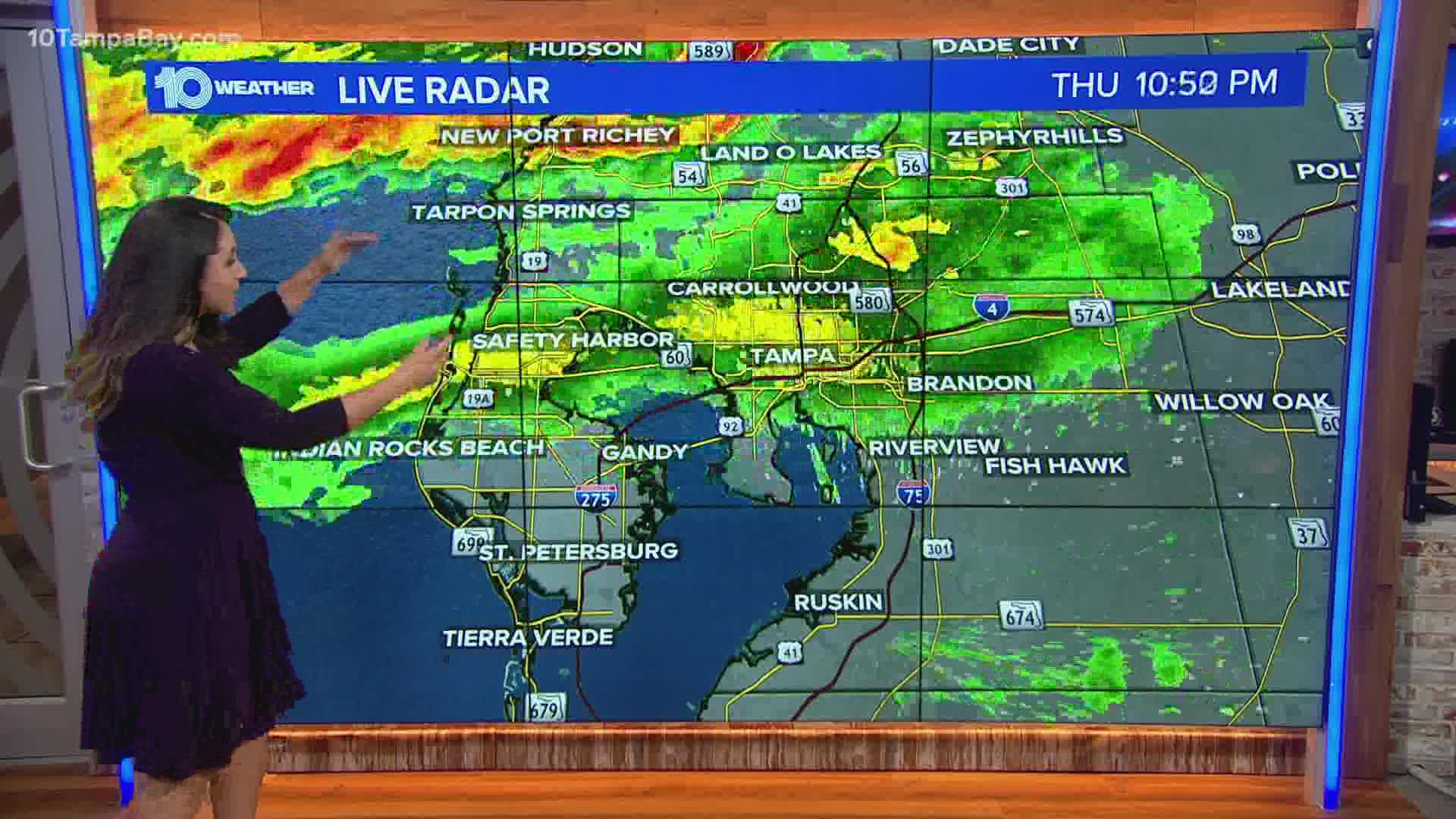
TAMPA, Fla — A powerful storm system has produced multiple days of severe weather with tornadoes and damaging winds across the Deep South. While this line of storms is expected to weaken as it approaches, we will still see the chance for an isolated severe storm.
The highest risk will be towards the Nature Coast this evening.
Storm reports 🌪
Unfortunately, this storm system has turned deadly. Earlier this morning, a tornado touched down in the Florida Panhandle causing two fatalities.

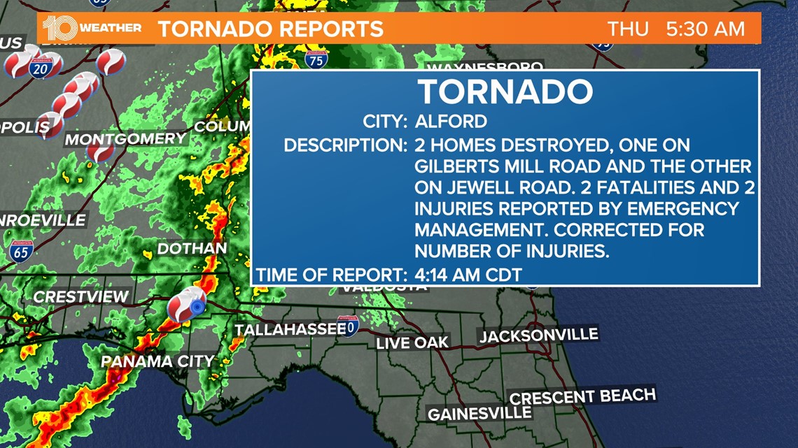
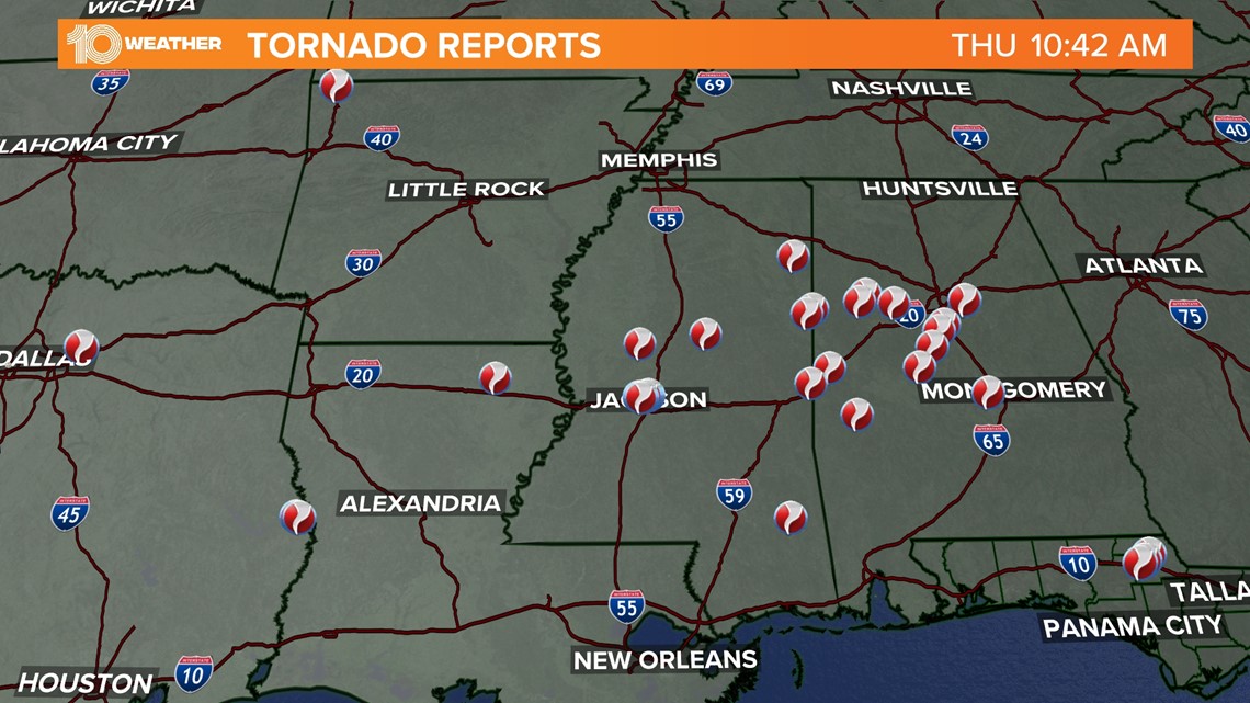
Wednesday alone, there were close to 250 reports of damaging winds and more than 30 reports of tornadoes.

The timing ⏰
Most of today will be dry but it will be breezy and warm. Winds will gust over 35 mph from the south.
A line of storms will start to move in toward the Nature Coast by around sunset. Between 5 p.m. and midnight will be our greatest risk for an isolated severe storm. North of Tampa into the Nature Coast will be the main area of concern.

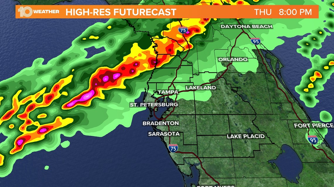
Showers and storms will move into Tampa and St. Petersburg closer toward 8-11 p.m. Storms will have some heavy downpours and gusty winds.
The front will slow down as it moves across the area. That will keep the chance for some scattered showers Friday morning. That activity should push south giving us a drier Friday afternoon.
The threats 🌪️

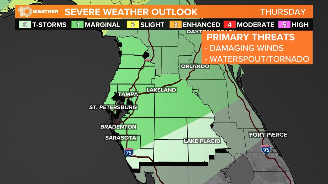
The Storm Prediction Center placed most of the area under a marginal — a level one out of five — risk for severe weather Thursday evening.
Compared to the Deep South, our severe risk is much lower, but gusty winds and an isolated waterspout or tornado can not be ruled out.
Thunderstorms embedded in the squall line will be capable of producing heavy rain in a short amount of time, leading to pooling on roads and low-lying areas.

